
File:Doreen 1977 rainfall.png

Size of this preview: 421 × 600 pixels. Other resolutions: 168 × 240 pixels | 624 × 889 pixels.
Original file (624 × 889 pixels, file size: 27 KB, MIME type: image/png)
| This is a file from the Wikimedia Commons. Information from its description page there is shown below. Commons is a freely licensed media file repository. You can help. |
Summary
| Description |
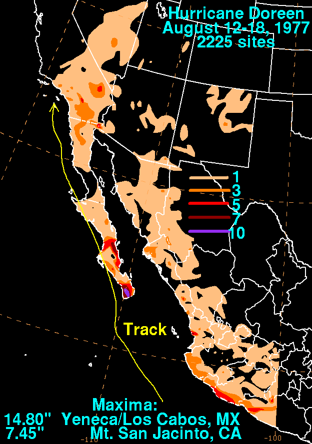
English: Storm total rainfall map of Hurricane Doreen during August 1977. |
|||
| Date | ||||
| Source | WPC tropical cyclone rainfall data | |||
| Author | David Roth, Weather Prediction Center, Camp Springs, Maryland | |||
| Permission (Reusing this file) |
|
Original upload log
| Date/Time | Dimensions | User | Comment |
|---|---|---|---|
| 11 August 2011, 23:45:48 | 624 × 889 (29470 bytes) | 12george1 (talk · contribs) |
File history
Click on a date/time to view the file as it appeared at that time.
| Date/Time | Thumbnail | Dimensions | User | Comment | |
|---|---|---|---|---|---|
| current | 06:06, 5 January 2015 | | 624 × 889 (27 KB) | GifTagger | Bot: Converting file to superior PNG file. (Source: Doreen_1977_rainfall.gif). This GIF was problematic due to non-greyscale color table. |
File usage
The following pages on the English Wikipedia use this file (pages on other projects are not listed):