
File:FourMileRunTrail.jpg
Size of this preview: 800 × 448 pixels. Other resolutions: 320 × 179 pixels | 640 × 359 pixels | 1,024 × 574 pixels | 1,703 × 954 pixels.
Original file (1,703 × 954 pixels, file size: 661 KB, MIME type: image/jpeg)
| This is a file from the Wikimedia Commons. Information from its description page there is shown below. Commons is a freely licensed media file repository. You can help. |
Summary
| Description |
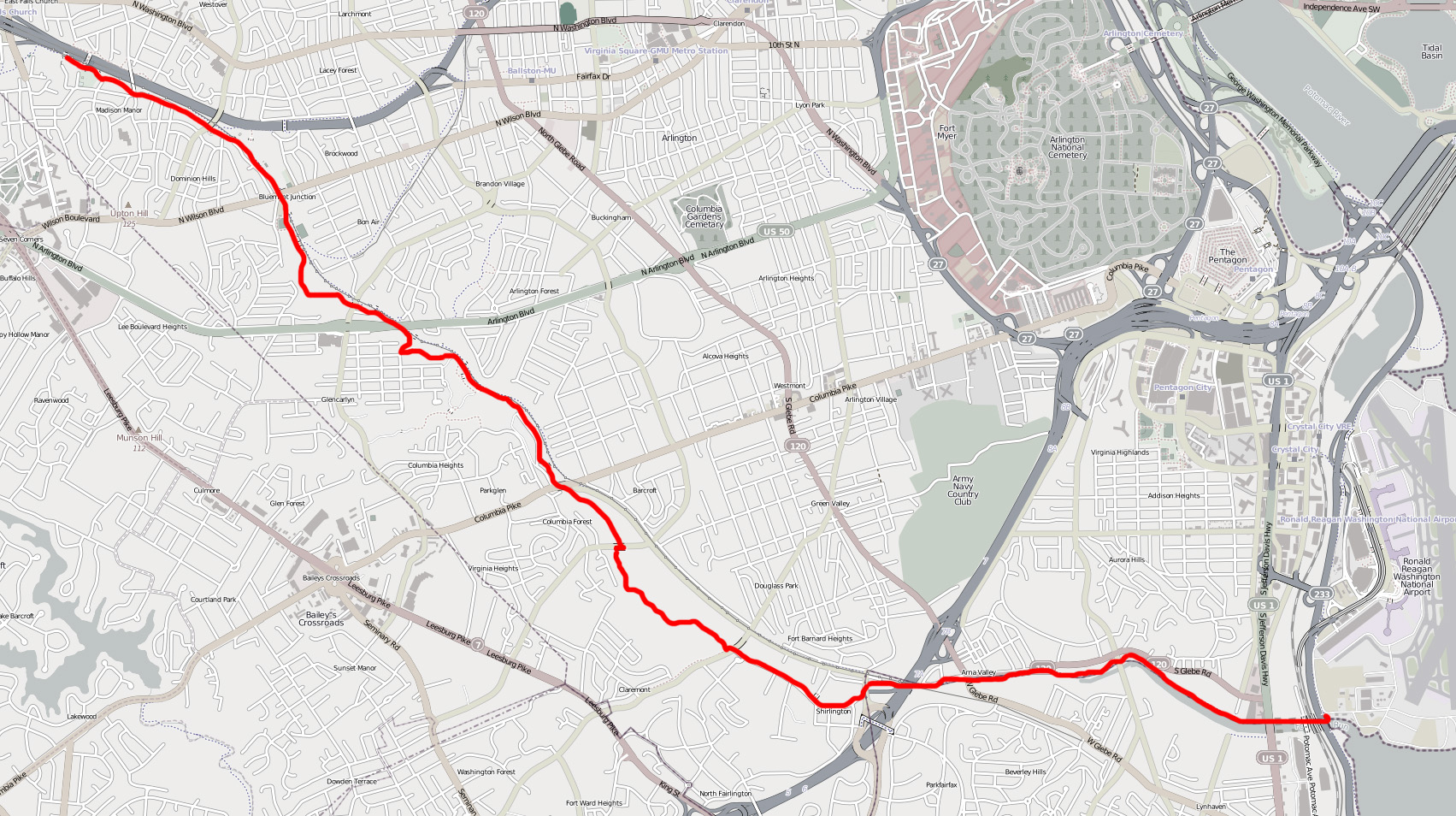
English: Map of the Four Mile Run Trail. Image has been modified from its original form (trail has been highlighted with a red line and rest of image has been desaturated). |
||||||||||||
| Date | |||||||||||||
| Source | http://www.openstreetmap.org/?lat=38.8685&lon=-77.0944&zoom=13&layers=M | ||||||||||||
| Author | OpenStreetMap | ||||||||||||
| Permission (Reusing this file) |
|
Licensing
This file is licensed under the Creative Commons Attribution-Share Alike 3.0 Unported license.
- You are free:
- to share – to copy, distribute and transmit the work
- to remix – to adapt the work
- Under the following conditions:
- attribution – You must give appropriate credit, provide a link to the license, and indicate if changes were made. You may do so in any reasonable manner, but not in any way that suggests the licensor endorses you or your use.
- share alike – If you remix, transform, or build upon the material, you must distribute your contributions under the same or compatible license as the original.
File history
Click on a date/time to view the file as it appeared at that time.
| Date/Time | Thumbnail | Dimensions | User | Comment | |
|---|---|---|---|---|---|
| current | 19:37, 26 March 2011 | | 1,703 × 954 (661 KB) | Bobco85 | {{Information |Description ={{en|1=Map of the Four Mile Run Trail. Image has been modified from its original form (trail has been highlighted with a red line and rest of image has been desaturated). }} |Source =http://www.openstreetmap.org/?lat |
File usage
The following pages on the English Wikipedia use this file (pages on other projects are not listed):
Global file usage
The following other wikis use this file:
- Usage on www.wikidata.org