
File:GeologicalMapRappahannockCountyVA.jpg
Size of this preview: 388 × 599 pixels. Other resolutions: 155 × 240 pixels | 311 × 480 pixels | 497 × 768 pixels | 1,057 × 1,633 pixels.
Original file (1,057 × 1,633 pixels, file size: 177 KB, MIME type: image/jpeg)
| This is a file from the Wikimedia Commons. Information from its description page there is shown below. Commons is a freely licensed media file repository. You can help. |
Summary
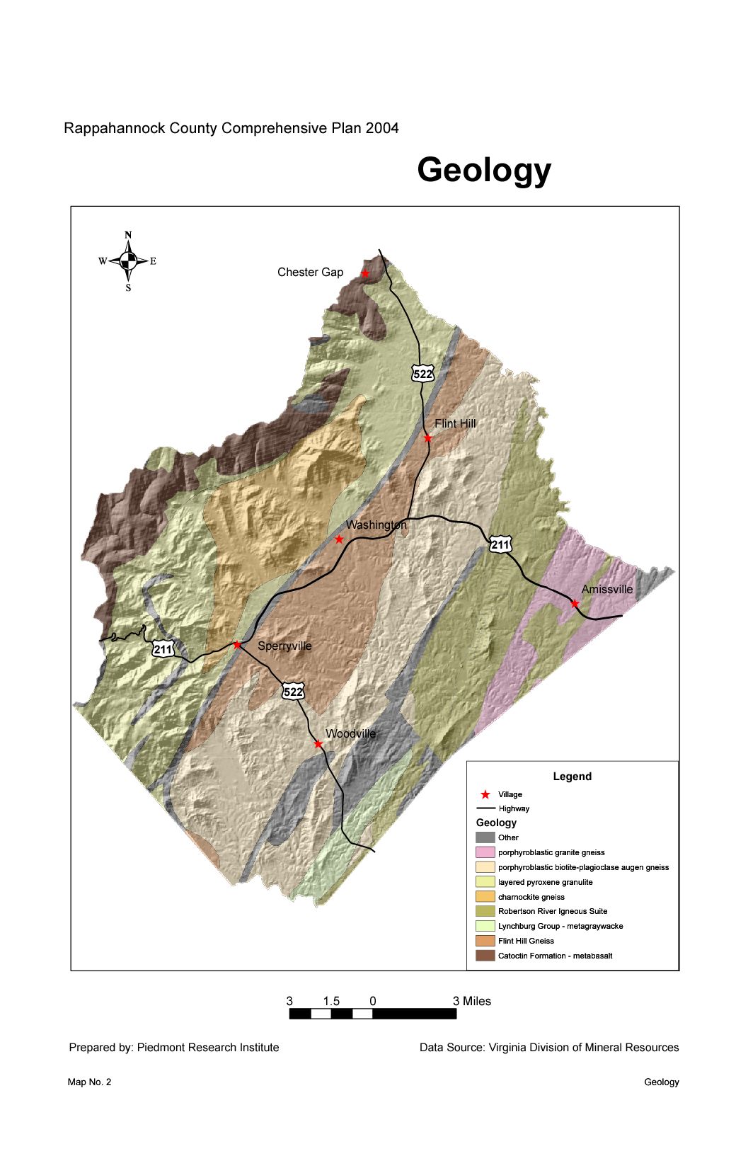
| Description | Geological map of Rappahannock County, Virginia |
| Date | |
| Source | http://www.rappahannockcountyva.gov/compplan.html |
| Author | U.S. Geological Survery |
Licensing
This image is in the public domain in the United States because it only contains materials that originally came from the United States Geological Survey, an agency of the United States Department of the Interior. For more information, see the official USGS copyright policy.
|
Original upload log
The original description page was here. All following user names refer to en.wikipedia.
| Date/Time | Dimensions | User | Comment |
|---|---|---|---|
| 2016-08-07 01:28:04 | 1057× 1633× | Radixmalum | Uploading a public-domain item using [[Wikipedia:File_Upload_Wizard|File Upload Wizard]] |
File history
Click on a date/time to view the file as it appeared at that time.
| Date/Time | Thumbnail | Dimensions | User | Comment | |
|---|---|---|---|---|---|
| current | 08:23, 19 September 2016 | | 1,057 × 1,633 (177 KB) | FastilyClone | Transferred from en.wikipedia (MTC!) |
File usage
The following pages on the English Wikipedia use this file (pages on other projects are not listed):