
File:Good Ground Windmill map-1.jpg

Size of this preview: 800 × 571 pixels. Other resolutions: 320 × 228 pixels | 640 × 457 pixels | 1,024 × 731 pixels | 1,280 × 913 pixels | 2,314 × 1,651 pixels.
Original file (2,314 × 1,651 pixels, file size: 748 KB, MIME type: image/jpeg)
| This is a file from the Wikimedia Commons. Information from its description page there is shown below. Commons is a freely licensed media file repository. You can help. |
Summary
| Description |
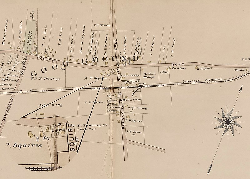
English: The Good Ground mill site at 10 E. Montauk Highway was owned in the 1860s by Martin Van Buren Squires. He purchased the gristmill at Shelter Island and moved it to Good Ground. |
| Date | |
| Source | File:Suffolk_County,_V._1,_Double_Page_Plate_No._22_(Map_bounded_by_Part_of_Good_Ground_and_Canoeplace,_East_Quogue,_Quiogue)_NYPL2055478.tiff |
| Author | Hyde, E. Belcher, Map Company, Inc. Atlas of Suffolk County, Long Island |
| Camera location | | View this and other nearby images on: OpenStreetMap |
|---|
Detail of map by Hyde, E. Belcher - Publisher",date:"1902-1909","description":"Suffolk County, V. 1
Licensing
This file is licensed under the Creative Commons Attribution-Share Alike 4.0 International license.
- You are free:
- to share – to copy, distribute and transmit the work
- to remix – to adapt the work
- Under the following conditions:
- attribution – You must give appropriate credit, provide a link to the license, and indicate if changes were made. You may do so in any reasonable manner, but not in any way that suggests the licensor endorses you or your use.
- share alike – If you remix, transform, or build upon the material, you must distribute your contributions under the same or compatible license as the original.
File history
Click on a date/time to view the file as it appeared at that time.
| Date/Time | Thumbnail | Dimensions | User | Comment | |
|---|---|---|---|---|---|
| current | 17:50, 29 January 2023 | | 2,314 × 1,651 (748 KB) | CaptJayRuffins | Uploaded a work by Hyde, E. Belcher, Map Company, Inc. Atlas of Suffolk County, Long Island from https://commons.wikimedia.org/wiki/File:Suffolk_County,_V._1,_Double_Page_Plate_No._22_(Map_bounded_by_Part_of_Good_Ground_and_Canoeplace,_East_Quogue,_Quiogue)_NYPL2055478.tiff with UploadWizard |
File usage
The following page uses this file: