
File:Hagupit 2014-12-04 0438Z.jpg

Size of this preview: 450 × 600 pixels. Other resolutions: 180 × 240 pixels | 360 × 480 pixels | 576 × 768 pixels | 768 × 1,024 pixels | 1,536 × 2,048 pixels | 2,850 × 3,800 pixels.
Original file (2,850 × 3,800 pixels, file size: 3.61 MB, MIME type: image/jpeg)
| This is a file from the Wikimedia Commons. Information from its description page there is shown below. Commons is a freely licensed media file repository. You can help. |
Summary
| Description |
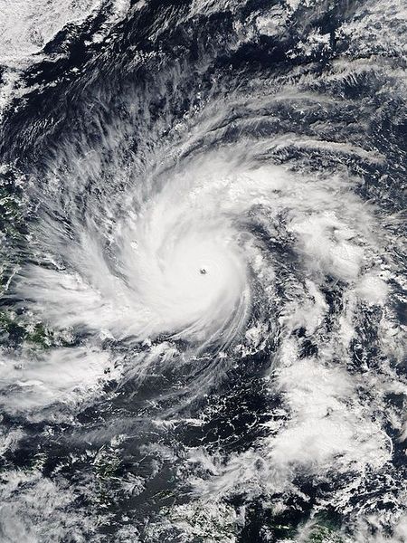
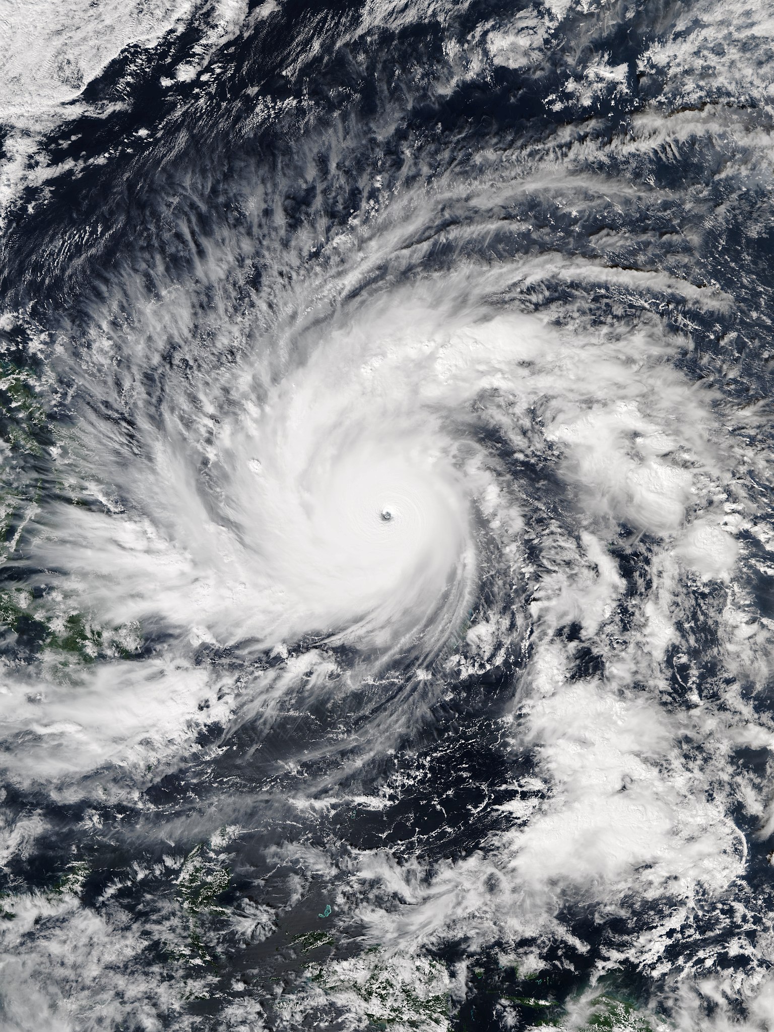
English: The Visible Infrared Imaging Radiometer Suite (VIIRS) sensor on Suomi-NPP captured this image of Typhoon Hagupit shortly before peak intensity on December 4, 2014, at 04:38 Universal Time. |
| Date | |
| Source | http://www.nnvl.noaa.gov/view/#TRUE?timespan=daily&date=2014-12-04&lat=9.8291366906481&lon=129.82947841727&zoom=4 |
| Author | VIIRS imagery from the Suomi NPP satellite operated by the National Oceanic and Atmospheric Administration |
| Other versions |
|

| Camera location | | View this and other nearby images on: OpenStreetMap |
|---|
Licensing
This image is in the public domain because it contains materials that originally came from the U.S. National Oceanic and Atmospheric Administration, taken or made as part of an employee's official duties.
|
File history
Click on a date/time to view the file as it appeared at that time.
| Date/Time | Thumbnail | Dimensions | User | Comment | |
|---|---|---|---|---|---|
| current | 15:54, 5 December 2014 | | 2,850 × 3,800 (3.61 MB) | Meow | User created page with UploadWizard |
File usage
The following pages on the English Wikipedia use this file (pages on other projects are not listed):
Global file usage
The following other wikis use this file:
- Usage on ca.wikipedia.org
- Usage on de.wikipedia.org
- Usage on es.wikipedia.org
- Usage on fr.wikipedia.org
- Usage on fr.wikinews.org
- Usage on ja.wikipedia.org
- Usage on ko.wikipedia.org
- Usage on nl.wikipedia.org
- Usage on no.wikipedia.org
- Usage on pt.wikipedia.org
- Usage on pt.wikinews.org
- Usage on ru.wikipedia.org
- Usage on th.wikipedia.org
- Usage on tl.wikipedia.org
- Usage on vi.wikipedia.org
- Usage on www.wikidata.org
- Usage on zh.wikipedia.org