
File:Hampshire and Hampden Canal map, 1831 - Anthony Finley.jpg
Size of this preview: 767 × 599 pixels. Other resolutions: 307 × 240 pixels | 615 × 480 pixels | 983 × 768 pixels | 1,280 × 1,000 pixels | 2,560 × 2,000 pixels | 3,644 × 2,847 pixels.
Original file (3,644 × 2,847 pixels, file size: 5.98 MB, MIME type: image/jpeg)
| This is a file from the Wikimedia Commons. Information from its description page there is shown below. Commons is a freely licensed media file repository. You can help. |
Summary
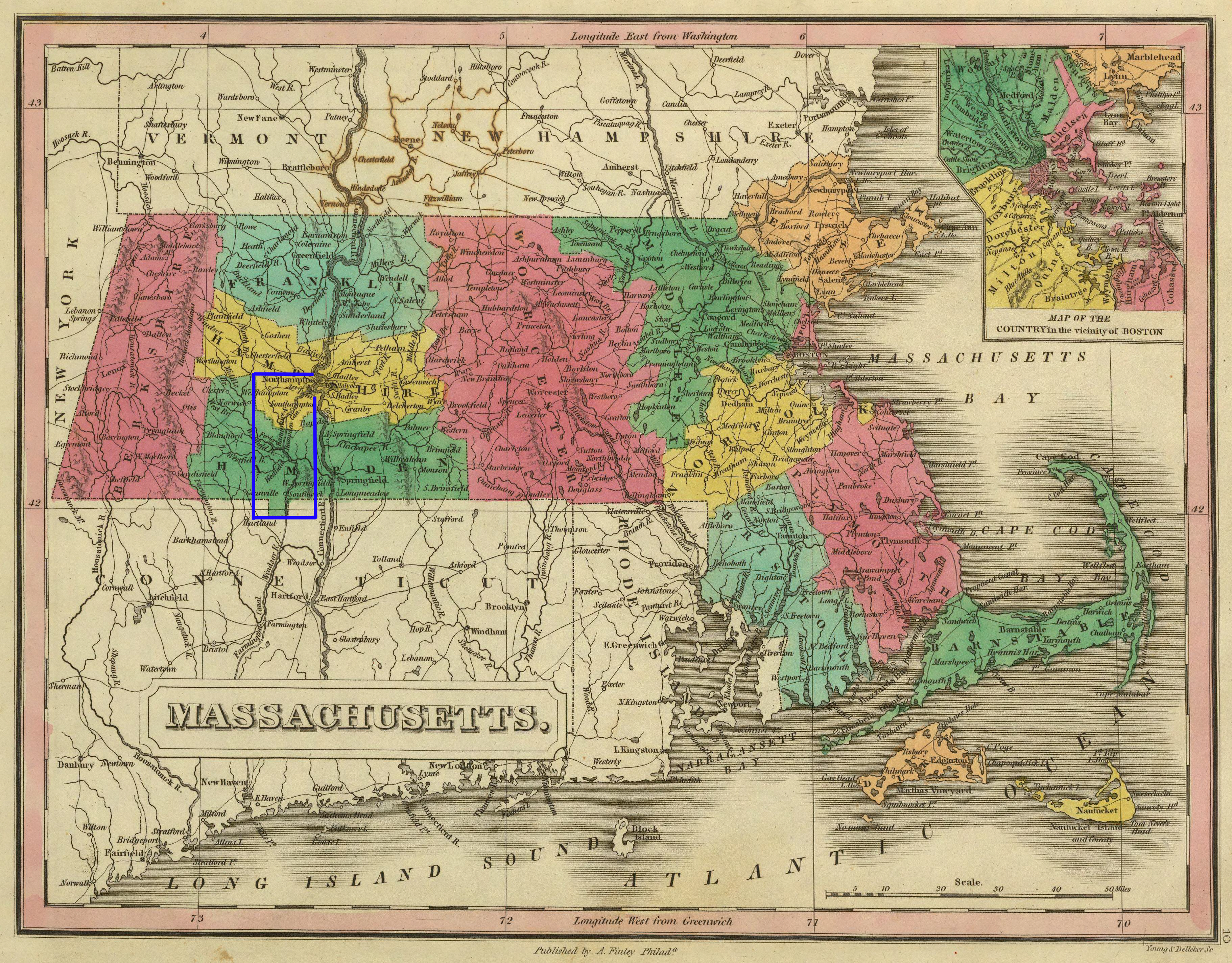
| Description | Map of Massachusetts, USA, and portions of neighboring states, with highlighting added for the Hampshire and Hampden Canal. |
| Date | |
| Source | "A New General Atlas", publisher Anthony Finley, Philadelphia, 1831. This map is on page 10. I added the highlighting. |
| Author | Author / mapmaker unknown. |
| Permission (Reusing this file) |
Public domain - author died more than 70 years ago. |
Licensing
|
This work is in the public domain in its country of origin and other countries and areas where the copyright term is the author's life plus 70 years or fewer. | |
| This file has been identified as being free of known restrictions under copyright law, including all related and neighboring rights. | |
File history
Click on a date/time to view the file as it appeared at that time.
| Date/Time | Thumbnail | Dimensions | User | Comment | |
|---|---|---|---|---|---|
| current | 11:48, 24 January 2007 | | 3,644 × 2,847 (5.98 MB) | Daderot | {{Information |Description=Map of Massachusetts, USA, and portions of neighboring states, with highlighting added for the Hampshire and Hampden Canal. |Source="A New General Atlas", publisher Anthony Finley, Philadelphia, 1831. This map is on page 10. I a |
File usage
The following page uses this file: