
File:Ile des Faisans vue de l'amont.jpg

Size of this preview: 800 × 600 pixels. Other resolutions: 320 × 240 pixels | 640 × 480 pixels | 1,024 × 768 pixels | 1,280 × 960 pixels | 2,560 × 1,920 pixels | 2,816 × 2,112 pixels.
Original file (2,816 × 2,112 pixels, file size: 2.34 MB, MIME type: image/jpeg)
| This is a file from the Wikimedia Commons. Information from its description page there is shown below. Commons is a freely licensed media file repository. You can help. |
Summary
| Description |
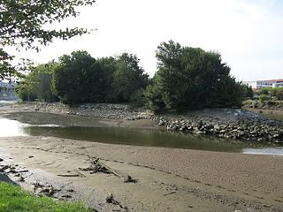
English: Pheasant Island seen from upstream.)
Français : Ile des Faisans vue de l'amont. |
| Date | |
| Source | Self-photographed |
| Author | Tangopaso |
| Camera location | | View this and other nearby images on: OpenStreetMap |
|---|
Licensing
| I, the copyright holder of this work, release this work into the public domain. This applies worldwide. In some countries this may not be legally possible; if so: I grant anyone the right to use this work for any purpose, without any conditions, unless such conditions are required by law. |
File history
Click on a date/time to view the file as it appeared at that time.
| Date/Time | Thumbnail | Dimensions | User | Comment | |
|---|---|---|---|---|---|
| current | 14:39, 7 November 2016 | | 2,816 × 2,112 (2.34 MB) | Tangopaso | == {{int:filedesc}} == {{Information |Description= {{en|1=Pheasant Island seen from upstream.)}} {{fr|1=Ile des Faisans vue de l'amont.}} |source={{sf}} |date=2016-09-22 |author=Tangopaso |permission= |other_versions= }} {{Location|4... |
File usage
No pages on the English Wikipedia use this file (pages on other projects are not listed).
Global file usage
The following other wikis use this file:
- Usage on fr.wikipedia.org
- Usage on hu.wikipedia.org