
File:Kalamazoo River Map.png
Size of this preview: 800 × 413 pixels. Other resolutions: 320 × 165 pixels | 640 × 331 pixels | 1,187 × 613 pixels.
Original file (1,187 × 613 pixels, file size: 65 KB, MIME type: image/png)
| This is a file from the Wikimedia Commons. Information from its description page there is shown below. Commons is a freely licensed media file repository. You can help. |
Summary
| Description |
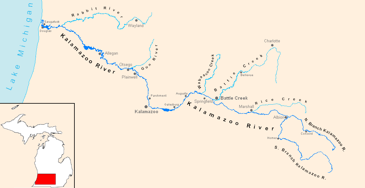
English: Created using MapMaker 3.5, Photoshop 6, and publicly available USGS data |
| Date | 8 February 2007 (original upload date) |
| Source | Transferred from en.wikipedia to Commons. |
| Author | Munion at English Wikipedia |
Licensing
| This work has been released into the public domain by its author, Munion at English Wikipedia. This applies worldwide. In some countries this may not be legally possible; if so: Munion grants anyone the right to use this work for any purpose, without any conditions, unless such conditions are required by law. |
Original upload log
The original description page was here. All following user names refer to en.wikipedia.
- 2007-06-19 00:35 Munion 1187×613× (66283 bytes) Created using state-provided GIS data.
- 2007-02-08 01:49 Munion 1207×692× (59248 bytes) Created using MapMaker 3.5, Photoshop 6, and publically available USGS data
File history
Click on a date/time to view the file as it appeared at that time.
| Date/Time | Thumbnail | Dimensions | User | Comment | |
|---|---|---|---|---|---|
| current | 04:50, 5 October 2013 | | 1,187 × 613 (65 KB) | OgreBot | (BOT): Reverting to most recent version before archival |
| 04:50, 5 October 2013 |  | 1,207 × 692 (58 KB) | OgreBot | (BOT): Uploading old version of file from en.wikipedia; originally uploaded on 2007-02-08 01:49:52 by Munion | |
| 07:48, 28 November 2012 |  | 1,187 × 613 (65 KB) | Urdangaray | {{Information |Description={{en|Created using MapMaker 3.5, Photoshop 6, and publicly available USGS data}} |Source=Transferred from [http://en.wikipedia.org en.wikipedia] |Date={{Original upload date|2007-02-08}} (first version); {{Original upload dat... |
File usage
No pages on the English Wikipedia use this file (pages on other projects are not listed).
Global file usage
The following other wikis use this file:
- Usage on arz.wikipedia.org
- Usage on ceb.wikipedia.org
- Usage on www.wikidata.org