
File:Karakash River IMG 3396.jpg
No higher resolution available.
Karakash_River_IMG_3396.jpg (800 × 533 pixels, file size: 97 KB, MIME type: image/jpeg)
| This is a file from the Wikimedia Commons. Information from its description page there is shown below. Commons is a freely licensed media file repository. You can help. |
Summary
| Description |
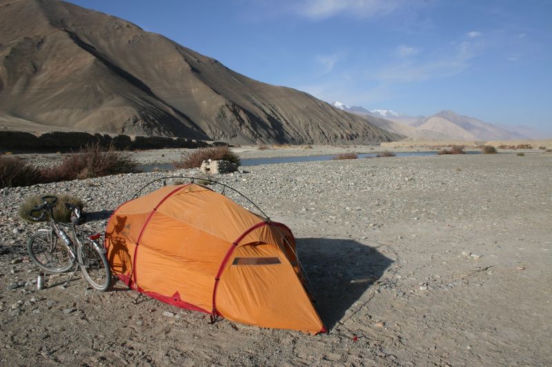
English: Camp next to Karakash River |
| Date | Taken on 10 October 2006, 07:34:20 |
| Source | https://www.flickr.com/photos/martinamor/272040296/ |
| Author | Nicolai Bangsgaard |
| Camera location | | View this and other nearby images on: OpenStreetMap |
|---|
The geographical information in this file was retrospectively estimated.
The location may therefore be somewhat imprecise. Verifying and refining these coordinates is strongly encouraged. |
- Notes about location estimate
- Previous photo in the Flickr photostream was taken within 20 seconds of this photo according to EXIF.
- That previous photo can be identified by the hill with white-ish corner on the right. This hill with white-ish corner is visible on satellite maps.
- This also aligns location-wise with other photos in the Flickr user's photostream.
- He was cycling along the G219 highway from Xinjiang to Tibet.
- Photo 2 days earlier is of Kirgizjangal Pass
- Photo 1 day later is at Dahongliutan
Licensing
This file is licensed under the Creative Commons Attribution 2.0 Generic license.
- You are free:
- to share – to copy, distribute and transmit the work
- to remix – to adapt the work
- Under the following conditions:
- attribution – You must give appropriate credit, provide a link to the license, and indicate if changes were made. You may do so in any reasonable manner, but not in any way that suggests the licensor endorses you or your use.
| This image was originally posted to Flickr by Nicolai Bangsgaard at https://flickr.com/photos/32885684@N00/272040296. It was reviewed on 4 July 2020 by FlickreviewR 2 and was confirmed to be licensed under the terms of the cc-by-2.0. |
File history
Click on a date/time to view the file as it appeared at that time.
| Date/Time | Thumbnail | Dimensions | User | Comment | |
|---|---|---|---|---|---|
| current | 19:14, 17 September 2022 | | 800 × 533 (97 KB) | Hubert Kororo | Reverted to version as of 22:42, 3 June 2021 (UTC), Commons:Overwriting existing files#DO NOT overwrite: Major changes (e.g. a radical crop) |
| 22:43, 3 June 2021 | 790 × 258 (58 KB) | Toddst1 | Reverted to version as of 22:40, 3 June 2021 (UTC) | ||
| 22:42, 3 June 2021 |  | 800 × 533 (97 KB) | Toddst1 | Reverted to version as of 06:57, 4 July 2020 (UTC) | |
| 22:40, 3 June 2021 | 790 × 258 (58 KB) | Toddst1 | cropped out the guy's holiday gear | ||
| 06:57, 4 July 2020 |  | 800 × 533 (97 KB) | Voidvector | Uploaded a work by Nicolai Bangsgaard from https://www.flickr.com/photos/martinamor/272040296/ with UploadWizard |
File usage
The following pages on the English Wikipedia use this file (pages on other projects are not listed):
Global file usage
The following other wikis use this file:
- Usage on arz.wikipedia.org
- Usage on ceb.wikipedia.org
- Usage on de.wikipedia.org
- Usage on es.wikipedia.org
- Usage on fa.wikipedia.org
- Usage on he.wikivoyage.org
- Usage on it.wikipedia.org
- Usage on lt.wikipedia.org
- Usage on pnb.wikipedia.org
- Usage on ro.wikipedia.org
- Usage on ru.wikipedia.org
- Usage on tr.wikipedia.org
- Usage on ug.wikipedia.org
- Usage on uk.wikipedia.org
- Usage on www.wikidata.org
- Usage on zh.wikipedia.org