
File:Karte Kanton Freiburg 2010.png
Size of this preview: 590 × 599 pixels. Other resolutions: 236 × 240 pixels | 472 × 480 pixels | 756 × 768 pixels | 1,008 × 1,024 pixels | 2,066 × 2,099 pixels.
Original file (2,066 × 2,099 pixels, file size: 948 KB, MIME type: image/png)
| This is a file from the Wikimedia Commons. Information from its description page there is shown below. Commons is a freely licensed media file repository. You can help. |
| Description |
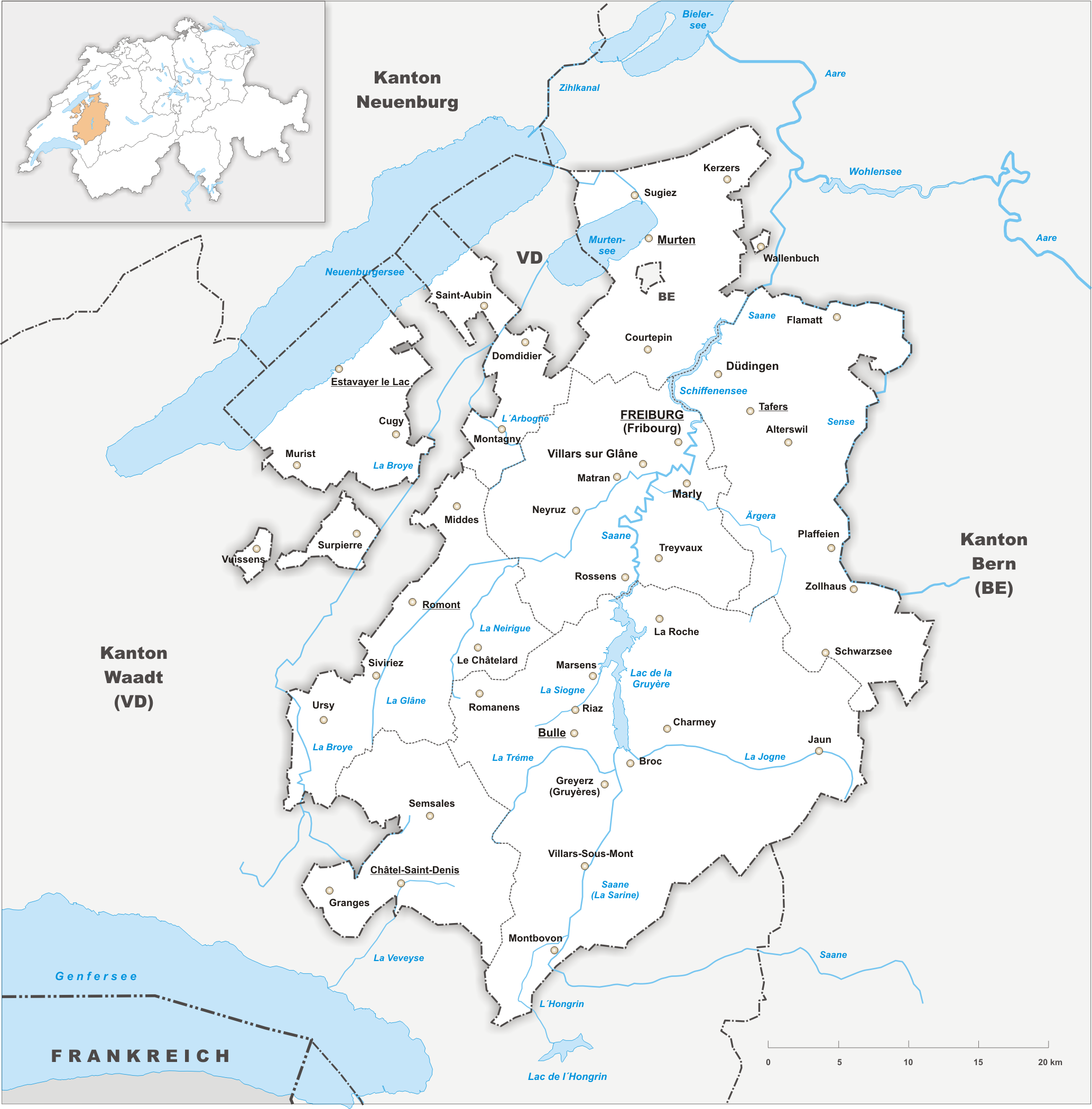
Deutsch: Karte des Kanton Freiburg. |
||||||||
| Date | |||||||||
| Source | Own work | ||||||||
| Author | Tschubby | ||||||||
| Permission (Reusing this file) |
I, the copyright holder of this work, hereby publish it under the following licenses:
This file is licensed under the Creative Commons Attribution-Share Alike 2.5 Generic, 2.0 Generic and 1.0 Generic license.
You may select the license of your choice. |

File history
Click on a date/time to view the file as it appeared at that time.
| Date/Time | Thumbnail | Dimensions | User | Comment | |
|---|---|---|---|---|---|
| current | 21:34, 15 March 2022 | | 2,066 × 2,099 (948 KB) | Delusion23 | Removed BE |
| 21:27, 15 March 2022 |  | 2,066 × 2,099 (949 KB) | Delusion23 | Clavaleyres now part of Fribourg | |
| 20:28, 22 October 2009 |  | 2,066 × 2,099 (1.09 MB) | Tschubby | {{Information |Description= |Source= |Date= |Author= |Permission= |other_versions= }} | |
| 20:13, 22 October 2009 |  | 2,066 × 2,099 (1.08 MB) | Tschubby | {{Information |Description= {{de| Karte des Kanton Freiburg.}} |Source={{own}} |Date= 22.10.2009 |Author= Tschubby |Permission= {{self|GFDL|Cc-by-sa-3.0-migrated|Cc-by-sa-2.5,2.0,1.0}} }} [[Category:Maps of t |
File usage
The following pages on the English Wikipedia use this file (pages on other projects are not listed):
Global file usage
The following other wikis use this file:
- Usage on ar.wikipedia.org
- Usage on ast.wikipedia.org
- Usage on be-tarask.wikipedia.org
- Usage on be.wikipedia.org
- Usage on bg.wikipedia.org
- Usage on ca.wikipedia.org
- Usage on ceb.wikipedia.org
- Usage on el.wikipedia.org
- Usage on eu.wikipedia.org
- Usage on gl.wikipedia.org
- Usage on hu.wikipedia.org
- Usage on ia.wikipedia.org
- Usage on ilo.wikipedia.org
- Usage on li.wikipedia.org
- Usage on lld.wikipedia.org
- Usage on lmo.wikipedia.org
- Usage on mk.wikipedia.org
- Usage on mzn.wikipedia.org
- Usage on nl.wikipedia.org
- Usage on oc.wikipedia.org
- Usage on sk.wikipedia.org
- Usage on sr.wikipedia.org
- Usage on th.wikipedia.org
- Usage on ur.wikipedia.org
- Usage on www.wikidata.org