
File:Lexington Michigan aerial view.jpg
Size of this preview: 800 × 558 pixels. Other resolutions: 320 × 223 pixels | 640 × 447 pixels | 1,024 × 715 pixels | 1,280 × 893 pixels | 1,500 × 1,047 pixels.
Original file (1,500 × 1,047 pixels, file size: 983 KB, MIME type: image/jpeg)
| This is a file from the Wikimedia Commons. Information from its description page there is shown below. Commons is a freely licensed media file repository. You can help. |
Summary
| Description |
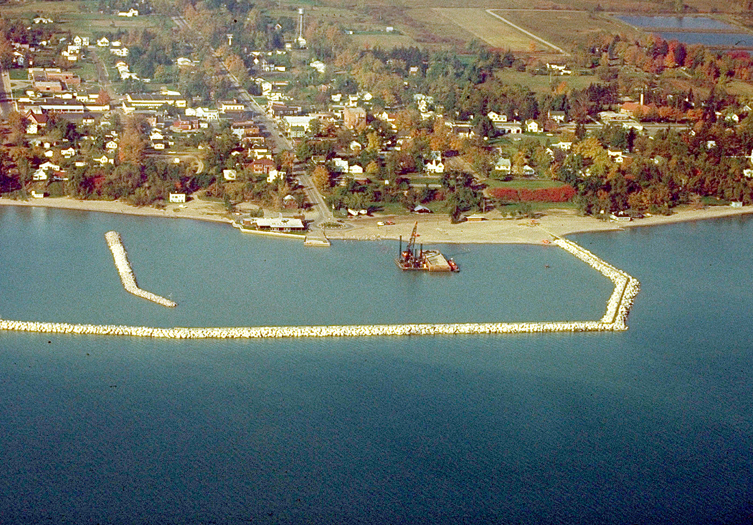
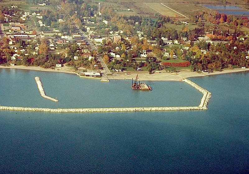
English: Aerial view of Lexington, Michigan, USA. The U.S. Army Corps of Engineers constructed the harbor and breakwater on Lake Huron. |
|||
| Date | Unknown date, but apparently not recent. | |||
| Source |
U.S. Army Corps of Engineers Digital Visual Library Image page Image description page Digital Visual Library home page |
|||
| Author | U.S. Army Corps of Engineers, photographer not specified or unknown | |||
| Permission (Reusing this file) |
|
|||
| Location | Lexington, Sanilac County, Michigan, USA |
| Camera location | | View this and other nearby images on: OpenStreetMap |
|---|
File history
Click on a date/time to view the file as it appeared at that time.
| Date/Time | Thumbnail | Dimensions | User | Comment | |
|---|---|---|---|---|---|
| current | 00:16, 30 March 2007 | | 1,500 × 1,047 (983 KB) | DanMS | {{Information | Description = {{en|Aerial view of Lexington, Michigan, USA. The U.S. Army Corps of Engineers constructed the harbor and breakwater on Lake Huron.}} | Source = U.S. Army Corps of Engineers Digital Visual Library<br />[http://imag |
File usage
The following pages on the English Wikipedia use this file (pages on other projects are not listed):
Global file usage
The following other wikis use this file:
- Usage on pl.wikipedia.org
- Usage on sv.wikipedia.org