
File:Mapa de Estremadura, por Tomás López (1756).jpg
Size of this preview: 732 × 599 pixels. Other resolutions: 293 × 240 pixels | 586 × 480 pixels | 938 × 768 pixels | 1,251 × 1,024 pixels | 1,529 × 1,252 pixels.
Original file (1,529 × 1,252 pixels, file size: 1.76 MB, MIME type: image/jpeg)
| This is a file from the Wikimedia Commons. Information from its description page there is shown below. Commons is a freely licensed media file repository. You can help. |
.jpg)
Summary
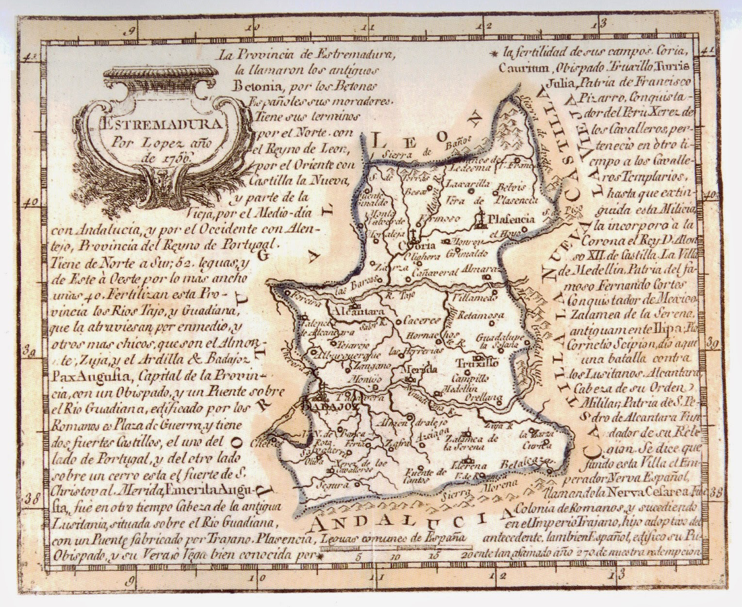
| Description | Map of Extremadura |
| Date | |
| Source | http://www.paseovirtual.net/america/#1 |
| Author | Tomás López |
Licensing
|
This work is in the public domain in its country of origin and other countries and areas where the copyright term is the author's life plus 100 years or fewer. | |
| This file has been identified as being free of known restrictions under copyright law, including all related and neighboring rights. | |
File history
Click on a date/time to view the file as it appeared at that time.
| Date/Time | Thumbnail | Dimensions | User | Comment | |
|---|---|---|---|---|---|
| current | 14:44, 7 July 2016 | | 1,529 × 1,252 (1.76 MB) | Alonso de Mendoza | Mejor |
| 21:27, 20 April 2009 |  | 750 × 628 (294 KB) | Rαge | elimino línea central, disimilo un poco el doblez | |
| 10:29, 13 July 2007 |  | 750 × 628 (102 KB) | Manuel.Frutos | {{Information |Description=Map of Extremadura |Source=http://www.paseovirtual.net/america/#1 |Date=1756 |Author=Thomas Lopez |Permission= |other_versions= }} |
File usage
The following pages on the English Wikipedia use this file (pages on other projects are not listed):
Global file usage
The following other wikis use this file:
- Usage on ast.wikipedia.org
- Usage on azb.wikipedia.org
- Usage on eo.wikipedia.org
- Usage on es.wikipedia.org
- Usage on fr.wikipedia.org
- Usage on pt.wikipedia.org
- Usage on qu.wikipedia.org
.jpg)