
File:Mt.Sobo.jpg

Size of this preview: 800 × 600 pixels. Other resolutions: 320 × 240 pixels | 640 × 480 pixels | 1,024 × 768 pixels | 1,280 × 960 pixels | 2,048 × 1,536 pixels.
Original file (2,048 × 1,536 pixels, file size: 643 KB, MIME type: image/jpeg)
| This is a file from the Wikimedia Commons. Information from its description page there is shown below. Commons is a freely licensed media file repository. You can help. |
Summary
| Description |
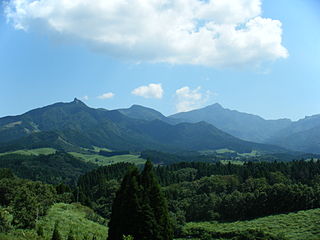
English: The WNW side of Mount Sobo (Sobosan) on the border between Oita and Miyazaki Prefectures, Japan.
日本語: 大分県と宮崎県にまたがる祖母山を西南西から望む。宮崎県西臼杵郡高千穂町の三秀台より。祖母山は右奥の峰。 |
| Date | |
| Source | Own work |
| Author | As6673 |
| Camera location | | View this and other nearby images on: OpenStreetMap |
|---|
Licensing
| I, the copyright holder of this work, release this work into the public domain. This applies worldwide. In some countries this may not be legally possible; if so: I grant anyone the right to use this work for any purpose, without any conditions, unless such conditions are required by law. |
| Annotations | This image is annotated: View the annotations at Commons |
File history
Click on a date/time to view the file as it appeared at that time.
| Date/Time | Thumbnail | Dimensions | User | Comment | |
|---|---|---|---|---|---|
| current | 00:57, 31 August 2009 | | 2,048 × 1,536 (643 KB) | As6673 | {{Information |Description={{en|1=Mt.Sobo}} {{ja|1=祖母山}} |Source=ownwork |Author=As6673 |Date=2009-08-31 |Permission= |other_versions= }} Category:Mountains of Miyazaki prefecture Category:Mountains of Oita prefecture |
File usage
The following pages on the English Wikipedia use this file (pages on other projects are not listed):
- List of Important Agricultural Heritage Systems (Japan)
- List of Japanese prefectures by highest mountain
- Mount Sobo
- Sobo, Katamuki and Okue Biosphere Reserve
- Sobo-Katamuki Quasi-National Park
- Sobo Katamuki Prefectural Natural Park (Miyazaki)
- Sobo Katamuki Prefectural Natural Park (Ōita)
- Takachiho, Miyazaki
Global file usage
The following other wikis use this file:
- Usage on arz.wikipedia.org
- Usage on ceb.wikipedia.org
- Usage on de.wikipedia.org
- Usage on es.wikipedia.org
- Usage on fa.wikipedia.org
- Usage on fr.wikipedia.org
- Usage on ig.wikipedia.org
- Usage on ja.wikipedia.org
- Usage on lld.wikipedia.org
- Usage on pl.wikipedia.org
- Usage on pnb.wikipedia.org
- Usage on uk.wikipedia.org
- Usage on vi.wikipedia.org
- Usage on www.wikidata.org
- Usage on zh.wikipedia.org