
File:NJ 47 Hsi-ning.jpg

Size of this preview: 551 × 600 pixels. Other resolutions: 220 × 240 pixels | 441 × 480 pixels | 706 × 768 pixels | 941 × 1,024 pixels | 1,882 × 2,048 pixels | 4,740 × 5,159 pixels.
Original file (4,740 × 5,159 pixels, file size: 7.66 MB, MIME type: image/jpeg)
| This is a file from the Wikimedia Commons. Information from its description page there is shown below. Commons is a freely licensed media file repository. You can help. |
Summary
| Description |
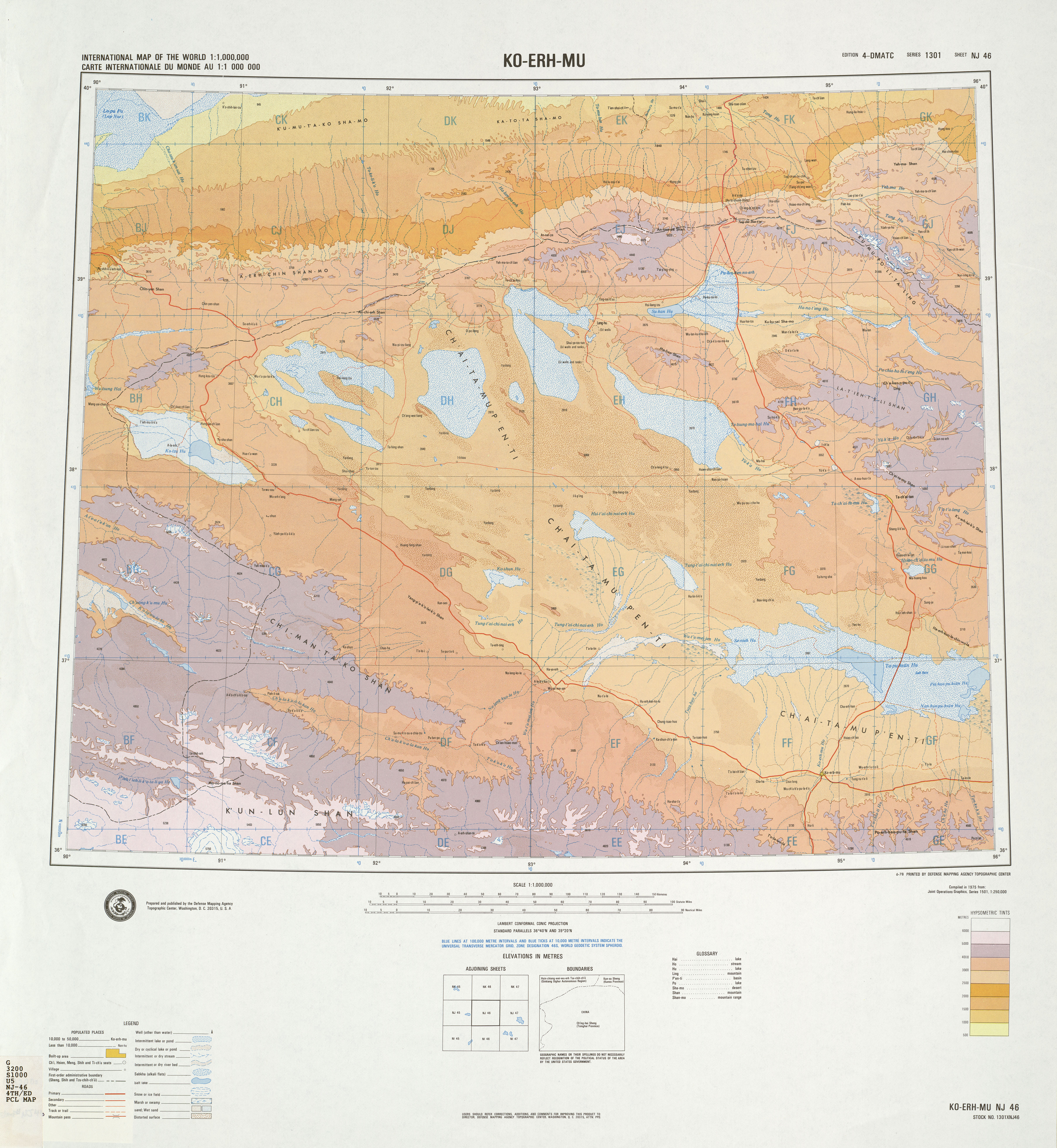
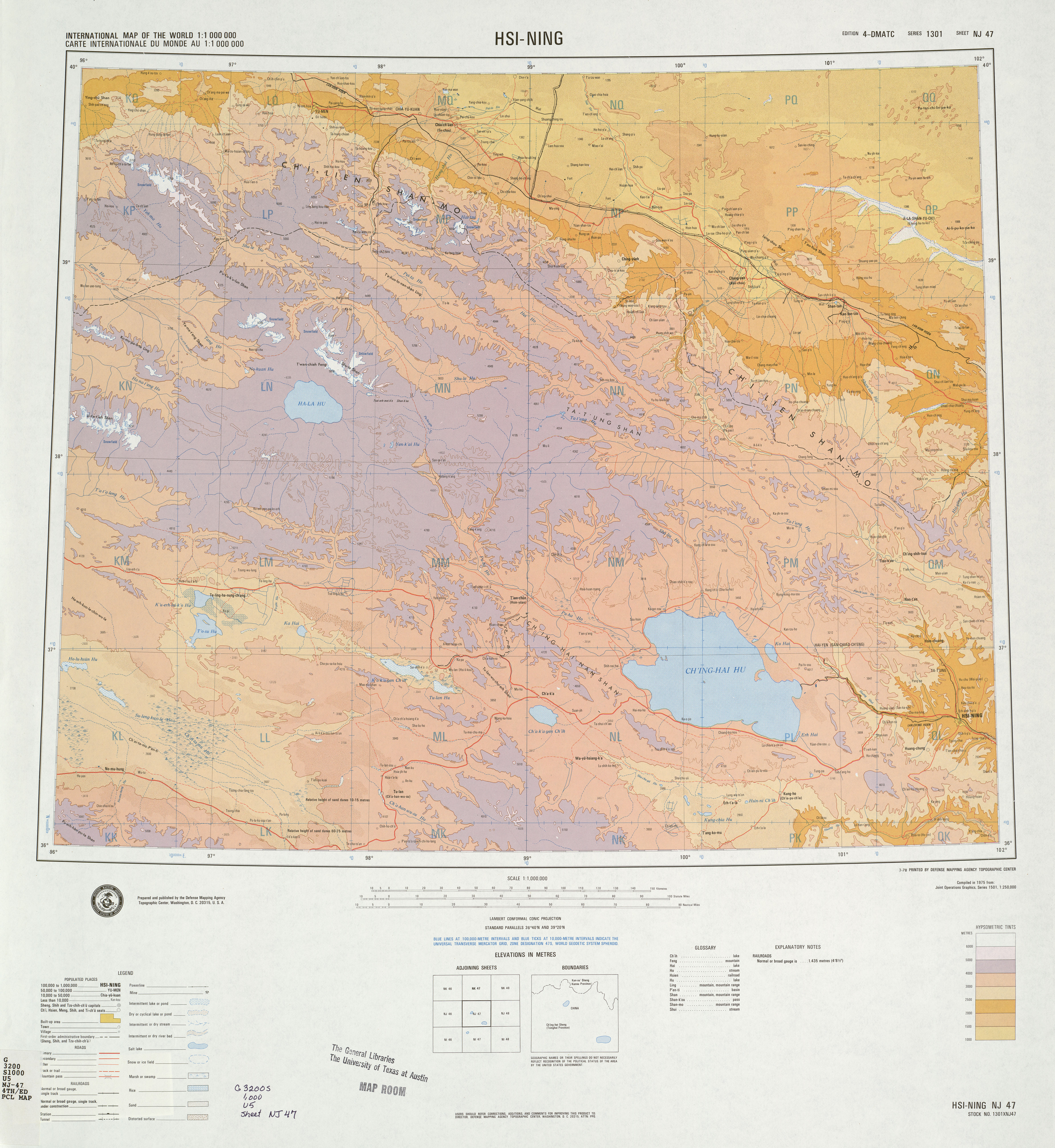
English: A map of the eastern Qaidam Basin, Qinghai Lake, and the area around Xining, Qinghai, China. Names given in Chinese using Wade–Giles romanization. Elevation given in meters above sea level. |
| Date | |
| Source | NJ-46: Ko-erh-mu & NJ-47: Hsi-ning, hosted at the University of Texas's Perry–Castañeda Library Map Collection (NJ 47 [1]) |
| Author | Topographic Center of the United States Defense Mapping Agency |
Licensing
This work is in the public domain in the United States because it is a work prepared by an officer or employee of the United States Government as part of that person’s official duties under the terms of Title 17, Chapter 1, Section 105 of the US Code.
Note: This only applies to original works of the Federal Government and not to the work of any individual U.S. state, territory, commonwealth, county, municipality, or any other subdivision. This template also does not apply to postage stamp designs published by the United States Postal Service since 1978. (See § 313.6(C)(1) of Compendium of U.S. Copyright Office Practices). It also does not apply to certain US coins; see The US Mint Terms of Use.
|
 | |
| This file has been identified as being free of known restrictions under copyright law, including all related and neighboring rights. | ||
File history
Click on a date/time to view the file as it appeared at that time.
| Date/Time | Thumbnail | Dimensions | User | Comment | |
|---|---|---|---|---|---|
| current | 07:24, 7 August 2019 | | 4,740 × 5,159 (7.66 MB) | LlywelynII | User created page with UploadWizard |
File usage
The following pages on the English Wikipedia use this file (pages on other projects are not listed):
Global file usage
The following other wikis use this file:
- Usage on en.wiktionary.org
- Usage on nl.wikipedia.org
- Usage on sl.wikipedia.org
- Usage on sr.wikipedia.org
- Usage on www.wikidata.org
- Usage on zh.wikipedia.org