
File:Williamson West Virginia aerial view.jpg
Size of this preview: 800 × 534 pixels. Other resolutions: 320 × 214 pixels | 640 × 427 pixels | 1,024 × 683 pixels | 1,500 × 1,001 pixels.
Original file (1,500 × 1,001 pixels, file size: 634 KB, MIME type: image/jpeg)
| This is a file from the Wikimedia Commons. Information from its description page there is shown below. Commons is a freely licensed media file repository. You can help. |
| Description |
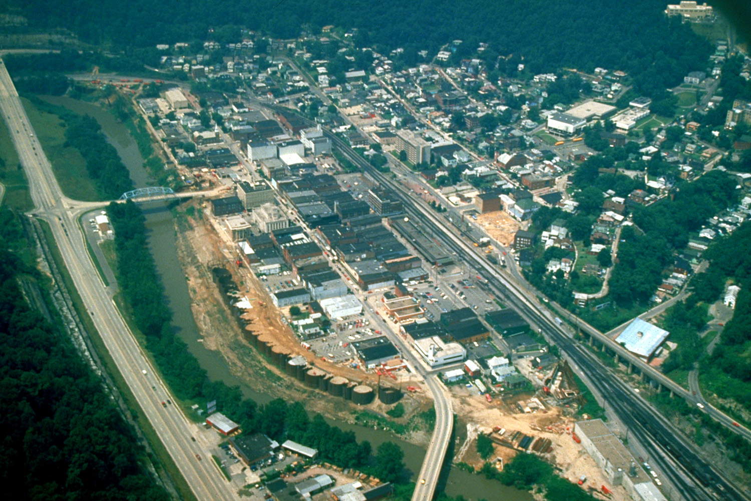
English: Aerial view of Williamson, West Virginia, USA. The border between West Virginia and Kentucky runs along the Tug Fork River, and the highway on the left is in the state of Kentucky. |
|||
| Date | or prior | |||
| Source |
U.S. Army Corps of Engineers Digital Visual Library Image page Image description page Digital Visual Library home page |
|||
| Author | U.S. Army Corps of Engineers, photographer not specified or unknown | |||
| Permission (Reusing this file) |
|
|||
| Location | Williamson, West Virginia, USA |
| Camera location | | View this and other nearby images on: OpenStreetMap |
|---|
File history
Click on a date/time to view the file as it appeared at that time.
| Date/Time | Thumbnail | Dimensions | User | Comment | |
|---|---|---|---|---|---|
| current | 01:42, 22 March 2007 | | 1,500 × 1,001 (634 KB) | DanMS | {{Information | Description = {{en|Aerial view of Williamson, West Virginia, USA. The border between West Virginia and Kentucky runs along the Tug Fork River, and the highway on the left is in the state of Kentucky.}} | Source = U.S. Army Corps |
File usage
The following pages on the English Wikipedia use this file (pages on other projects are not listed):
Global file usage
The following other wikis use this file:
- Usage on ru.wikipedia.org