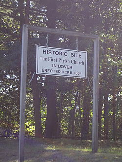
First Parish Church Site-Dover Point
First Parish Church Site-Dover Point | |
 | |
| Location | Dover Point Rd., Dover, New Hampshire |
|---|---|
| Coordinates | 43°8′26″N 70°50′21″W / 43.14056°N 70.83917°W |
| Area | 0.4 acres (0.16 ha) |
| Built | 1653 |
| Architect | Walderne,Richard |
| NRHP reference No. | 83001153[1] |
| Added to NRHP | May 27, 1983 |
The First Parish Church Site-Dover Point is a historic church site on Dover Point Road in Dover, New Hampshire. It is the site of the second meetinghouse of the First Parish Church, a congregation established in 1633. The meetinghouse was, according to surviving documentation, 40 feet (12 m) long and 26 feet (7.9 m) wide, and was built in 1653. In 1713 a new meetinghouse was built at "Pine Hill", where Dover's center is now located, and services were halted at this location around 1720. The building was demolished later in the 18th century. The site is located on the west side of Dover Point Road, and includes the foundations of a palisade and earthworks that once surrounded the church.[2]
The site was listed on the National Register of Historic Places in 1983.[1]
See also
References
- ^ a b "National Register Information System". National Register of Historic Places. National Park Service. March 13, 2009.
- ^ "NRHP nomination for First Parish Church Site-Dover Point". National Park Service. Retrieved 2014-08-08.
External links
- Archaeological sites on the National Register of Historic Places in New Hampshire
- Churches on the National Register of Historic Places in New Hampshire
- Churches in Strafford County, New Hampshire
- Buildings and structures in Dover, New Hampshire
- National Register of Historic Places in Strafford County, New Hampshire
- New Hampshire Registered Historic Place stubs
- New Hampshire church stubs


