
Geoje
Geoje
거제시 | |
|---|---|
| Korean transcription(s) | |
| • Hangul | 거제시 |
| • Hanja | 巨濟市 |
| • Revised Romanization | Geoje-si |
| • McCune-Reischauer | Kŏje-shi |
 Geoje beach | |
|
Emblem of Geoje | |
 | |
| Country | |
| Region | Yeongnam |
| Administrative divisions | 9 myeon, 10 dong |
| Area | |
| • Total | 401.63 km2 (155.07 sq mi) |
| Population (2009.05) | |
| • Total | 229,500 |
| • Density | 547/km2 (1,420/sq mi) |
| • Dialect | Gyeongsang |
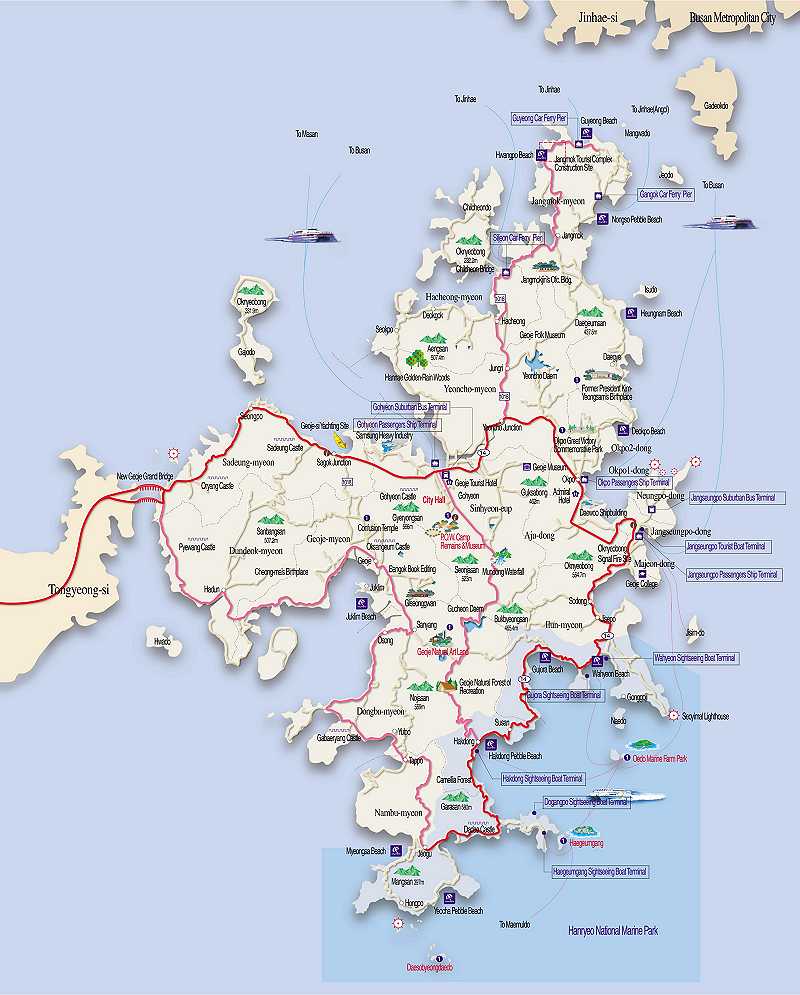
Geoje is a city located in South Gyeongsang province, just off the coast of the port city of Busan, South Korea. Daewoo Shipbuilding & Marine Engineering (former Daewoo Shipyard) in Okpo and Samsung Heavy Industries (SHI) in Gohyeon are both located on Geoje Island. The city also offers a wide range of tourist sights. The city is made up of a number of islands, of which by far the largest is Geoje Island.
History
In 757, Gyeongdeok of Silla classified the island as "Geoje-gun" (Geoje county). Modern Geoje is classified as a "si" (city). In 1170, Uijong of Goryeo secretly escaped to Geoje when Jung Jungbu raised a rebellion against him, instating his brother, Myeongjong as king. Geoje served as a strategic location in preparation of the naval forces for the Gihae Eastern Expedition (기해동정) of Tsushima Island in 1419 by the Korean general Yi Jong Mu. At the time of the Seven-Year War in 1592, admiral Yi Sun-sin gained a great naval victory against Japanese invaders near the town of Okpo in Geoje. Since then. Yi was referred to by his noble title, "Chung Mu Gong," which roughly translates into English as "Earner of Great National Respect."
In the Korean War (1950–53), the military government of General Douglas MacArthur used the island as a place for the settlement for 170,000 POWs, and a prison war camp measuring at 11,800,000 m² was established during these years. After the war, a portion (23,000 m2) was converted into a tourist attraction.[1]
The Geneva Convention of 1949 failed to foresee to the development of hardcore, organized prisoner groups on Geoje-do in 1951-52 or to provide protection for the captor nation in dealing with stubborn resistance, mainly as a result of the harsh treatment that the prisoners received from the military government.
Geography
Geoje city covers an area of 401.63 km², encompassing Geoje-do (383.44 km²) and 60 other small islets, of which 10 are inhabited.[2] The main island is joined to land by two bridges from nearby Tongyeong.
Climate
Geoje experiences a temperate climate, and temperatures reaching below zero degrees Celsius in winter are frequent during December to February. However, the island is kept relatively warm by the influence of warm ocean currents.
| Climate data for Geoje (1981−2010) | |||||||||||||
|---|---|---|---|---|---|---|---|---|---|---|---|---|---|
| Month | Jan | Feb | Mar | Apr | May | Jun | Jul | Aug | Sep | Oct | Nov | Dec | Year |
| Mean daily maximum °C (°F) | 7.3 (45.1) |
9.4 (48.9) |
13.2 (55.8) |
18.3 (64.9) |
22.6 (72.7) |
25.5 (77.9) |
27.6 (81.7) |
29.4 (84.9) |
26.4 (79.5) |
21.9 (71.4) |
15.4 (59.7) |
9.7 (49.5) |
18.9 (66.0) |
| Daily mean °C (°F) | 2.5 (36.5) |
4.3 (39.7) |
8.2 (46.8) |
13.2 (55.8) |
17.5 (63.5) |
21.0 (69.8) |
24.3 (75.7) |
25.6 (78.1) |
21.9 (71.4) |
16.6 (61.9) |
10.3 (50.5) |
4.7 (40.5) |
14.2 (57.6) |
| Mean daily minimum °C (°F) | −1.6 (29.1) |
−0.4 (31.3) |
3.2 (37.8) |
8.1 (46.6) |
12.7 (54.9) |
17.0 (62.6) |
21.6 (70.9) |
22.4 (72.3) |
18.1 (64.6) |
12.0 (53.6) |
5.6 (42.1) |
0.3 (32.5) |
9.9 (49.8) |
| Average precipitation mm (inches) | 41.0 (1.61) |
59.9 (2.36) |
113.8 (4.48) |
177.0 (6.97) |
235.1 (9.26) |
269.9 (10.63) |
426.4 (16.79) |
335.6 (13.21) |
200.7 (7.90) |
63.6 (2.50) |
54.7 (2.15) |
29.7 (1.17) |
2,007.3 (79.03) |
| Average precipitation days (≥ 0.1 mm) | 4.7 | 5.3 | 7.5 | 9.5 | 9.1 | 11.1 | 14.8 | 11.5 | 9.2 | 4.9 | 5.4 | 3.8 | 96.8 |
| Average relative humidity (%) | 53.6 | 53.4 | 56.5 | 59.0 | 65.2 | 71.7 | 78.1 | 74.6 | 70.9 | 65.2 | 61.2 | 55.4 | 63.7 |
| Mean monthly sunshine hours | 163.2 | 178.6 | 201.3 | 216.8 | 232.2 | 187.2 | 147.3 | 183.1 | 172.5 | 206.2 | 165.9 | 167.9 | 2,204.9 |
| Source: Korea Meteorological Administration [3] | |||||||||||||
Demographics
Geoje had a population of 219,500 according to the whitebook published by Goeje City in July 2008. A significant portion of the population depends on shipbuilding to support their livehood, and this can be evidenced by the fact that nearly 33% of workers are employed in the shipbuilding industry.
Tourism
Geoje offers a variety of attractions, including Oedo (located 4 km from Geoje), a marine western-style botanical garden in Hallyeo-Haesang National Park, built by Lee Chang-ho and his wife when they settled on the island in 1969.
Tourists also visit Jisim-do for trekking. Jisim is known for its Camellia vegetation. However, the Maemi typhoon in 2003 severely affected the island's plant life. Another popular tourist attraction, Haegeumgang-do (located southeast of Geoje) hosts the Sipja Donggul Cave. Buddhist and Shamanist sculptures can be found in the cave.
Islands of Geoje city
Sister cities
See also
References
- ^ http://www.visitkorea.or.kr/eng/info_db/dest/sight_detail.jsp?seqno=4066
- ^ http://i.b5z.net/i/u/1628001/i/Map_low_1.jpg
- ^ "평년값자료(1981−2010) 거제(294)". Korea Meteorological Administration. Retrieved 2011-05-02.
