Hamilton West, New Zealand
Hamilton West | |
|---|---|
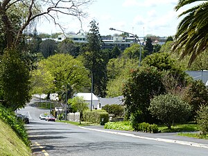
 Radnor Street in Hamilton West, Hamilton. | |
 | |
| Country | New Zealand |
| City | Hamilton, New Zealand |
| Electoral ward | Hamilton West |
| Population (2006 Census) | |
• Total | 3,876 |
| Hamilton Central | ||
| Dinsdale |
|
Hamilton East |
| Melville |
Hamilton West, also known as Hamilton Lake, is a suburb in western Hamilton in New Zealand.[1]
Hamilton Lake (aka Lake Rotoroa) is located to the west. To the east is the Waikato River and the Victoria Bridge, which links with Hamilton East on the other side of the river. To the north are Hamilton Central (the business and shopping centre of the city) and then Hamilton North. To the south is the suburb of Melville.
Hamilton West School, a primary school established in 1864, is located here.[2]
Hamilton West is located close to the central part of the city of Hamilton, known as Hamilton Central, where notable attractions bordering on Hamilton West include Waikato Museum and St Peter's Cathedral, the Anglican cathedral for the Diocese of Waikato, both on Victoria Street.
The former office of the Waikato District Hospital and Charitable Aid Board, now Diggers Bar and Café is located in the suburb.[3]
See also
References
- ^ "Hamilton Map". Hamilton City Council. Retrieved 18 September 2010.
- ^ Hamilton West School, Hamilton, New Zealand.
- ^ AA Maps Retrieved January 2012
