
Hula Valley

The Hula Valley (Hebrew: עמק החולה, Emek HaHula) is an agricultural region in northern Israel with abundant fresh water. It is an important bottleneck site for birds migrating along the Syrian-African Rift Valley between Africa, Europe, and Asia
Lake Hula (the Biblical Lake Merom) and its surrounding swamps were drained in the 1950s as an attempt to alter the environment to suit agricultural needs. Though initially perceived as a great national achievement for Israel, with time it became evident that the benefits from transforming the "wasteland" of Lake Hula and its swamps were limited. In the past few years, following nearly 50 years of an unsuccessful struggle to utilize the drained valley's resources, the Israeli government has finally recognized that successful development can endure only if a balanced compromise between nature and development is reached. Thus, a small section of the former lake and swamp region was recently reflooded in an attempt to prevent further soil deterioration and to revive the nearly extinct ecosystem.
Topography
The Hula Valley lies within the northern part of the Syrian-African Rift Valley at an elevation of about 70 metres above sea level, and covers an area of 177 square kilometres (25 km by 6-8 km).
On both sides of the valley are steep slopes: the Golan Heights to the east and the Upper Galilee's Naftali mountains to the west rise to 400 to 900 metres above sea level.
Basaltic hills of about 200 metres above sea level along the southern side of the valley intercept the Jordan River, and are commonly referred to as the basalt "plug" (actually a temporary geologic base level), as they restrict water drainage downstream into the Sea of Galilee.
Climate
The Hula Valley has a Mediterranean climate of hot dry summers and cool rainy winters Although its enclosure within two mountain ranges leads to more extreme seasonal and daily temperature fluctuations.
Annual rainfall varies greatly between different parts of the valley and ranges from about 400 millimetres in the south of the valley, to up to 800 millimetres in the north of the valley .
More than 1,500 millimetres of precipitation falls on the Hermon mountain range (mostly in the form of snow), feeding underground springs, including the sources of the Jordan River, all eventually flowing through the valley.
The wind regime is dominated by regional patterns in the winter with occasional strong north-easterly wind storms known in Arabic as Sharkiyah.
Names
Lake Hula was historically referred to by several different names. The 14th century BCE Egyptians called the lake Samchuna, while the Hebrew Bible records it as Merom. In the 1st century CE, the Jewish-Roman historian Flavius Josephus termed it Semechonitis, while in the Talmud it is called Yam Sumchi - i.e. Sea of Sumchi. Currently the lake is called Buheirat el Huleh in Arabic and Agam ha-Hula in Hebrew, stemming from the Aramaic Hulata or Ulata.
The "Waters of Merom" has sometimes been used erroneously in scientific literature, although that term refers specifically to springs on the western side of the valley.
History
Prior to its drainage in the 1950s, Lake Hula was 5.3 kilometres long and 4.4 kilometres wide, extending over 12-14 square kilometres. It was about one and a half metres deep in summer and three metres deep in winter.
The lake attracted human settlement from early prehistoric times. Paleolithic archaeological remains were found near the Bnot Yaakov ("Daughters of Jacob") bridge at the southern end of the valley. The first permanent settlement, Enan (Mallaha), dates from 9,000-10,000 years ago and was discovered in the valley.
The Hula Valley was a main junction on the important trade route connecting the large commercial centre of Damascus with the eastern Mediterranean coast and Egypt. During the Bronze Age, the cities of Hazor and Laish were built at key locations on this route approximately 4,000 years ago. At the end of the 13th century BCE, the Israelite tribe of Dan destroyed the city of Laish and built in its place a new city which they named Dan, and for about 400 years, the Israelites ruled over the Hula Valley until it was captured by the Assyrian armies of Tiglath-Pileser III and its inhabitants were driven away. The Bible records the lake "Merom" as the site of a victory of Joshua over the Canaanites.[1]
Throughout the Hellenistic, Roman, Byzantine and early Arab periods (fourth century BCE to eighth centuries CE) rural settlement in the Hula Valley was uninterrupted. During the Seleucid Empire, the town Seleucia Samulias was founded on the lake shore.
Traditional crops were rice (as early as the Hellenistic period), cotton and sugar cane (Brought by the Arabs following their conquest in 636), sorghum and maize. Water buffalo were introduced in the eighth century supplying milk and serving as beasts of burden.
The first modern Jewish settlement in the Hula Valley, Yesod HaMa'ala on the western shore of the lake, was established in 1883 during the first aliyah. In total, by 1948 there were 12 Jewish and 23 Arab settlements in the Hula Valley. Following the establishment of Israel and the 1948 Arab-Israeli War, the Arab inhabitants fled the valley to neighbouring Arab countries.
The Drainage of the Lake
The draining operations, carried out by the Jewish National Fund (JNF), began in 1951 and were completed by 1958. It was achieved by two main engineering operations: The deepening and widening of the Jordan River downstream; and two newly-dug peripheral canals diverting the Jordan at the north of the valley.
As concern was voiced by scientists and naturalists who opposed the project because they viewed the swamps as an ecological treasure that must be preserved for future generations, a small (3.50 km²) area of papyrus swampland in the southwest of the valley was set aside and in 1963, became Israel's first nature reserve.
Lake Agmon
Lake Agmon, located in the southern part of the Hula Valley in the area that once served as the transition between Lake Hula and the surrounding swamps was created as part of the rehabilitation program of the valley. This new lake is shallower and much smaller than the original lake. It has an irregular shape, covering an area of one square kilometre with mostly less than one metre depth of water. Several smaller islands were created in the middle of the lake, to provide protected nesting sites for birds.
-
-
 Water buffalo are kept as livestock in the swamps; their grazing also helps maintain habitat diversity.
 -
![Swamp turtles[verification needed]](//upload.wikimedia.org/wikipedia/commons/thumb/0/0f/Hulah_Valley%2C_Israel%2C_Swamp_Turtle.jpg/120px-Hulah_Valley%2C_Israel%2C_Swamp_Turtle.jpg) Swamp turtles[verification needed]
Swamp turtles[verification needed] -
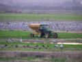
 Wheat in the Hula valley, 2007


![Swamp turtles[verification needed]](/wiki/File:Hulah_Valley,_Israel,_Swamp_Turtle.jpg)

References
- ^ Josh. 11:5-7
See also
Species that became extinct by the drainng of the lake:
Sources
- Lake Hula and Lake Agmon, Jewish Virtual Library
- Photos of Hulah Valley
- Photos of Hulah Valley