Iraí
From Wikipedia, the free encyclopedia
Place in South, Brazil
Iraí | |
|---|---|
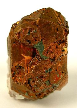
 Native copper from Iraí | |
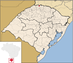
 Location in Rio Grande do Sul State | |
| Coordinates: 27°11′31.5″S 53°15′15.6″W / 27.192083°S 53.254333°W / -27.192083; -53.254333 | |
| Country | Brazil |
| Region | South |
| State | State of Rio Grande do Sul |
| Founded | September 1, 1933 |
| Area | |
| • Total | 181 km2 (70 sq mi) |
| Elevation | 123 m (404 ft) |
| Population (2020 [1]) | |
| • Total | 7,141 |
| • Density | 44.64/km2 (115.6/sq mi) |
| Demonym | Iraiense |
| Time zone | UTC−3 (BRT) |
| Website | http://www.irai.rs.gov.br/ |
Iraí is a municipality in the state of Rio Grande do Sul, Brazil.
See also[edit]
References[edit]
Wikimedia Commons has media related to Iraí.
| International | |
|---|---|
| National | |
 | This geographical article relating to Rio Grande do Sul is a stub. You can help Wikipedia by expanding it. |
Retrieved from "https://en.wikipedia.org/w/index.php?title=Iraí&oldid=1114479642"


