Japorã
Appearance
Japorã | |
|---|---|
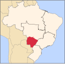
 Location in Mato Grosso do Sul state | |
| Coordinates: 23°53′27″S 54°24′14″W / 23.89083°S 54.40389°W | |
| Country | Brazil |
| Region | Central-West |
| State | Mato Grosso do Sul |
| Area | |
• Total | 420 km2 (160 sq mi) |
| Population (2020 [1]) | |
• Total | 9,243 |
| • Density | 22/km2 (57/sq mi) |
| Time zone | UTC−4 (AMT) |
Japorã is a municipality located in the Brazilian state of Mato Grosso do Sul. Its population was 9,243 (2020) and its area is 420 km2.
References
[edit]


