
Kansas, Alabama
Kansas, Alabama | |
|---|---|
 Location of Kansas in Walker County, Alabama. | |
| Coordinates: 33°54′11″N 87°33′24″W / 33.90306°N 87.55667°W | |
| Country | United States |
| State | Alabama |
| County | Walker |
| Area | |
| • Total | 1.02 sq mi (2.64 km2) |
| • Land | 1.02 sq mi (2.63 km2) |
| • Water | 0.00 sq mi (0.01 km2) |
| Elevation | 459 ft (140 m) |
| Population (2020) | |
| • Total | 180 |
| • Density | 176.99/sq mi (68.36/km2) |
| Time zone | UTC-6 (Central (CST)) |
| • Summer (DST) | UTC-5 (CDT) |
| ZIP code | 35573 |
| Area code(s) | 205, 659 |
| FIPS code | 01-39280 |
| GNIS feature ID | 0121084 |
Kansas is a town in Walker County, Alabama, United States. It incorporated in 1956.[2] At the 2010 census the population was 226, down from 260 in 2000.
History[edit]
A post office called Kansas has been in operation since 1855.[3] The town was named after the Kansas Territory.[4]
Geography[edit]
Kansas is located at 33°54′11″N 87°33′24″W / 33.90306°N 87.55667°W (33.903168, -87.556716).[5]
According to the U.S. Census Bureau, the town has a total area of 1.0 square mile (2.6 km2), all land.
Demographics[edit]
| Census | Pop. | Note | %± |
|---|---|---|---|
| 1960 | 211 | — | |
| 1970 | 227 | 7.6% | |
| 1980 | 267 | 17.6% | |
| 1990 | 230 | −13.9% | |
| 2000 | 260 | 13.0% | |
| 2010 | 226 | −13.1% | |
| 2020 | 180 | −20.4% | |
| U.S. Decennial Census[6] 2013 Estimate[7] | |||
As of the census[8] of 2000, there were 260 people, 117 households, and 80 families residing in the town. The population density was 260.0 inhabitants per square mile (100.4/km2). There were 128 housing units at an average density of 128.0 per square mile (49.4/km2). The racial makeup of the town was 99.23% White, 0.38% Asian, and 0.38% from two or more races.
There were 117 households, out of which 25.6% had children under the age of 18 living with them, 53.0% were married couples living together, 12.0% had a female householder with no husband present, and 31.6% were non-families. 26.5% of all households were made up of individuals, and 12.8% had someone living alone who was 65 years of age or older. The average household size was 2.22 and the average family size was 2.69.
In the town, the population was spread out, with 19.2% under the age of 18, 8.8% from 18 to 24, 25.0% from 25 to 44, 28.8% from 45 to 64, and 18.1% who were 65 years of age or older. The median age was 42 years. For every 100 females, there were 85.7 males. For every 100 females age 18 and over, there were 81.0 males.
The median income for a household in the town was $23,021, and the median income for a family was $24,167. Males had a median income of $25,000 versus $21,750 for females. The per capita income for the town was $13,416. About 16.3% of families and 16.4% of the population were below the poverty line, including 21.2% of those under the age of eighteen and 21.6% of those 65 or over.
References[edit]
- ^ "2020 U.S. Gazetteer Files". United States Census Bureau. Retrieved October 29, 2021.
- ^ "Praying for Kansas, Alabama | City on Its Knees". Archived from the original on October 24, 2013. Retrieved March 21, 2016.
- ^ "Walker County". Jim Forte Postal History. Retrieved March 2, 2015.
- ^ "Towns named after states". Reading Eagle. July 2, 1897. p. 3. Retrieved October 14, 2015.
- ^ "US Gazetteer files: 2010, 2000, and 1990". United States Census Bureau. February 12, 2011. Retrieved April 23, 2011.
- ^ "U.S. Decennial Census". Census.gov. Retrieved June 6, 2013.
- ^ "Annual Estimates of the Resident Population: April 1, 2010 to July 1, 2013". Archived from the original on May 22, 2014. Retrieved June 3, 2014.
- ^ "U.S. Census website". United States Census Bureau. Retrieved January 31, 2008.
33°54′11″N 87°33′24″W / 33.903168°N 87.556716°W
Municipalities and communities of Walker County, Alabama, United States | ||
|---|---|---|
| Cities | 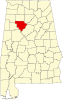 | |
| Towns | ||
| Unincorporated communities | ||
| Footnotes | ‡This populated place also has portions in an adjacent county or counties | |
| Authority control databases: Geographic |
|---|