
Lewisville, North Carolina
Lewisville, North Carolina | |
|---|---|
 Location of Lewisville, North Carolina | |
| Country | United States |
| State | North Carolina |
| County | Forsyth |
| Area | |
| • Total | 10.8 sq mi (28.1 km2) |
| • Land | 10.7 sq mi (27.8 km2) |
| • Water | 0.1 sq mi (0.3 km2) |
| Elevation | 988 ft (301 m) |
| Population (2010) | |
| • Total | 12,639 |
| • Density | 822.0/sq mi (317.4/km2) |
| Time zone | UTC-5 (Eastern (EST)) |
| • Summer (DST) | UTC-4 (EDT) |
| ZIP code | 27023 |
| Area code | 336 |
| FIPS code | 37-38040Template:GR |
| GNIS feature ID | 1027418Template:GR |
| Website | www.lewisvillenc.net |
Lewisville is a village in Forsyth County, North Carolina, United States. The population was 12,639 at the 2010 census. It is a Piedmont Triad community.
Geography
Lewisville is located at 36°5′53″N 80°24′58″W / 36.09806°N 80.41611°W (36.098087, -80.416030)Template:GR.
According to the United States Census Bureau, the town has a total area of 10.9 square miles (28 km2), of which, 10.7 square miles (28 km2) of it is land and 0.1 square miles (0.26 km2) of it (1.01%) is water.
Demographics
As of the censusTemplate:GR of 2000, there were 8,826 people, 3,341 households, and 2,676 families residing in the town. The population density was 822.0 people per square mile (317.3/km²). There were 3,501 housing units at an average density of 326.0 per square mile (125.9/km²). The racial makeup of the town was 93.11% White, 4.19% African American, 0.19% Native American, 1.34% Asian, 0.54% from other races, and 0.62% from two or more races. Hispanic or Latino of any race were 1.23% of the population.
There were 3,341 households out of which 40.0% had children under the age of 18 living with them, 70.5% were married couples living together, 7.4% had a female householder with no husband present, and 19.9% were non-families. 16.6% of all households were made up of individuals and 4.7% had someone living alone who was 65 years of age or older. The average household size was 2.64 and the average family size was 2.98.
In the town the population was spread out with 26.8% under the age of 18, 5.8% from 18 to 24, 31.7% from 25 to 44, 27.5% from 45 to 64, and 8.2% who were 65 years of age or older. The median age was 38 years. For every 100 females there were 98.0 males. For every 100 females age 18 and over, there were 92.6 males.
The median income for a household in the town was $64,571, and the median income for a family was $72,250. Males had a median income of $50,229 versus $34,496 for females. The per capita income for the town was $29,999. About 1.6% of families and 2.5% of the population were below the poverty line, including 2.0% of those under age 18 and 3.0% of those age 65 or over.
Education
Public schools in Lewisville are managed by the Winston-Salem/Forsyth County Schools school district.
Intentionally Small Town
As with many suburbs, the driving force for the incorporation of Lewisville was to prevent annexation by the large city of the county, (Winston-Salem, North Carolina). However, Lewisville's early formation and its current approach to planning and growth was also influenced by the problems encountered by its neighboring suburb, Clemmons, North Carolina, which was noted for over commercialization of its downtown area. Lewisville responded with planning that included a ban on drive through restaurants, a downtown park and other features aimed at preserving a small town feel.
Notable residents
- Chris Paul (b. 1985) – NBA player; was born in Lewisville.[1]
- Austin Dillon (b. 1990) – NASCAR driver.
- Neal Hendrix (b. 1973) American Professional Skateboarder.
References
External links
Municipalities and communities of Forsyth County, North Carolina, United States | ||
|---|---|---|
| Cities | 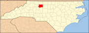 | |
| Towns | ||
| Villages | ||
| Townships | ||
| CDP | ||
| Unincorporated communities | ||
| Footnotes | ‡This populated place also has portions in an adjacent county or counties | |