
Lički Osik
Lički Osik | |
|---|---|
Village | |
 Lički Osik Location of Lički Osik in Croatia | |
| Coordinates: 44°36′13″N 15°25′27″E / 44.60361°N 15.42417°E | |
| Country | |
| County | Lika-Senj |
| Municipality | Gospić |
| Area | |
| • Total | 717 km2 (277 sq mi) |
| Elevation | 575 m (1,886 ft) |
| Population (2011)[1] | |
| • Total | 1,914 |
| Time zone | UTC+1 (CET) |
| • Summer (DST) | UTC+2 (CEST) |
| Area code | (+385) 053 |
Lički Osik is a village in Croatia situated 8 km north-east from Gospić. It is connected by the D25 highway. There is a football club, NK Croatia Lički Osik, which was founded in 1951.
Demographics
According to the 2011 census,[1] the village of Lički Osik has 1914 inhabitants. This represents 66.34% of its pre-war population according to the 1991 census.
The 1991 census[2] recorded that 54.42% of the village population were ethnic Serbs (1570/2885), 40.07% were Croats (1156/2885), 3.09% were Yugoslavs (89/2885) while 2.42% were of other ethnic origin (70/2885).
Sources: Croatian Bureau of Statistics
- NOTE: The 1981 and 1991 figures include Budak population.
Notable natives and residents
This section is empty. You can help by adding to it. (July 2018) |
Gallery
-
 Park and primary school in Lički Osik
 -
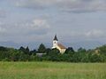 Roman Catholic church in Lički Osik


References
- ^ a b c "Population by Age and Sex, by Settlements, 2011 Census: Lički Osik". Census of Population, Households and Dwellings 2011. Zagreb: Croatian Bureau of Statistics. December 2012.
- ^ Izdanje Državnog zavoda za statistiku RH: Narodnosni sastav stanovništva RH od 1880-1991. godine.
- ^ Naselja i stanovništvo Republike Hrvatske 1857-2001, www.dzs.hr
44°36′13″N 15°25′27″E / 44.60361°N 15.42417°E
This Lika-Senj County geography article is a stub. You can help Wikipedia by expanding it. |