
List of highest counties in the United States

The following table ranks the 50 highest United States counties or county-equivalents[a] by mean elevation.[b] This list uses the "mean of extremes" elevation which is the arithmetic mean of the highest and lowest elevations.
Lake County, Colorado has the highest U.S. county mean elevation of 11,702 feet (3,567 m). Lake County is the home of Mount Elbert and Mount Massive, the two highest summits of the Rocky Mountains of the United States and Canada. Lake County is also the home of the highest U.S. county low point, the Arkansas River at the Chaffee County line with an elevation of 8,965 feet (2,733 m).
With the highest mountain of all North America, the Denali Borough of Alaska has both the highest U.S. county high point, the summit of Denali at 20,310 feet (6,190.5 m) elevation, and the greatest U.S. county elevation range of 19,925 feet (6,073 m).
Of these 50 highest U.S. counties, 34 counties are located in Colorado, four counties in Wyoming, four counties in New Mexico, three counties in Utah, two boroughs in Alaska, and one county each in California, Idaho, and Nevada.
Highest U.S. counties[edit]
Gallery[edit]
-

-

-

-

-

-
-

-
-

-

-
 Denali in Denali Borough, Alaska (14)
 -
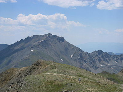
 Conejos Peak in Conejos County, Colorado (15)
 -

-
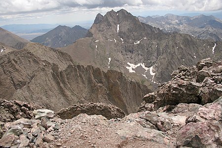
 Mount Sneffels in Ouray County, Colorado (17)
 -


_-_2006-07-16.jpg)

_July_2016.jpg)


See also[edit]
- Lists of counties in the United States
- Lists of highest points
- Geography of the United States
- Outline of the United States
Notes[edit]
- ^ a b c Forty-eight U.S. states have counties, Louisiana has parishes, and Alaska has boroughs and census areas in the Unorganized Borough. The entire District of Columbia is considered a county-equivalent, as are the 38 independent cities of Virginia, and the independent cities of Baltimore, Maryland, St. Louis, Missouri, and Carson City, Nevada.[1]
- ^ a b c The "mean of extremes" elevation is the arithmetic mean of the highest and lowest elevations.
- ^ Rank among United States counties and county-equivalents by mean elevation.[1]
- ^ The high point of an area is the point of maximum topographic elevation. The high point may, or may not, be a summit.
- ^ a b Topographic elevations are adjusted to the North American Vertical Datum of 1988.[6]
- ^ The low point of an area is the point of minimum topographic elevation. The low point is often a gulch, stream, river, reservoir, lake, ocean, or endorheic basin.
- ^ a b The elevation range is the arithmetic difference between the highest and lowest elevations.
- ^ Geodetic coordinates are adjusted to the World Geodetic System 1984.[7]
- ^ Lake County, Colorado is the highest county in the United States by mean elevation[b] at 11,702 feet (3,567 m).
- ^ Mount Elbert is the highest summit of the Rocky Mountains of the United States and Canada. Mount Elbert is the highest summit of the State of Colorado and the highest point in the Mississippi River Basin.
- ^ The point where the Arkansas River flows out of Lake County and into Chaffee County, Colorado, is the highest county low point in the United States at 8,965 feet (2,733 m) elevation.
- ^ Uncompahgre Peak is the highest summit of the San Juan Mountains. Uncompahgre Peak is the highest point in the Colorado River Basin of the United States and México.
- ^ Grays Peak is the highest summit of the Front Range and the highest point on the Continental Divide in North America.
- ^ a b Blanca Peak is the highest summit of the Sangre de Cristo Range and the easternmost point of its elevation in the United States. Blanca Peak is the highest point in the Rio Grande Basin of the United States and México.
- ^ Mount Lincoln is the highest summit of the Mosquito Range.
- ^ Mount Harvard is the highest summit of the Collegiate Peaks and the easternmost point of its elevation in the United States.
- ^ Grays Peak is the highest summit of the Front Range and the highest point on the Continental Divide in North America.
- ^ Clark Peak is the highest summit of the Medicine Bow Mountains.
- ^ The Denali Borough, Alaska has the greatest elevation range[g] of any U.S. county or county-equivalent[a] at 19,925 feet (6,073 m).
- ^ The summit of Denali is the highest point in the United States and all of North America with an elevation of 20,310 feet (6,190.5 m). Denali is both the third most topographically prominent summit and the third most topographically isolated summit on Earth after Mount Everest and Aconcagua. Denali is the highest point in the Arctic Ocean Basin.
- ^ a b Castle Peak is the highest summit of the Elk Mountains.
- ^ Mount Sneffels is the highest summit of the Sneffels Range.
- ^ a b Gannett Peak is the highest summit of the Wind River Range, the Central Rocky Mountains, and the State of Wyoming. Gannett Peak is the highest point in the Green River Basin.
- ^ Crestone East Peak is located 432 feet (132 m) east-northeast and 34 feet (10.4 m) below the summit of Crestone Peak.
- ^ Mount of the Holy Cross is the highest summit of the northern Sawatch Range.
- ^ Windom Peak is the highest summit of the Needle Mountains.
- ^ The Devils Playground is located 2.15 miles (3.46 km) northwest and 1,040 feet (317 m) below the summit of Pikes Peak. The Devils Playground is named for the way lightning sometimes dances around the prominence during lightning storms.
- ^ Grand Teton is the highest summit of the Teton Range. Grand Teton is the highest point in the Columbia River drainage basin of Canada and the United States.
- ^ The Blanca Peak Tripoint is located 140 feet (43 m) north-northeast and 25 feet (7.6 m) below the summit of Blanca Peak. The Tripoint is the junction of Alamosa, Costilla, and Huerfano counties, Colorado. This point gave surveyors a better point to set the intersection of the three counties than the summit itself.
- ^ Mount Wilson is the highest summit of the San Miguel Mountains.
- ^ Summit Peak is the highest summit of the southern San Juan Mountains.
- ^ The elevation of Navajo Reservoir varies seasonally.
- ^ Wilson Peak is located 1.51 miles (2.43 km) north-northeast and 229 feet (70 m) lower than the summit of Mount Wilson.
- ^ Pikes Peak is the highest summit of the southern Front Range and the easternmost point of its elevation in the United States.
- ^ Longs Peak is the highest summit of the northern Front Range.
- ^ Wheeler Peak is the highest summit of the Taos Mountains and the State of New Mexico.
- ^ White Mountain Peak is the highest summit of the White Mountains.
- ^ Francs Peak is the highest summit of the Absaroka Range.
- ^ Gilbert Peak is located 3.7 miles (6.0 km) north-northeast and 86 feet (26 m) lower than the summit of Kings Peak.
- ^ Truchas Peak is the highest summit of the Santa Fe Mountains.
- ^ Mount Zirkel is the highest summit of the Park Range.
- ^ Kings Peak is the highest summit of the Uinta Range, the Western Rocky Mountains, and the State of Utah.
- ^ Hagues Peak is the highest summit of the Mummy Range.
- ^ Borah Peak is the highest summit of the Lost River Range and the State of Idaho.
- ^ Wheeler Peak is the highest summit of the Snake Range.
- ^ The full name of the City of Santa Fe is La Villa Real de la Santa Fe de San Francisco de Asís.
- ^ Mount Saint Elias is the highest summit of the Saint Elias Mountains and the second highest major summit of both Canada and the United States.
- ^ Delano Peak is the highest summit of the Tushar Mountains.
- ^ West Spanish Peak is the higher summit of the two Spanish Peaks. Both Spanish Peaks are the easternmost points of their respective elevation in the United States. The Spanish Peaks were important historic landmarks along the Santa Fe Trail.
- ^ Hesperus Mountain is the highest summit of the La Plata Mountains.
References[edit]
- ^ a b "County and equivalent entity". United States Census Bureau, United States Department of Commerce. Retrieved August 17, 2022.
- ^ a b c d "National Map Search". United States Geological Survey, United States Department of Commerce. Retrieved August 17, 2022.
- ^ a b "Peak List". Peakbagger.com. Retrieved August 17, 2022.
- ^ a b "Finding Survey Marks and Datasheets". National Geodetic Survey, National Oceanic and Atmospheric Administration, United States Department of Commerce. Retrieved August 17, 2022.
- ^ "Elevation Point Query Service". United States Geological Survey, United States Department of Commerce. Retrieved August 17, 2022.
- ^ "North American Vertical Datum of 1988 (NAVD 88)". National Geodetic Survey, National Oceanic and Atmospheric Administration, United States Department of Commerce. July 12, 2018. Retrieved August 17, 2022.
- ^ "World Geodetic System 1984 (WGS 84)". National Geospatial-Intelligence Agency, United States Department of Defense. March 1, 2022. Retrieved August 17, 2022.
- ^ "MOUNT ELBERT". NGS Data Sheet. National Geodetic Survey, National Oceanic and Atmospheric Administration, United States Department of Commerce. Retrieved September 7, 2022.
- ^ "Mount Elbert, Colorado". Peakbagger.com. Retrieved September 7, 2022.
- ^ "Uncompahgre Peak, Colorado". Peakbagger.com. Retrieved August 16, 2022.
- ^ "Phoenix Peak, Colorado". Peakbagger.com. Retrieved August 16, 2022.
- ^ "Vermilion Peak, Colorado". Peakbagger.com. Retrieved August 16, 2022.
- ^ a b "GRAYS PEAK". NGS Data Sheet. National Geodetic Survey, National Oceanic and Atmospheric Administration, United States Department of Commerce. Retrieved September 7, 2022.
- ^ a b "Grays Peak, Colorado". Peakbagger.com. Retrieved September 7, 2022.
- ^ a b "Blanca Peak, Colorado". Peakbagger.com. Retrieved August 16, 2022.
- ^ "Crestone Peak, Colorado". Peakbagger.com. Retrieved August 17, 2022.
- ^ "MT LINCOLN". NGS Data Sheet. National Geodetic Survey, National Oceanic and Atmospheric Administration, United States Department of Commerce. Retrieved September 7, 2022.
- ^ "Mount Lincoln, Colorado". Peakbagger.com. Retrieved August 16, 2022.
- ^ "HARVARD". NGS Data Sheet. National Geodetic Survey, National Oceanic and Atmospheric Administration, United States Department of Commerce. Retrieved September 7, 2022.
- ^ "Mount Harvard, Colorado". Peakbagger.com. Retrieved August 16, 2022.
- ^ "Bennett Peak, Colorado". Peakbagger.com. Retrieved August 16, 2022.
- ^ "CLARK". NGS Data Sheet. National Geodetic Survey, National Oceanic and Atmospheric Administration, United States Department of Commerce. Retrieved September 7, 2022.
- ^ "Clark Peak, Colorado". Peakbagger.com. Retrieved August 16, 2022.
- ^ "Denali, Alaska". Peakbagger.com. Retrieved August 16, 2022.
- ^ "CONEJOS". NGS Data Sheet. National Geodetic Survey, National Oceanic and Atmospheric Administration, United States Department of Commerce. Retrieved September 7, 2022.
- ^ "Conejos Peak, Colorado". Peakbagger.com. Retrieved August 16, 2022.
- ^ a b "CASTLE PK". NGS Data Sheet. National Geodetic Survey, National Oceanic and Atmospheric Administration, United States Department of Commerce. Retrieved September 7, 2022.
- ^ a b "Castle Peak, Colorado". Peakbagger.com. Retrieved September 7, 2022.
- ^ "SNEFFLES". NGS Data Sheet. National Geodetic Survey, National Oceanic and Atmospheric Administration, United States Department of Commerce. Retrieved September 7, 2022.
- ^ "Mount Sneffels, Colorado". Peakbagger.com. Retrieved August 16, 2022.
- ^ "Pettingell Peak, Colorado". Peakbagger.com. Retrieved August 16, 2022.
- ^ a b "GANNETT PEAK CAIRN". NGS Data Sheet. National Geodetic Survey, National Oceanic and Atmospheric Administration, United States Department of Commerce. Retrieved September 7, 2022.
- ^ a b "Gannett Peak, Wyoming". Peakbagger.com. Retrieved September 7, 2022.
- ^ "James Peak, Colorado". Peakbagger.com. Retrieved August 16, 2022.
- ^ "Crestone Peak-East Peak, Colorado". Peakbagger.com. Retrieved August 17, 2022.
- ^ "MT HOLY CROSS ET". NGS Data Sheet. National Geodetic Survey, National Oceanic and Atmospheric Administration, United States Department of Commerce. Retrieved September 7, 2022.
- ^ "Mount of the Holy Cross, Colorado". Peakbagger.com. Retrieved August 16, 2022.
- ^ "Windom Peak, Colorado". Peakbagger.com. Retrieved August 16, 2022.
- ^ "Devils Playground, Colorado". Peakbagger.com. Retrieved August 17, 2022.
- ^ "GRAND TETON". NGS Data Sheet. National Geodetic Survey, National Oceanic and Atmospheric Administration, United States Department of Commerce. Retrieved September 7, 2022.
- ^ "Grand Teton, Wyoming". Peakbagger.com. Retrieved August 16, 2022.
- ^ "Blanca Peak-Northeast Slope, Colorado". Peakbagger.com. Retrieved August 16, 2022.
- ^ "Mount Wilson, Colorado". Peakbagger.com. Retrieved August 17, 2022.
- ^ "SUMMIT". NGS Data Sheet. National Geodetic Survey, National Oceanic and Atmospheric Administration, United States Department of Commerce. Retrieved September 7, 2022.
- ^ "Summit Peak, Colorado". Peakbagger.com. Retrieved August 16, 2022.
- ^ "Wilson Peak, Colorado". Peakbagger.com. Retrieved August 17, 2022.
- ^ "PIKES PEAK". NGS Data Sheet. National Geodetic Survey, National Oceanic and Atmospheric Administration, United States Department of Commerce. Retrieved September 7, 2022.
- ^ "Pikes Peak, Colorado". Peakbagger.com. Retrieved August 17, 2022.
- ^ "LONGS PEAK". NGS Data Sheet. National Geodetic Survey, National Oceanic and Atmospheric Administration, United States Department of Commerce. Retrieved September 7, 2022.
- ^ "Longs Peak, Colorado". Peakbagger.com. Retrieved August 16, 2022.
- ^ "WHEELER". NGS Data Sheet. National Geodetic Survey, National Oceanic and Atmospheric Administration, United States Department of Commerce. Retrieved September 7, 2022.
- ^ "Wheeler". NGS Data Sheet. National Geodetic Survey, National Oceanic and Atmospheric Administration, United States Department of Commerce. Retrieved August 25, 2022.
- ^ "Wheeler Peak, New Mexico". Peakbagger.com. Retrieved August 16, 2022.
- ^ "WHITE MOUNTAIN PEAK". NGS Data Sheet. National Geodetic Survey, National Oceanic and Atmospheric Administration, United States Department of Commerce. Retrieved September 7, 2022.
- ^ "White Mountain Peak, California". Peakbagger.com. Retrieved August 16, 2022.
- ^ "FRANCS PK 2". NGS Data Sheet. National Geodetic Survey, National Oceanic and Atmospheric Administration, United States Department of Commerce. Retrieved September 7, 2022.
- ^ "Francs Peak, Wyoming". Peakbagger.com. Retrieved August 16, 2022.
- ^ "Gilbert Peak, Utah". Peakbagger.com. Retrieved August 17, 2022.
- ^ "TRUCHAS". NGS Data Sheet. National Geodetic Survey, National Oceanic and Atmospheric Administration, United States Department of Commerce. Retrieved September 7, 2022.
- ^ "Truchas Peak, New Mexico". Peakbagger.com. Retrieved August 16, 2022.
- ^ "Mount Zirkel, Colorado". Peakbagger.com. Retrieved August 16, 2022.
- ^ "Kings Peak, Utah". Peakbagger.com. Retrieved August 17, 2022.
- ^ "HAGUE RM". NGS Data Sheet. National Geodetic Survey, National Oceanic and Atmospheric Administration, United States Department of Commerce. Retrieved September 7, 2022.
- ^ "Hagues Peak, Colorado". Peakbagger.com. Retrieved August 16, 2022.
- ^ "BEAUTY RESET". NGS Data Sheet. National Geodetic Survey, National Oceanic and Atmospheric Administration, United States Department of Commerce. Retrieved September 7, 2022.
- ^ "WHEELER PEAK". NGS Data Sheet. National Geodetic Survey, National Oceanic and Atmospheric Administration, United States Department of Commerce. Retrieved September 7, 2022.
- ^ "Borah Peak, Idaho". Peakbagger.com. Retrieved August 16, 2022.
- ^ "WHEELER PEAK". NGS Data Sheet. National Geodetic Survey, National Oceanic and Atmospheric Administration, United States Department of Commerce. Retrieved September 7, 2022.
- ^ "Wheeler Peak, Nevada". Peakbagger.com. Retrieved August 16, 2022.
- ^ "SANTA FE BALDY". NGS Data Sheet. National Geodetic Survey, National Oceanic and Atmospheric Administration, United States Department of Commerce. Retrieved September 7, 2022.
- ^ "Santa Fe Baldy, New Mexico". Peakbagger.com. Retrieved August 16, 2022.
- ^ "TWIN". NGS Data Sheet. National Geodetic Survey, National Oceanic and Atmospheric Administration, United States Department of Commerce. Retrieved September 7, 2022.
- ^ "Bushnell Peak, Colorado". Peakbagger.com. Retrieved August 16, 2022.
- ^ "Little Costilla Peak, New Mexico". Peakbagger.com. Retrieved August 16, 2022.
- ^ "Mount Saint Elias, Alaska/Yukon". Peakbagger.com. Retrieved August 16, 2022.
- ^ "DELANO PEAK M 5". NGS Data Sheet. National Geodetic Survey, National Oceanic and Atmospheric Administration, United States Department of Commerce. Retrieved September 7, 2022.
- ^ "Delano Peak, Utah". Peakbagger.com. Retrieved August 16, 2022.
- ^ "West Spanish Peak, Colorado". Peakbagger.com. Retrieved August 16, 2022.
- ^ "Hesperus Mountain, Colorado". Peakbagger.com. Retrieved August 16, 2022.
External links[edit]
 Media from Commons
 News from Wikinews
 Quotations from Wikiquote
 Resources from Wikiversity
 Travel information from Wikivoyage
| General | ||
|---|---|---|
| Demographics | ||
| Economy | ||
| Geography | ||
| Name origins | ||
| See also | ||