
List of lighthouses in the Dominican Republic
This is a list of lighthouses in the Dominican Republic.[1][2]
Lighthouses[edit]
| Name | Image | Year built |
Location & coordinates |
Class of Light[2] | Focal height[2] |
NGA number[2] |
Admiralty number[2] |
Range nml[2] |
|---|---|---|---|---|---|---|---|---|
| Cabo Engaño Lighthouse | Image Archived 2016-10-10 at the Wayback Machine | 1990s | Punta Cana 18°34′01.3″N 68°19′34.6″W / 18.567028°N 68.326278°W |
Fl W 5 s. | 43 metres (141 ft) | 14296 | J5444 | 11 |
| Cabo Frances Viejo Lighthouse | Image | 2000s | María Trinidad Sánchez Province 19°39′58.9″N 69°56′13.4″W / 19.666361°N 69.937056°W |
L Fl W 10s. | 50 metres (160 ft) | 14272 | J5434 | 18 |
| Cabo Samana Lighthouse | 1915 est. | Samaná Peninsula 19°18′03.5″N 69°09′10.4″W / 19.300972°N 69.152889°W |
Fl W 5s. | 141 metres (463 ft) | 14280 | J5738 | 10 | |
| Cabras Island Lighthouse | 1800s | Monte Cristi Province 19°53′22.4″N 71°40′07.2″W / 19.889556°N 71.668667°W |
L Fl W 12s. | 34 metres (112 ft) | 14248 | J5426 | 13 | |
| Cayo Arenas Lighthouse | 1940s est. | offshore Monte Cristi 19°52′11.7″N 71°51′51.1″W / 19.869917°N 71.864194°W |
L Fl W 6s. | 20 metres (66 ft) | 14240 | J5422 | 13 | |
| Cayo Vigna Lighthouse | n/a | Samaná Bay 19°11′42.6″N 69°19′39.5″W / 19.195167°N 69.327639°W |
F R | 7 metres (23 ft) | 14288 | J5440.5 | 8 | |
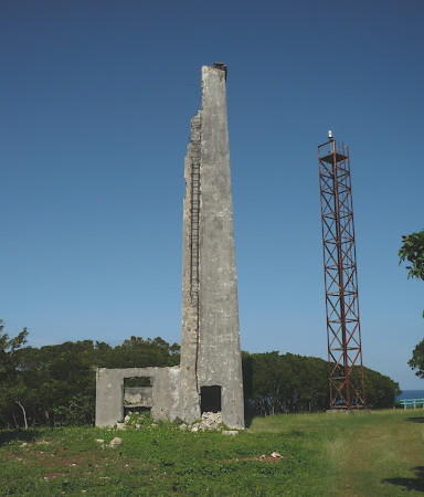
| Isla Alto Velo Lighthouse | Image | 1915 est. | Alto Velo Island 17°28′26.6″N 71°38′27.7″W / 17.474056°N 71.641028°W |
Fl (2) W 10s. | 163 metres (535 ft) | 14388 | J5482 | 13 |
| Isla Saona Lighthouse | n/a | Saona Island 18°06′43.9″N 68°34′25.5″W / 18.112194°N 68.573750°W |
Fl W 10s. | 32 metres (105 ft) | 14304 | J5446 | 16 | |
| La Romana Lighthouse | Image | 1960s | La Romana 18°24′54.6″N 68°57′30.5″W / 18.415167°N 68.958472°W |
Fl W 6s. | 27 metres (89 ft) | 14312 | J5448 | 15 |
| Puerto Liberator Lighthouse | Image Archived 2016-10-15 at the Wayback Machine | 1948 est. | Pepillo Salcedo 19°42′35.9″N 71°44′35.3″W / 19.709972°N 71.743139°W |
Iso R 20s. | 15 metres (49 ft) | 14244 | J5424 | 10 |
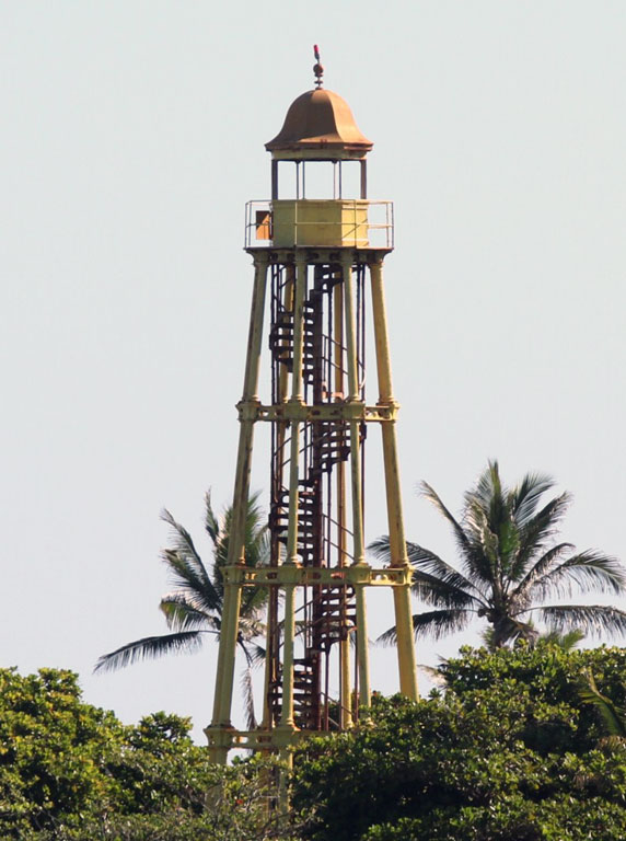
| Puerto Plata Lighthouse | Image | 1879 | Puerto Plata 19°48′10.9″N 70°41′40.6″W / 19.803028°N 70.694611°W |
L Fl W 6s. | 42 metres (138 ft) | 14260 | J5430 | 18 |
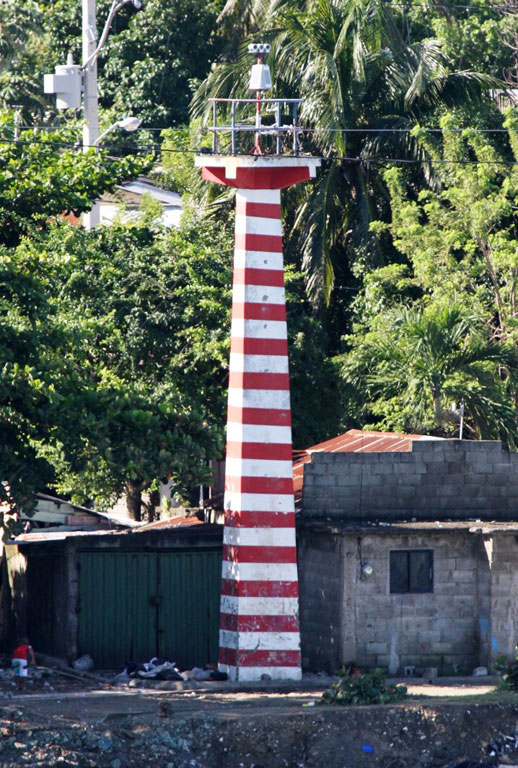
| Puerto Plata Sector Lighthouse | Image | n/a | Puerto Plata 19°47′56.2″N 70°42′13.2″W / 19.798944°N 70.703667°W |
F WRG | 11 metres (36 ft) | 14265 | J5431.1 | 9 |
| Punta Balandra Lighthouse | n/a | Samaná Bay 19°10′48.4″N 69°13′54.3″W / 19.180111°N 69.231750°W |
Fl W 4s: | 47 metres (154 ft) | 14284 | J5440 | 10 | |
| Punta Laguna Lighthouse | n/a | Saona Island 18°08′13.8″N 68°45′23.2″W / 18.137167°N 68.756444°W |
Fl W 10s. | 14 metres (46 ft) | 14308 | J5447 | 10 | |
| Punta Nibison Lighthouse | n/a | Lagunas de Nisibón 18°58′24.7″N 68°46′32.3″W / 18.973528°N 68.775639°W |
Fl (2) W 10s. | 15 metres (49 ft) | 14292 | J5442 | 12 | |
| Punta Palenque Lighthouse | n/a | Peravia Province 18°13′49.4″N 70°09′22.3″W / 18.230389°N 70.156194°W |
Fl W 7s. | 14 metres (46 ft) | 14360 | J5466 | 12 |
See also[edit]
References[edit]
- ^ Rowlett, Russ. "Lighthouses of the Dominican Republic". The Lighthouse Directory. University of North Carolina at Chapel Hill. Retrieved 2016-09-04.
- ^ a b c d e f List of Lights, Pub. 110: Greenland, The East Coasts of North and South America (Excluding Continental U.S.A. Except the East Coast of Florida) and the West Indies (PDF). List of Lights. United States National Geospatial-Intelligence Agency. 2016.
External links[edit]
- Rowlett, Russ. "The Lighthouse Directory". University of North Carolina at Chapel Hill.
| Types |
| _-_cropped.jpg) | ||||
|---|---|---|---|---|---|---|
| Fixtures | ||||||
| Maintenance | ||||||
| Locations | ||||||
| Categories | ||||||
| Global organizations | ||||||