Loreto Formation
| Loreto Formation | |
|---|---|
| Stratigraphic range: Priabonian (Divisaderan) | |
| Type | Geological formation |
| Underlies | not observed |
| Overlies | Leña Dura Formation |
| Lithology | |
| Primary | Sandstone |
| Other | Conglomerate, coal |
| Location | |
| Coordinates | 53°06′S 71°06′W / 53.1°S 71.1°W |
| Approximate paleocoordinates | 55°18′S 61°24′W / 55.3°S 61.4°W |
| Region | Magallanes y la Antártica Chilena Region |
| Country | |
| Extent | Magallanes Basin |
| Type section | |
| Named by | Hoffstetter et al. |
| Year defined | 1957 |
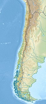
Loreto Formation (Spanish: Formación Loreto) is a sedimentary formation of Late Eocene age in the southernmost Magallanes Basin. It overlies the Leña Dura Formation and the contact with an overlying formation is not observed.[1] From 2013 to 2020 its coals were mined in Invierno mine, Riesco Island.[2][3][4]
Description[edit]
The formation contains fossil wood, leaf imprints and palynomorphs.[5] Also fossil fish of Striatolamia macrota and Ischyodus dolloi and indeterminate Spheniscidae fossils have been found in the formation.[6][7]
The formation crops out in Brunswick Peninsula and Sierra Baguales among other places.[8]
References[edit]
- ^ Torres et al., 2009, p.2
- ^ "Los errores y contradicciones del caso Mina Invierno". Guía minera de Chile (in Spanish). Retrieved 2023-04-06.
- ^ Pozo B., Andrés (2014-08-11). "El silencioso primer año de Mina Invierno". Diario Financiero (in Spanish). Retrieved 2023-03-15.
- ^ González Encina, Verónica (2022-03-08). "Copec concreta la venta de su participación en Mina Invierno". Reporte Minero (in Spanish). Retrieved 2022-06-08.
- ^ Otero et al., 2012
- ^ Salaberry et al., 2010, p.1062
- ^ Rio de las Minos at Fossilworks.org
- ^ Bostelmann et al., 2012
Bibliography[edit]
- Bostelmann, Enrique; Jacobus P. Le Roux; Ana Vasquez; Nestor Gutiérrez; José Luis Oyarzún; Catalina Carreño; Teresa Torres; Rodrigo Otero, and Andrea Llanos, C. Mark Fanning, Sven N. Nielsen and Francisco Hervé. 2012. [[1] A revised lithostratigraphy of the Sierra Baguales, Magallanes Basin], 698–700. XIII Congeso Geológico Chileno. Accessed 2019-02-15.
- Otero, Rodrigo A.; Teresa Torres; Jacobus P. Le Roux; Francisco Hervé; C. Mark Fanning; Roberto E. Yuri Yáñez, and David Rubilar Rogers. 2012. A Late Eocene age proposal for the Loreto Formation (Brunswick Peninsula, southernmost Chile), based on fossil cartilaginous fishes, paleobotany and radiometric evidence. Andean Geology 39. 180–200. Accessed 2019-02-15.
- Sallaberry, M.A.; R.E. Yury Yáñez; R.A. Otero; S. Soto Acuña, and T.G. Torres. 2010. Eocene birds from the western margin of southernmost South America. Journal of Paleontology 84. 1061–1070. Accessed 2019-02-15.
- Torres, T.; H. Meón; R. Otero, and H. Galleguillos. 2009. Palinoflora y macroflora de la Formación Loreto, Punta Arenas, Región de Magallanes, Chile, 1–4. XII Congreso Geológico Chileno. Accessed 2019-02-15.

