
Marmolada
This article needs additional citations for verification. (May 2014) |
| Marmolada | |
|---|---|
 July 2004 | |
| Highest point | |
| Elevation | 3,343 m (10,968 ft)[1] |
| Prominence | 2,131 m (6,991 ft)[1] Ranked 9th in the Alps |
| Listing | Ultra |
| Coordinates | 46°26′05″N 11°51′03″E / 46.43472°N 11.85083°E[1] |
| Geography | |
 Marmolada Alps | |
| Location | Italy |
| Parent range | Dolomites |
| Climbing | |
| First ascent | 28 September 1864 by Paul Grohmann, Angelo Dimai, F. Dimai |
| Easiest route | rock/ice climb |
Marmolada (German: Marmolata, Ladin: Marmoleda) is a mountain in northeastern Italy and the highest mountain of the Dolomites (a section of the Alps). It lies between the borders of Trentino and Veneto.
Geography
The mountain is located about 100 kilometres north-northwest of Venice, from which it can be seen on a clear day. It consists of a ridge running west to east. Towards the south it breaks suddenly into sheer cliffs, forming a rock face several kilometres long. On the north side there is a comparatively flat glacier, the only large glacier in the Dolomites (the Marmolada Glacier, Ghiacciaio della Marmolada).
The ridge is composed of several summits, decreasing in altitude from west to east: Punta Penia (3,343 m), Punta Rocca (3,309 m), Punta Ombretta (3,230 m), Monte Serauta (3,069 m), and Pizzo Serauta (3,035 m). An aerial tramway goes to the top of Punta Rocca. During the ski season the Marmolada's main ski run is opened for skiers and snowboarders alike, making it possible to ski down into the valley.
History
Paul Grohmann made the first ascent in 1864, along the north route. The south face was climbed for the first time in 1901 by Beatrice Tomasson, Michele Bettega and Bartolo Zagonel.[2]
Until the end of World War I the border between Austria-Hungary and Italy ran over Marmolada, so it formed part of the front line during that conflict. Austro-Hungarian soldiers were quartered in deep tunnels bored into the northern face's glacier, and Italian soldiers were quartered on the south face's rocky precipices. It was also the site of fierce mine warfare on the Italian Front. As glaciers retreat, soldiers' remains and belongings are occasionally discovered.
Gallery
-
 Sunset
 -

-
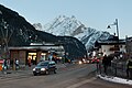 Marmolada from Canazei
 -


See also
References
- ^ a b c "Europe Ultra-Prominences". Peaklist.org. Retrieved 2014-05-24.
- ^ Reisach, Hermann (2001). "Beatrice Tomasson and the South Face of the Marmolada" (PDF). Alpine Journal: 105–113. Retrieved 8 April 2014.
External links
- Computer generated summit panoramas North South Index
- Marmolada on Hribi.net
- Description of via ferrata on the Western ridge
| International | |
|---|---|
| National | |