Moita
Appearance
Moita | |
|---|---|
Settlement | |
 | |
| Coordinates: 38°39′N 08°59′W / 38.650°N 8.983°W | |
| Country | |
| Region | Lisbon |
| Metropolitan area | Lisbon |
| District | Setúbal |
| Area | |
| • Total | 55.26 km2 (21.34 sq mi) |
| Population (2011) | |
| • Total | 66,029 |
| • Density | 1,200/km2 (3,100/sq mi) |
| Time zone | UTC±00:00 (WET) |
| • Summer (DST) | UTC+01:00 (WEST) |
| Website | http://www.cm-moita.pt |
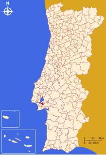
Moita (Portuguese pronunciation: [ˈmojtɐ]) is a municipality in the district of Setúbal in Portugal. The population in 2011 was 66,029,[1] in an area of 55.26 km².[2]
The present Mayor is Rui Garcia, elected by the Democratic Unity Coalition. The municipal holiday is the 1st Tuesday after the 2nd Sunday of September.
Parishes
Administratively, the municipality is divided into 4 civil parishes (freguesias):[3]
References
- ^ Instituto Nacional de Estatística
- ^ Direção-Geral do Território Archived 2014-09-29 at archive.today
- ^ Diário da República. "Law nr. 11-A/2013, pages 552 74-75" (pdf) (in Portuguese). Retrieved 28 July 2014.
External links


