Montaña Blanca
| Montaña Blanca | |
|---|---|
 Volcano Montaña Blanca on Teide | |
| Highest point | |
| Elevation | 2,748 m (9,016 ft)[1] |
| Prominence | 28 m (92 ft)[1] |
| Coordinates | 28°16′8″N 16°36′51″W / 28.26889°N 16.61417°W[1] |
| Geography | |
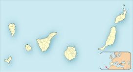
| Location | Tenerife, Canary Islands, Spain |
Montaña Blanca is a mountain on the Canary Island of Tenerife. Its flat summit on the eastern flank of the Pico del Teide above the edge mountains of the Las Cañadas basin at a height of 2,748 m (9,016 ft).[1] This makes the Montaña Blanca the third highest peak in Tenerife after the Pico del Teide (3,718 m (12,198 ft)) and the Pico Viejo (3,135 m (10,285 ft)).[2]
Formation[edit]
The Montaña Blanca is a flank volcano of the Pico del Teide, whose name is due to the beige color of the light-colored pumice on its surface.[2] It was created by volcanic processes that took place around 50 BC, in three phases.[3] Initially, phonolitic lava with a volume of about 0.022 km3 emerged from a west-northwest-east-southeast trending eruption fissure system on the east flank of the Pico del Teide. The eruption then transitioned into an explosive sub-Plinian phase, measuring magnitude 4 on the Volcanic Explosivity Index. Within 7 to 11 hours, phonolitic pumice and ash (approximately 0.25 km3 DRE) descended from a 15 km high eruptive column in a northeasterly direction[3] and covered an area of at least 40 km2.[4] In the third phase, about 0.025 km3 of lava came out, and today's lava dome was formed. The Montaña Blanca subplinian eruption is the only known explosive eruption in the Pico del Teide-Pico Viejo volcanic complex.[3]
Ascent[edit]
The Montaña Blanca is an excellent vantage point. It can be easily climbed via a branch from the Sendero trail no. 7 (from the car park on the TF-21 below the Montaña Blanca to the summit of the Teide). The tour can also start at the El Portillo Visitor Center and then take either trails #1 and #6 or #1 and #22 to Sendero #7.[5][6]
References[edit]
- ^ a b c d "Montana Blanca, Spain". Peakbagger.com. Retrieved 17 March 2023.
- ^ a b "Montaña Blanca". Gequotravel. Retrieved 13 March 2017.
- ^ a b c G. J. Ablay, G. G. J. Ernst, J. Marti, R. S. J. Sparks (1995). The ~2 ka subplinian eruption of Montaña Blanca, Tenerife. Vol. 57. pp. 337–355.
{{cite book}}:|work=ignored (help)CS1 maint: multiple names: authors list (link) - ^ Francisco J. Perez-Torrado, Juan Carlos Carracedo, Alejandro Rodriguez-Gonzalez, Sebastian Wiesmaier (2013). Juan Carlos Carracedo, Valentin R. Troll (ed.). Eruptive Styles at the Teide Volcanic Complex. pp. 213–231. ISBN 978-3-642-25892-3.
{{cite book}}: CS1 maint: multiple names: authors list (link) - ^ "Teide Nationalpark – Wanderwege des Hauptnetzes" (PDF). www.todotenerife.es. Retrieved 15 March 2017.
- ^ "Plan der Wanderwege im Teide-Nationalpark" (PDF) (in Spanish). Retrieved 15 March 2017.

