From Wikipedia, the free encyclopedia
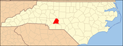
This list includes properties and districts listed on the National Register of Historic Places in Stanly County, North Carolina . Click the "Map of all coordinates" link to the right to view an online map of all properties and districts with latitude and longitude coordinates in the table below.[ 1]
Current listings
This National Park Service list is complete through NPS recent listings posted September 20, 2024. [ 2]
[ 3] Name on the Register[ 4]
Image
Date listed[ 5]
Location
City or town
Description
1
Albemarle Graded School-Central Elementary School Upload image December 2, 2014 (#14000991 ) 219 E. North St. 35°21′08″N 80°11′45″W / 35.3523°N 80.1959°W / 35.3523; -80.1959 (Albemarle Graded School-Central Elementary School ) Albemarle
2
Badin Historic District Upload image October 12, 1983 (#83004000 ) Roughly bounded by NC 740, Pine St., and the country club property line 35°24′13″N 80°06′45″W / 35.403611°N 80.1125°W / 35.403611; -80.1125 (Badin Historic District ) Badin
3
Thomas Marcellus Denning House Thomas Marcellus Denning House January 24, 2011 (#10001177 ) 415 N. Second St. 35°21′22″N 80°11′53″W / 35.356111°N 80.198056°W / 35.356111; -80.198056 (Thomas Marcellus Denning House ) Albemarle
4
Downtown Albemarle Historic District Downtown Albemarle Historic District March 28, 2002 (#02000275 ) Portions of S. 2nd, W. Main and N. and S. 1st Sts. 35°21′00″N 80°11′58″W / 35.35°N 80.199444°W / 35.35; -80.199444 (Downtown Albemarle Historic District ) Albemarle
5
Five Points Historic District Five Points Historic District October 16, 2002 (#02001179 ) Junction of E. Main St., Pee Dee Ave., and 4th St. 35°21′01″N 80°11′41″W / 35.350278°N 80.194722°W / 35.350278; -80.194722 (Five Points Historic District ) Albemarle
6
Hardaway Site (31ST4) Upload image March 1, 1984 (#84002529 ) By Badin Lake, west of the Badin Dam[ 6] 35°25′08″N 80°06′02″W / 35.418889°N 80.100556°W / 35.418889; -80.100556 (Hardaway Site (31ST4) ) Badin
7
Narrows Dam and Power Plant Complex Upload image October 12, 1983 (#83004001 ) Yadkin River and SR 1704 35°25′07″N 80°05′33″W / 35.418611°N 80.0925°W / 35.418611; -80.0925 (Narrows Dam and Power Plant Complex ) Badin
8
Opera House-Starnes Jewelers Building Opera House-Starnes Jewelers Building March 9, 1995 (#95000180 ) 127-133 W. Main St. 35°21′01″N 80°11′56″W / 35.350278°N 80.198889°W / 35.350278; -80.198889 (Opera House-Starnes Jewelers Building ) Albemarle
9
Pee Dee Avenue Historic District Pee Dee Avenue Historic District January 7, 1998 (#97001612 ) Along Pee Dee Ave., roughly from Arey Ave. to Miller St. 35°21′12″N 80°11′13″W / 35.353333°N 80.186944°W / 35.353333; -80.186944 (Pee Dee Avenue Historic District ) Albemarle
10
Pfeiffer Junior College Historic District Pfeiffer Junior College Historic District April 28, 1999 (#99000480 ) U.S. Route 52 , 1.0 mile north of its junction with NC 4935°29′05″N 80°17′04″W / 35.484722°N 80.284444°W / 35.484722; -80.284444 (Pfeiffer Junior College Historic District ) Misenheimer
11
Randle House Randle House September 8, 1992 (#92001172 ) Southern side of NC 1802 at its junction with NC 1743 35°15′45″N 80°06′15″W / 35.2625°N 80.104167°W / 35.2625; -80.104167 (Randle House ) Norwood
12
Richfield Milling Company Upload image September 19, 2016 (#16000647 ) 303 S. Main St. 35°27′57″N 80°15′40″W / 35.465800°N 80.261031°W / 35.465800; -80.261031 (Richfield Milling Company ) Richfield
13
Second Street Historic District Second Street Historic District April 6, 2005 (#05000266 ) Portions of the 100 and 200 blocks of N. Second St. and the 100 block of W. North St. 35°21′08″N 80°11′54″W / 35.352222°N 80.198333°W / 35.352222; -80.198333 (Second Street Historic District ) Albemarle
14
Isaiah Wilson Snugs House Isaiah Wilson Snugs House March 9, 1995 (#95000190 ) 112 N. Third St. 35°21′03″N 80°11′46″W / 35.350833°N 80.196111°W / 35.350833; -80.196111 (Isaiah Wilson Snugs House ) Albemarle
15
West Badin Historic District Upload image October 12, 1983 (#83004002 ) Roughly bounded by Sims, Lincoln, Marion, and Lee Sts. 35°24′35″N 80°07′28″W / 35.409722°N 80.124444°W / 35.409722; -80.124444 (West Badin Historic District ) Badin
See also
References
^ The latitude and longitude information provided in this table was derived originally from the National Register Information System, which has been found to be fairly accurate for about 99% of listings. Some locations in this table may have been corrected to current GPS standards.
^ National Park Service, United States Department of the Interior , "National Register of Historic Places: Weekly List Actions" , retrieved September 20, 2024.
^ Numbers represent an alphabetical ordering by significant words. Various colorings, defined here , differentiate National Historic Landmarks and historic districts from other NRHP buildings, structures, sites or objects.
^ "National Register Information System" . National Register of Historic Places National Park Service . April 24, 2008.^ The eight-digit number below each date is the number assigned to each location in the National Register Information System database, which can be viewed by clicking the number.
^ Master Site Record , Research Laboratories of Archaeology, University of North Carolina at Chapel Hill, n.d. Accessed 2014-06-23.
Topics Lists Other lists
Topics Lists by state Lists by insular areas Lists by associated state Other areas Related