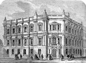
Northumberland Avenue

Northumberland Avenue is a street in the City of Westminster in central London that runs from Trafalgar Square in the west to the Thames Embankment in the east. The road was built on the site of Northumberland House, the London home of the Percy family, the Dukes of Northumberland.
Several British government departments are located in buildings on Northumberland Avenue; the Ministry of Defence and the Air Ministry formerly occupied the triangular-shaped Metropole Hotel on the street. Other buildings include the Nigerian high commission and a London School of Economics halls of residence (opposite The Sherlock Holmes pub).
Northumberland Avenue has a square on the British Monopoly board named after it.
History

In 1608–09, the Earl of Northampton built Northumberland House on the eastern portion of the former property of the Chapel and Hospital of St. Mary Rounceval, at Charing Cross. This was a considerable property consisting of a house and gardens, running down to the River Thames, and adjoining Scotland Yard to the west. The house suffered some damage in the Wilkes' election riots of 1768, but the duke saved his property by the expedient of opening the nearby Ship Ale House, which drew off the rioters.[1]
In June 1874, the whole of the duke's property at Charing Cross was purchased by the Metropolitan Board of Works for the formation of Northumberland Avenue.[1]
Thomas Edison's British headquarters, Edison House, was situated on the road. Many prominent personalities of the day had their voices recorded there by the phonograph, including William Ewart Gladstone and P. T. Barnum; these recordings still exist today.
Northumberland Avenue formed part of the marathon course of the 2012 Olympic and Paralympic Games. The women's Olympic marathon took place on 5 August and the men's Olympic marathon on 12 August. The Paralympic marathons will be held on 9 September.[2][3]
See also
References
- ^ a b Northumberland House, Survey of London: volume 18: St Martin-in-the-Fields II: The Strand (1937), pp. 10-20. Date accessed: 14 February 2009
- ^ http://www.london2012.com/athletics/event/men-marathon/coursemap/
- ^ http://www.london2012.com/athletics/event/women-marathon/coursemap/
51°30′24″N 0°07′27″W / 51.5068°N 0.1242°W

