
Novi Grad, Bosnia and Herzegovina
Novi Grad
Нови Град | |
|---|---|
Town and municipality | |
 Novi Grad | |
 Location of Novi Grad within Republika Srpska | |
 | |
| Coordinates: 45°02′53″N 16°22′37″E / 45.048°N 16.377°E | |
| Country | |
| Entity | Republika Srpska |
| • Municipality | 472.72 km2 (182.52 sq mi) |
| Population (2013 census) | |
| • Town | 11,063 |
| • Municipality | 27,115 |
| • Municipality density | 57/km2 (150/sq mi) |
| Website | www |


Novi Grad (Serbian Cyrillic: Нови Град), is a town and municipality in Republika Srpska, an entity of Bosnia and Herzegovina. Situated in the far northwest of the country, it lies across the Una from the Croatian town of Dvor. According to the 2013 census[update], the town has a population of 11,063 while its municipality comprises a total of 27,115 inhabitants.
Known for its scenic quay, Novi Grad lies at the confluence of the Una and Sana rivers.
Geography
Novi Grad is located on the right bank of the Una and both banks of the Sana, between two geographic zones: the slopes of the mountains of Grmeč and Kozara, and the alluvial land surrounding the town's two rivers. The town itself is located 122 m (400 feet) above sea level, at nearly 45°N; the climate is temperate-continental. Its governed municipality covers an area of 470 km2 (180 sq mi).
History
The town was first mentioned in 1280 under the Latin name Castrum Novum which, literally translated, means 'new fort'. It belonged to the dukes of Blagaj and in the early sixteenth century came under power of Nikola Zrinski. Croatian ban Adam Bačan conquered Novi in 1693.[1] Evliya Çelebi on his journey through Bosnia mentions that Croatian nobles built Novi Grad. [2] In 1895, during Austro-Hungarian rule in Bosnia and Herzegovina, the town was officially given the name 'Bosanski Novi'. At the same time, the city included around 3,300 people with 550 households. Wooden bridges existed across the Una and Sana rivers which the citizens had to guard against floods in the autumn and spring. For that reason, a current-day symbol of the town was built in 1906—the Una quay.
In 1872, Novi Grad was the first municipality to have a train station on the new Bosnian railway, which afforded it significant cultural and economic advantages over other Krajina[3] municipalities. The first hospital was established around the same time.
From 1929 to 1941, Novi Grad was part of the Vrbas Banovina of the Kingdom of Yugoslavia.
From 1992 through 1995, the town was ethnically cleansed of its Bosniak and Croat inhabitants, thereby rendering it almost completely Serb-populated. In order to distance the town from its Bosnian history and its cultural roots and in tune with the war politics, the local Serb government renamed the town to Novi Grad, a change criticized by Croat and Bosniak residents. Consequently, majority of people from Bosanski Novi were misplaced and live all over Europe, the American continent, Australia and elsewhere around the globe.
After the Bosnian war, Kostajnica was split from the municipality.
Settlements
Aside from the town of Novi Grad, the municipality includes the following settlements:
- Ahmetovci
- Blagaj Japra
- Blagaj Rijeka
- Blatna
- Kostajnica
- Cerovica
- Crna Rijeka
- Čađavica Donja
- Čađavica Gornja
- Čađavica Srednja
- Ćele
- Devetaci
- Dobrljin
- Donje Vodičevo
- Donji Agići
- Donji Rakani
- Gornja Slabinja
- Gornje Vodičevo
- Gornji Agići
- Gornji Rakani
- Grabašnica
- Grdanovac
- Gumnjani
- Hozići
- Johovica
- Jošava
- Kalenderi
- Kršlje
- Kuljani
- Lješljani
- Mala Krupska Rujiška
- Mala Novska Rujiška
- Mala Žuljevica
- Maslovare
- Matavazi
- Mazić
- Mrakodol
- Mraovo Polje
- Petkovac
- Petrinja
- Pobrđani
- Podoška
- Poljavnice
- Prusci
- Radomirovac
- Rakovac
- Rašće
- Ravnice
- Rudice
- Sokolište
- Suhača
- Svodna
- Tavija
- Trgovište
- Vedovica
- Velika Rujiška
- Velika Žuljevica
- Vitasavci
- Zovik
Demographics

Population
| Population of settlements – Novi Grad municipality | ||||||||
|---|---|---|---|---|---|---|---|---|
| 1948. | 1953. | 1961. | 1971. | 1981. | 1991. | 2013. | ||
| Total | 41,216 | 42,142 | 41,665 | 27,115 | ||||
| 1 | Blagaj Japra | 1,279 | 807 | |||||
| 2 | Blagaj Rijeka | 980 | 488 | |||||
| 3 | Blatna | 443 | 367 | |||||
| 4 | Čađavica Donja | 408 | 338 | |||||
| 5 | Čađavica Gornja | 297 | 240 | |||||
| 6 | Čađavica Srednja | 262 | 192 | |||||
| 7 | Dobrljin | 1,141 | 858 | |||||
| 8 | Donje Vodičevo | 801 | 615 | |||||
| 9 | Donji Agići | 935 | 637 | |||||
| 10 | Donji Rakani | 315 | 338 | |||||
| 11 | Gornje Vodičevo | 368 | 278 | |||||
| 12 | Gornji Agići | 540 | 244 | |||||
| 13 | Gornji Rakani | 254 | 249 | |||||
| 14 | Hozići | 958 | 610 | |||||
| 15 | Kršlje | 632 | 434 | |||||
| 16 | Mala Krupska Rujiška | 431 | 384 | |||||
| 17 | Mala Novska Rujiška | 573 | 412 | |||||
| 18 | Maslovare | 500 | 284 | |||||
| 19 | Matavazi | 563 | 466 | |||||
| 20 | Novi Grad | 4,070 | 4,884 | 7,023 | 9,849 | 12,186 | 13,588 | 11,063 |
| 21 | Petkovac | 227 | 205 | |||||
| 22 | Poljavnice | 1,137 | 1,266 | |||||
| 23 | Radomirovac | 557 | 419 | |||||
| 24 | Ravnice | 639 | 581 | |||||
| 25 | Rudice | 452 | 590 | |||||
| 26 | Sokolište | 611 | 410 | |||||
| 27 | Suhača | 1,087 | 506 | |||||
| 28 | Svodna | 1,270 | 1,038 | |||||
| 29 | Trgovište | 377 | 274 | |||||
| 30 | Velika Žuljevica | 410 | 224 | |||||
| 31 | Vitasavci | 385 | 399 | |||||
Ethnic composition
| Ethnic composition – Novi Grad town | |||||||
|---|---|---|---|---|---|---|---|
| 2013. | 1991. | 1981. | 1971. | ||||
| Total | 11,063 (100,0%) | 13,588 (100,0%) | 12,186 (100,0%) | 9,849 (100,0%) | |||
| Bosniaks | 6,831 (50,27%) | 5,211 (42,76%) | 5,520 (56,05%) | ||||
| Serbs | 5,121 (37,69%) | 3,900 (32,00%) | 3,610 (36,65%) | ||||
| Yugoslavs | 1,117 (8,220%) | 2,647 (21,72%) | 308 (3,127%) | ||||
| Others | 332 (2,443%) | 42 (0,345%) | 74 (0,751%) | ||||
| Croats | 187 (1,376%) | 217 (1,781%) | 287 (2,914%) | ||||
| Albanians | 77 (0,632%) | 20 (0,203%) | |||||
| Roma | 66 (0,542%) | ||||||
| Montenegrins | 16 (0,131%) | 18 (0,183%) | |||||
| Slovenes | 8 (0,066%) | 11 (0,112%) | |||||
| Macedonians | 1 (0,008%) | ||||||
| Hungarians | 1 (0,008%) | 1 (0,010%) | |||||
| Ethnic composition | |||||||
|---|---|---|---|---|---|---|---|
| 2013. | 1991. | 1981. | 1971. | ||||
| Total | 27,115 (100,0%) | 41,665 (100,0%) | 42,142 (100,0%) | 41,216 (100,0%) | |||
| Serbs | 20,116 (74,19%) | 25,101 (60,24%) | 25,098 (59,56%) | 28,328 (68,73%) | |||
| Bosniaks | 6,439 (23,75%) | 14,040 (33,70%) | 11,745 (27,87%) | 1, 625 (28,21%) | |||
| Others | 379 (1,398%) | 564 (1,354%) | 116 (0,275%) | 173 (0,420%) | |||
| Croats | 181 (0,668%) | 403 (0,967%) | 458 (1,087%) | 640 (1,553%) | |||
| Yugoslavs | 1 557 (3,737%) | 4 525 (10,74%) | 366 (0,888%) | ||||
| Albanians | 85 (0,202%) | 26 (0,063%) | |||||
| Roma | 72 (0,171%) | ||||||
| Montenegrins | 24 (0,057%) | 32 (0,078%) | |||||
| Slovenes | 10 (0,024%) | 19 (0,046%) | |||||
| Hungarians | 6 (0,014%) | 5 (0,012%) | |||||
| Macedonians | 3 (0,007%) | 2 (0,005%) | |||||
Economy
The economy is based on a few industries and a number of private firms. Novi Grad has notable potential in tourism, wood processing, food production and management of water resources.
The following table gives a preview of total number of registered people employed in legal entities per their core activity (as of 2018):[4]
| Activity | Total |
|---|---|
| Agriculture, forestry and fishing | 92 |
| Mining and quarrying | 47 |
| Manufacturing | 722 |
| Electricity, gas, steam and air conditioning supply | 103 |
| Water supply; sewerage, waste management and remediation activities | 91 |
| Construction | 30 |
| Wholesale and retail trade, repair of motor vehicles and motorcycles | 1,038 |
| Transportation and storage | 438 |
| Accommodation and food services | 243 |
| Information and communication | 28 |
| Financial and insurance activities | 47 |
| Real estate activities | 4 |
| Professional, scientific and technical activities | 96 |
| Administrative and support service activities | 10 |
| Public administration and defense; compulsory social security | 304 |
| Education | 424 |
| Human health and social work activities | 187 |
| Arts, entertainment and recreation | 22 |
| Other service activities | 72 |
| Total | 3,998 |
Sport
There are several active sports organizations in the town, including football, handball and basketball clubs.
The local football club is FK Sloboda Novi Grad.
Gallery
-
 Vidorijska dzamija
 -
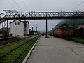 Railway station

.jpg)
See also
Notes
- ^ HAMDIJA KREŠEVLJAKOVIĆ
STARI BOSANSKI GRADOVI (VIEUX BOURGS BOSNIAQUES)
https://www.fmks.gov.ba/download/zzs/1953/1-1953.pdf
- page=36
- ^ Hazim Šabanović, Putopis : odlomci o jugoslavenskim zemljama, 1967, https://www.academia.edu/6486045/Evlija_Celebi_Putopis #page=219
- ^ Krajina, official name of region Archived 2015-06-07 at the Wayback Machine
- ^ "Cities and Municipalities of Republika Srpska" (PDF). rzs.rs.ba. Republika Srspka Institute of Statistics. 25 December 2019. Retrieved 31 December 2019.
References
- Mangold, Max (2005), Das Aussprachewörterbuch, Duden, ISBN 9783411040667
