
Paira Island
 Paira Island | |
| Geography | |
|---|---|
| Location | Bay of Bengal |
| Coordinates | 8°34′48″N 93°36′29″E / 8.58°N 93.608°E |
| Archipelago | Nicobar Islands |
| Adjacent to | Indian Ocean |
| Total islands | 1 |
| Major islands |
|
| Area | 0.05 km2 (0.019 sq mi)[1] |
| Length | 0.3 km (0.19 mi) |
| Width | 0.2 km (0.12 mi) |
| Coastline | 1.1 km (0.68 mi) |
| Highest elevation | 86 m (282 ft) |
| Highest point | Paira Rock[2] |
| Administration | |
| District | Nicobar |
| Island group | Nicobar Islands |
| Subdivisions of India | Nancowry Subdivision |
| Taluk | Teressa tehsil |
| Demographics | |
| Population | 0 (2011) |
| Pop. density | 0/km2 (0/sq mi) |
| Ethnic groups | Hindu, Nicobarese People |
| Additional information | |
| Time zone | |
| PIN | 744301 |
| Telephone code | 03192 |
| ISO code | IN-AN-00[3] |
| Official website | www |
| Literacy | 84.4% |
| Avg. summer temperature | 32.0 °C (89.6 °F) |
| Avg. winter temperature | 28.0 °C (82.4 °F) |
| Sex ratio | ♂/♀ |
| Census Code | 35.638.0002.645033 |
| Official Languages | Hindi, English, Tamil Car (regional) |
Paira is an island in the Nicobar district of Andaman and Nicobar Islands, India.
Administration[edit]
The island belongs to the township of Nancowry of Teressa Taluk.[4][5]
Geography[edit]
The island is a part of the Nicobar Islands chain, located in the northeast Indian Ocean between the Bay of Bengal and the Andaman Sea. It is located 0.75 km (0.47 mi) NNW of Cape Maud of Tillanchong Island.
Image gallery[edit]
-
 Map
Map -
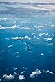 Photo Aerial


References[edit]
- ^ "Islandwise Area and Population - 2011 Census" (PDF). Government of Andaman. Archived from the original (PDF) on 28 August 2017. Retrieved 3 May 2016.
- ^ Info
- ^ Registration Plate Numbers added to ISO Code
- ^ "Tehsils" (PDF). Archived from the original (PDF) on 28 August 2017. Retrieved 3 May 2016.
- ^ "Andaman and Nicobar Islands villages" (PDF). Land Records Information Systems Division, NIC. Archived from the original (PDF) on 4 March 2016. Retrieved 25 July 2015.
 Andaman and Nicobar Islands travel guide from Wikivoyage
This Andaman and Nicobar Islands location article is a stub. You can help Wikipedia by expanding it. |