Peoria, Colorado
Appearance
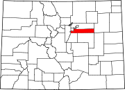
Peoria is a census-designated place (CDP) in Arapahoe County, Colorado, United States. The population as of the 2010 Census was 163.[1]
See also
- Outline of Colorado
- State of Colorado
References
- ^ Colorado Trend Report 2: State and Complete Places (Sub-state 2010 Census Data). Missouri Census Data Center. Accessed 2011-02-25.
39°40′47″N 104°06′51″W / 39.67972°N 104.11417°W

