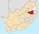
Perdekop
Perdekop | |
|---|---|
| Coordinates: 27°10′S 29°38′E / 27.167°S 29.633°E | |
| Country | South Africa |
| Province | Mpumalanga |
| District | Gert Sibande |
| Municipality | Pixley Ka Seme |
| Area | |
| • Total | 7.73 km2 (2.98 sq mi) |
| Elevation | 1,889 m (6,198 ft) |
| Population (2011)[1] | |
| • Total | 5,081 |
| • Density | 660/km2 (1,700/sq mi) |
| Racial makeup (2011) | |
| • Black African | 97.4% |
| • Coloured | 0.3% |
| • Indian/Asian | 1.7% |
| • White | 0.4% |
| • Other | 0.2% |
| First languages (2011) | |
| • Zulu | 82.3% |
| • Sotho | 9.9% |
| • English | 1.7% |
| • S. Ndebele | 1.5% |
| • Other | 4.6% |
| Time zone | UTC+2 (SAST) |
| Postal code (street) | 2465 |
| PO box | 2465 |
| Area code | 017 |
Perdekop, (Afrikaans for horses hill), is a small town situated on top of a 1,889 m peak in the Mpumalanga province, in South Africa. It is a village 38 km north of Volksrust and 47 km south of Standerton.
History
Formerly Paardekop, ‘horses hill’, from the practice of keeping horses there when horse-sickness prevailed in lower lying areas.[2]
The town was established during an equine sickness epidemic when farmers found that when they brought their horses to the top of this hill they were protected from the sickness.[3]: 303 During the Second Boer War the British operated a lookout balloon here to monitor Boer activities.
References
- ^ a b c d "Main Place Perdekop". Census 2011.
- ^ "Dictionary of Southern African Place Names (Public Domain)". Human Science Research Council. p. 363.
- ^ Erasmus, B.P.J. (2014). On Route in South Africa: Explore South Africa region by region. Jonathan Ball Publishers. p. 401. ISBN 9781920289805.


