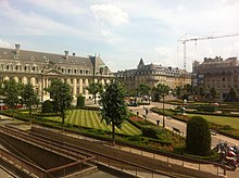
Place des Martyrs, Luxembourg


The Place des Martyrs is a garden square in Luxembourg City, in southern Luxembourg. The square lies to the south of the Pétrusse valley, in the quarter of Gare. It is colloquially known as the Rose Garden (Template:Lang-lb), on account of the red roses that dominate the garden's floriculture.[1]
Along its north-eastern side runs the Avenue de la Liberté, one of Luxembourg City's main thoroughfares. To the south-west runs the Rue Sainte-Zithe, whilst the Rue du Plébiscite and the Rue de la Grève make up the south-east and north-west sides of the square respectively. The headquarters of ArcelorMittal, the world's largest steelmaker, are located on the Place des Martyrs, across the Avenue de la Liberté.
The square was laid out in the 1920s, after the German occupation of the First World War.[1] Through the square run three radial paths, meeting at a point in front of the Arcelor headquarters, where a work by the British sculptor Henry Moore, depicting a mother and child, provides a focus.[1]
Footnotes
- ^ a b c Antoinette Lorang. "Architectural Tour of the Railway Station District" (PDF). Luxembourg City Tourist Office. Retrieved 2007-03-04.
