
Rich Street Bridge
Rich Street Bridge | |
|---|---|
 | |
| Coordinates | 39°57′26.8″N 83°0′18.3″W / 39.957444°N 83.005083°W |
| Carries | |
| Crosses | Scioto River |
| Locale | Columbus, Ohio |
| Maintained by | Ohio Department of Transportation |
| Location | |
 Interactive map pinpointing the Rich Street Bridge Interactive map pinpointing the Rich Street Bridge | |
The Rich Street Bridge is a bridge in Columbus, Ohio, United States, spanning the Scioto River and connecting downtown's Rich Street to Franklinton's Town Street. It carries U.S. Route 62 (US 62) and Ohio State Route 3 (SR 3). The bridge was completed in 2012.[1]
The bridge replaced the Town Street Bridge (1917-2009). The original eastern anchor remains, reutilized as the Prow, an observation platform in the Scioto Mile Promenade park.[2] The site features stone benches, lanterns, and a grove of birch trees.[3] The 1917 bridge was part of the Scioto River Bridge Group, listed on the Columbus Register of Historic Properties in 1983 and proposed as part of the Columbus Civic Center Historic District, nominated to the National Register of Historic Places in 1988.[4]
Gallery[edit]
-
 Night lighting
 -
 The prior bridge in 2006
 -
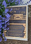
 Plaque commemorating prior bridges
 -
 Town Street Bridge plaque
 -
 The Prow, formerly an anchor to the Town Street Bridge


See also[edit]
References[edit]
- ^ "Rich Street Bridge Officially Opens Downtown". Columbus Underground. July 6, 2012. Archived from the original on October 22, 2018. Retrieved October 21, 2018.
- ^ "Ron Pizzuti's quest". Columbus Monthly. February 6, 2014. Archived from the original on June 4, 2020. Retrieved April 23, 2020.
- ^ "Scioto Mile: City banks on river in waterfront makeover". The Columbus Dispatch. July 7, 2011. Archived from the original on June 4, 2020. Retrieved April 23, 2020.
- ^ "Main Street Dam Removal & Scioto Greenways Feasibility Study". Stantec. 2012. pp. 14–15. Retrieved December 16, 2022.
External links[edit]
 Media related to Rich Street Bridge at Wikimedia Commons
Crossings of the Scioto River | ||||
|---|---|---|---|---|
| ||||
This article about a bridge in Ohio is a stub. You can help Wikipedia by expanding it. |
- 2012 establishments in Ohio
- Bridges completed in 2012
- Bridges in Columbus, Ohio
- U.S. Route 62
- Bridges of the United States Numbered Highway System
- Bridges over the Scioto River
- Midwestern United States bridge (structure) stubs
- Ohio building and structure stubs
- Ohio transportation stubs
- Columbus, Ohio building and structure stubs