Richterswil railway station
Richterswil | ||||||||||||||||
|---|---|---|---|---|---|---|---|---|---|---|---|---|---|---|---|---|
 The station building from Lake Zürich, 2011. | ||||||||||||||||
| General information | ||||||||||||||||
| Location | Seestrasse 20, 8805 Richterswil, Canton of Zürich Switzerland | |||||||||||||||
| Coordinates | 47°12′30″N 08°42′27″E / 47.20833°N 8.70750°E | |||||||||||||||
| Elevation | 408 m above the sea | |||||||||||||||
| Owned by | SBB-CFF-FFS | |||||||||||||||
| Operated by | SBB-CFF-FFS | |||||||||||||||
| Line(s) | Lake Zürich left-bank railway line (720) | |||||||||||||||
| Platforms | 2 | |||||||||||||||
| Connections | ||||||||||||||||
| Zürichsee-Schifffahrtsgesellschaft | ||||||||||||||||
| Zimmerberg bus line (ZVV) | ||||||||||||||||
| History | ||||||||||||||||
| Opened | 1875 | |||||||||||||||
| Services | ||||||||||||||||
| ||||||||||||||||
| ||||||||||||||||

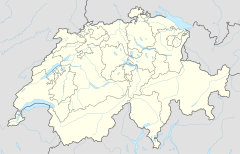
Richterswil railway station (Template:Lang-de) is a railway station that serves the municipality of Richterswil, in the canton of Zürich, Switzerland. It is owned and operated by Swiss Federal Railways, and forms part of the Lake Zürich left-bank railway line. The station is situated at the south-eastern edge of the town centre, on the shore of Lake Zürich a short distance to the south of the Zürichsee-Schifffahrtsgesellschaft (ZSG) ferry terminal.[1][2]
The station building is inscribed on the Swiss Inventory of Cultural Property of National Significance (class A).[3]
History
The station was opened in 1875, along with the rest of the Zürich HB to Ziegelbrücke section of the Lake Zürich left-bank railway line.
Facilities
The station has two tracks, flanked by a pair of side platforms. The station building is on the platform on the landward side of the station, flanking track 1. Both platforms are connected by a pedestrian subway, which also connects to the town centre on the landward side, and the ZSG terminal on the lake side.
Services
Zürich S-Bahn
The station is served by the following lines of the Zürich S-Bahn, operated by the Swiss Federal Railways:
- S2 Zürich Flughafen
 –Oerlikon–Zürich HB–Thalwil–Pfäffikon SZ–Ziegelbrücke (–Unterterzen)
Stops between Zürich Enge and Ziegelbrücke only in Thalwil, Horgen, Wädenswil, Richterswil, Pfäffikon SZ, Altendorf, Lachen and Siebnen-Wangen. Weekend services extended non-stop from Ziegelbrücke to Unterterzen at hourly intervals. - S8 Winterthur–Wallisellen–Oerlikon–Zürich HB–Thalwil–Pfäffikon SZ (–Ziegelbrücke)
Operates non stop between Winterthur and Effretikon; first and last services extended to Ziegelbrücke.
The two services each operated every half-hour during the day, combining to provide four trains per hour to and from Zürich, with a journey time of between 30 and 40 minutes.[4][5]
Bus services
Four Zimmerberg bus lines call at Wülflingen.[6]
| Line | Route |
|---|---|
| 170 | Richterswil ZH – Burghalden – Samstagern |
| 175 | Richterswil ZH – Erlenmatte |
| 176 | Richterswil ZH – Roos |
| 189 | Bhf. Pfäffikon SZ – Freienbach SOB – Bäch – Richterswil ZH |
See also
References
- ^ map.geo.admin.ch (Map). Swiss Confederation. Retrieved 2012-04-29.
- ^ Eisenbahnatlas Schweiz. Verlag Schweers + Wall GmbH. 2012. pp. 12–13. ISBN 978-3-89494-130-7.
- ^ "Schweizerisches Inventar der Kulturgüter von nationaler Bedeutung - Zürich" (PDF) (in German). Swiss Confederation. 2011. Retrieved 2011-09-13.
{{cite web}}: Unknown parameter|trans_title=ignored (|trans-title=suggested) (help) - ^ "Effretikon–Flughafen–Zürich HB–Pfäffikon SZ–Ziegelbrücke" (PDF). Bundesamt für Verkehr. Retrieved 2014-10-09.
- ^ "Pfäffikon SZ–Zürich HB–Wallisellen–Winterthur–Weinfelden" (PDF). Bundesamt für Verkehr. Retrieved 2014-10-09.
- ^ "ZVV Regionalnetz/Regional network" (PDF). Zürcher Verkehrsverbund. 2011. Retrieved 2011-11-21. Template:De icon Template:En icon
External links
 Media related to Richterswil railway station at Wikimedia Commons
- Richterswil railway station on SBB-CFF-FFS web site


