
Route nationale 5a (Madagascar)
(Redirected from Route Nationale 5a (Madagascar))
| Route nationale 5a | |
|---|---|
| Route information | |
| Length | 406 km (252 mi) |
| Major junctions | |
| to end | Ambilobe |
| from RN 6
| |
| Location | |
| Country | Madagascar |
| Highway system | |

Route nationale 5a (RN 5a) is a secondary highway in Madagascar of 406 km, running from Ambilobe to Antalaha. It crosses the regions of Diana and Sava.
The section from Ambilobe to Vohemar was completely unpaved and in very bad condition until 2020 when important road works had been undertaken. This part of the route had been paved in September 2022.[1] From Vohemar to Antalaha the road is paved and in good condition.
Selected locations on route[edit]
(north to south)
- Ambilobe - (intersection with RN 6 to Antsiranana and Ambondromamy)
- Daraina (75 km)[2]
- Vohemar (152 km)[3]
- Sambava (303 km - intersection with RN 3b to Andapa)
- Antalaha
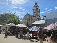
Gallery[edit]
-
-
 4x4 Bush taxis that serve between Ambilobe and Sava
 -
 crossing Daraina
 -
 RN5a at Antsirabe Nord
 -
 Fanambana River bridge at Fanambana
 -


.jpg)


See also[edit]
References[edit]
Wikimedia Commons has media related to Route Nationale 5a (Madagascar).