
Russell Vale, New South Wales
| Russell Vale Wollongong, New South Wales | |||||||||||||||
|---|---|---|---|---|---|---|---|---|---|---|---|---|---|---|---|
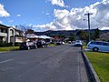
 The Princes Highway in Russell Vale | |||||||||||||||
| Population | 1,547 (2016 census)[1] | ||||||||||||||
| • Density | 783.7/km2 (2,029.7/sq mi) | ||||||||||||||
| Postcode(s) | 2517 | ||||||||||||||
| Elevation | 135 m (443 ft) | ||||||||||||||
| Area | 1.974 km2 (0.8 sq mi) | ||||||||||||||
| Location |
| ||||||||||||||
| LGA(s) | City of Wollongong | ||||||||||||||
| State electorate(s) | Keira | ||||||||||||||
| Federal division(s) | Cunningham | ||||||||||||||
| |||||||||||||||
Russell Vale is a small suburb of Wollongong in the Illawarra region of New South Wales, Australia.
Geography[edit]
Russell Vale straddles the Princes Highway.
History[edit]
Russell Vale was the home and estate of surveyor Francis Peter MacCabe, who died in 1897. The name Russell was the maiden name of his mother (Margaret née Russell). The estate was originally 250 acres (100 ha). In April 1904, 116 lots were subdivided and sold. In November 1904, a further 96 lots were subdivided and sold. The house at Russell Vale was demolished in 1966.[2]
Sporting amenities[edit]


Russell Vale is the home of the Russell Vale Golf Course, opened in 1986. It also contains the soccer field of Cawley Park, the homeground of the Russell Vale Soccer Club.
Demographics[edit]
At the 2016 census, Russell Vale had a population of 1,547,[1] an increase of 314 or 25% from the population of 1,233 at the 2001 census.[3]
Median family incomes in Russell Vale were slightly below average for the Wollongong LGA at $1,728 per week,[1] compared with $1,710 per week[4] respectively. Despite this, median rents were $30 per week greater in Russell Vale at $350 than in the rest of the Wollongong LGA, although median monthly mortgage repayments were the same at $1950.[1][4]
Mining[edit]
Russell Vale Colliery is an underground coal mine under the Woronora Plateau in the Sydney Drinking Water Catchment Area to the west of Russell Vale. The mine has been in operation since the 1880s using various underground mining methods to mine different coal seams. More recently, the mine has come under attack from local residents, as subsidence and cracking attributed to the mine's activities have been observed in the catchment area [5]
Gallery[edit]
-
 Sign for Russell Vale, coming from Woonona on the Princes Highway
 -
-


References[edit]
- ^ a b c d Australian Bureau of Statistics (27 June 2017). "Russell Vale (State Suburb)". 2016 Census QuickStats. Retrieved 16 July 2017.
- ^ Herben, Carol (May–June 2005). "Russell Vale House, The Estate of Francis Peter MacCabe". Illawarra Historical Society. Archived from the original on 12 November 2018. Retrieved 12 November 2018 – via University of Wollongong.
- ^ Australian Bureau of Statistics (9 March 2006). "Russell Vale (State Suburb)". 2001 Census QuickStats. Retrieved 16 July 2017.
- ^ a b Australian Bureau of Statistics (27 June 2017). "Wollongong (Local Government Area)". 2016 Census QuickStats. Retrieved 16 July 2017.
- ^ NSW Planning Assessment Commission (March 2016). "'Russell Vale Colliery Underground Expansion Project PAC Second Review Report'" (PDF). NSW Government, March 2016.