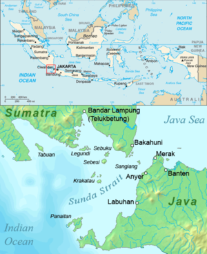
Sangiang
Appearance

This article needs additional citations for verification. (September 2014) |
Sangiang is an island midway in the Sunda Strait between the Indonesian islands of Sumatra and Java. Administratively it is a part of Banten province of western Java. One current design for the ambitious Sunda Strait Bridge allows for part of the bridge to be built crossing the island. It is uninhabited due to its status as a nature preserve.
The colonial Dutch called the island Dwars-in-den-weg ('Thwart-the-Way'; 'In the Way').[1]
- ^ Aa, Abraham Jacob van der, Aardrijkskundig woordenboek der Nederlanden, Vol. 3, Gorinchem, 1841, p. 592.
See also
5°57′21″S 105°51′18″E / 5.95583°S 105.85500°E
