
Strong, Arkansas
Strong, Arkansas | |
|---|---|
 Location of Strong in Union County, Arkansas. | |
| Coordinates: 33°6′35″N 92°21′30″W / 33.10972°N 92.35833°W | |
| Country | United States |
| State | Arkansas |
| County | Union |
| Area | |
| • Total | 1.60 sq mi (4.14 km2) |
| • Land | 1.60 sq mi (4.14 km2) |
| • Water | 0.00 sq mi (0.00 km2) |
| Elevation | 98 ft (30 m) |
| Population (2020) | |
| • Total | 410 |
| • Density | 256.73/sq mi (99.12/km2) |
| Time zone | UTC-6 (Central (CST)) |
| • Summer (DST) | UTC-5 (CDT) |
| ZIP code | 71765 |
| Area code | 870 |
| FIPS code | 05-67370 |
| GNIS feature ID | 0078476 |
Strong is a city in Union County, Arkansas, United States. The population was 558 at the 2010 census.
Geography[edit]
Strong is located in the southern part of Arkansas. 33°6′35″N 92°21′30″W / 33.10972°N 92.35833°W (33.109856, -92.358353).[2] According to the United States Census Bureau, the city has a total area of 1.1 square miles (2.8 km2), all land.
Demographics[edit]
| Census | Pop. | Note | %± |
|---|---|---|---|
| 1910 | 465 | — | |
| 1920 | 507 | 9.0% | |
| 1930 | 740 | 46.0% | |
| 1940 | 762 | 3.0% | |
| 1950 | 839 | 10.1% | |
| 1960 | 741 | −11.7% | |
| 1970 | 965 | 30.2% | |
| 1980 | 785 | −18.7% | |
| 1990 | 624 | −20.5% | |
| 2000 | 651 | 4.3% | |
| 2010 | 558 | −14.3% | |
| 2020 | 410 | −26.5% | |
| U.S. Decennial Census[3] | |||
As of the census[4] of 2000, there were 651 people, 256 households, and 171 families residing in the city. The population density was 581.3 inhabitants per square mile (224.4/km2). There were 285 housing units at an average density of 254.5 per square mile (98.3/km2). The racial makeup of the city was 42.24% White, 53.61% Black or African American, 0.15% Native American, 0.15% Asian, 3.07% from other races, and 0.77% from two or more races. 5.68% of the population were Hispanic or Latino of any race.
There were 256 households, out of which 29.3% had children under the age of 18 living with them, 37.5% were married couples living together, 23.8% had a female householder with no husband present, and 33.2% were non-families. 30.5% of all households were made up of individuals, and 14.1% had someone living alone who was 65 years of age or older. The average household size was 2.54 and the average family size was 3.19.
In the city, the population was spread out, with 29.8% under the age of 18, 10.0% from 18 to 24, 22.6% from 25 to 44, 20.3% from 45 to 64, and 17.4% who were 65 years of age or older. The median age was 36 years. For every 100 females, there were 77.9 males. For every 100 females age 18 and over, there were 75.1 males. The median income for a household in the city was $21,389, and the median income for a family was $26,023. Males had a median income of $25,750 versus $20,417 for females. The per capita income for the city was $10,802. About 24.3% of families and 32.3% of the population were below the poverty line, including 47.5% of those under age 18 and 22.6% of those age 65 or over.
Education[edit]
Strong is the home of the Strong–Huttig School District, which includes Gardner–Strong Elementary School and Strong High School.
On July 1, 2004, the Strong School District consolidated with the Huttig School District to form the Strong-Huttig School District.[5]
References[edit]
- ^ "2020 U.S. Gazetteer Files". United States Census Bureau. Retrieved October 29, 2021.
- ^ "US Gazetteer files: 2010, 2000, and 1990". United States Census Bureau. February 12, 2011. Retrieved April 23, 2011.
- ^ "Census of Population and Housing". Census.gov. Retrieved June 4, 2015.
- ^ "U.S. Census website". United States Census Bureau. Retrieved January 31, 2008.
- ^ "ConsolidationAnnex_from_1983.xls." Arkansas Department of Education. Retrieved on May 26, 2018.
Municipalities and communities of Union County, Arkansas, United States | ||
|---|---|---|
| Cities | 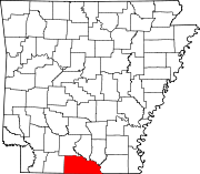 | |
| Town | ||
| CDPs | ||
| Other unincorporated communities | ||
| International | |
|---|---|
| National | |
| Geographic | |