
Talk:Quadripoint
| This article was nominated for deletion on 31 October 2010 (UTC). The result of the discussion was keep. |


Russia, China, Mongolia, Kazakhstan[edit]
what about Russia, Mongolia,China Kazakhstan border?
hmm not sure what you could mean by this but there is surely no cnkzmnru quadpoint by any name
Explanation of origin of this article[edit]
This article still needs a lot of work. I am planning to write an article tripoint and then come back to quadripoint and fix it up. By way of explanation, this article began as a translation by me of the Dutch article nl:Vierlandenpunt. However, I don't know any Dutch; I just ran it through a machine translator and then figured it out based on similarity to English and German. One thing I realized is that the Dutch word "Vierlandenpunt" is not the same thing as the English word "quadripoint": a Vierlandenpunt is literally a four-country point, while a quadripoint can be four subnational units (e.g. the U.S. Four Corners). In German, the word is "Vierländereck" meaning "four-country corner"; not quite the same thing as "four-country point" but close.
Among other things the images in this article need to be fixed up but I am hopeless at stuff like that. No need for such a large image of Lake Chad, but it needs to be large enough to see that within the lake are two tripoints rather than a single quadripoint. It would be great to have this image from the Dutch wiki. Also there must be photos of the Sweden/Norway quadripoint mentioned in the article. There's a monument at the Manitoba/Saskatchewan/NWT tripoint which may have become a quadripoint with Nunavut (see article); three photos are on this page. Also I like this photo even though it's a bit out of focus.--Mathew5000 21:57, 20 June 2006 (UTC)
three regions meet at a point...[edit]
"three regions meet at a point on the line...": sorry, if a house has four rooms that meet at a point, there are still four corners, even if not all 90 degrees. So explain your point better. --User:Jidanni 2006-10-29
- Here's what I mean. There are four countries meeting at a single point, but only three corners, not four:
- --Mathew5000 20:38, 10 November 2006 (UTC)

- It's a fair point but a bit pedantic for the intro. I've relegated it to a footnote, if that's ok. I don't see any other way you can have a quadripoint without four corners. jnestorius(talk) 02:40, 11 November 2006 (UTC)
>> The Zambia/Zimbabwe/Botswana/Namibia [possible] quadripoint is very similar to the one shown in that ^^ diagram --85.62.18.5 (talk) 20:05, 22 September 2011 (UTC) --DLMcN (talk) 20:07, 22 September 2011 (UTC)
- The footnote is fine. But there are definitely other ways you could have a quadripoint without four corners. For example, if two of the countries are shaped like ellipses, tangent to one another. Then there is a quadripoint with only two corners. But yeah I agree this is quite pedantic:

- --Mathew5000 04:14, 13 November 2006 (UTC)

- Indeed. Just about conceivable for one country to define part of its border along a circle of latitude and another to do so along a tangential great circle. If and when that happens, it should definitely take pride of place in the intro para :) jnestorius(talk) 21:49, 13 November 2006 (UTC)
Marine quadripoint[edit]

Looks to me like some kind of borders of Solomon Islands, Tuvalu, Kiribati, Nauru all meet at a point. Going by the various articles, these are not the territorial waters; are they the Exclusive Economic Zone? It might be worth mentioning in any case. jnestorius(talk) 19:47, 10 November 2006 (UTC)
- Apparently these lines are cartographic conveniences with no legal basis quadripoint in the Pacific- No!. jnestorius(talk) 21:45, 13 November 2006 (UTC)
Non-quintipoint in Colorado[edit]
The external link Local Curiosities has a sister page USA County curiosities which lists a possible quintipoint involving 3 counties of Colorado: Jefferson, Boulder and Broomfield. This large scale map suggests that where the SW fragment of Broomfield meets the main body, you have (clockwise from north-west) Boulder-Bloomfield(main)-Jefferson(pincer#1)-Bloomfield(fragment)-Jefferson(pincer#2). However, these detailed maps from the Bloomfield site north-east of quintipoint and south-west of quintipoint suggest either the fragment is an exclave, or it is linked to the parent by a corridor. (Or possibly by an infinitely thin line? Can they do that??) Anyway, no quintipoint. jnestorius(talk) 00:58, 16 January 2007 (UTC)
United Kingdom: Four Shire Stone[edit]
Before 19th century tidying up of local boundaries, the stone did mark the convergence of four counties: Oxfordshire, Warwickshire, Gloucestershire, and a detached portion of Worcestershire. FGB —The preceding unsigned comment was added by FatGravyBoat (talk • contribs) 10:24, 15 February 2007 (UTC).
United Kingdom: Cambs/Lincs/Northants/Rutland quadripoint[edit]
I'm not sure about this one. I've looked at the relevant OS 1:50,000 map (sheet 141) and it seems to show a Rutland/Lincs/Northants tripoint and a Lincs/Cambs/Northants tripoint about 600m apart, with a 2-300m wide 'tongue' of Lincolnshire keeping Rutland and Cambridgeshire(Peterborough UA) apart. FatGravyBoat 10:33, 15 February 2007 (UTC)FatGravyBoat
- No there are just 20 metres between these two counties that are not neighbours. It means that you have four counties within a 10 metre range. If four counties meet within ten metres range, it means that four Local Authority Districts (or equivilants of such), are within 10......Are there other places in the UK where you have four Local Authority Districts (need not be Counties)within less than say 100 metres? --85.164.223.189 (talk) 23:09, 20 December 2010 (UTC)
Names[edit]
Tetrapoint redirects here should we mention this usage?
Since we have trillion, quadrillion, quintillion, sextillion etc, would five or more areas joining at a point logically be called, 5-quintipoint/pentapoint 6-sextipoint/hexapoint 7-septapoint/heptapoint 8-octopoint 9-nonopoint/enneapoint 10-decapoint etc.
Octopoint is mentioned. Am I talking rubbish or are these ever used? Carlwev (talk) 17:55, 24 February 2008 (UTC)
no you are right to raise this but because tripoint along with quadripoint & quintipoint are at least somewhat common & latinate & tetrapoint & pentapoint etc are almost unheard of it has become fairly standard to extend the series with latin based terms rather than greek based ones
so quintipoint sexipoint septipoint & octapoint i would suggest btw rather than octopoint since octo is the number & octa is the combinative prefix
& probably not beyond 8s because there is not at the moment any occasion or reason to use them
one admittedly crazy exception tho is the former hypothetical sexinational hendecapoint at the south pole involving as it did adjoining & overlapping territorial claims rather than any agreed boundaries where the greek prefix hendeca has volunteered itself in the absence of any latin counterpart
but the perfectly good alternative is simply not to name or even mention it in the same article since it is not really a boundary multipoint at all as are all the others Egull (talk) 01:29, 25 October 2010 (UTC)
Jungholz is not a quadripoint[edit]
According to the several maps and sat images available in Map sources/GeoHack at the coordinates for Jungholz, at a high zoom it shows the area does not form a quadripoint although it is close. see here 47°33′20″N 10°27′17″E / 47.5555°N 10.4546°E
Carlwev (talk) 12:59, 27 February 2008 (UTC)
- Googlemaps et al are excellent in their way but not perfect. Borders are represented as layered overlays onto other GIS data. They may get confused by a quadripoint if the programmer hasn't worried about handling such anomalies. Layers may be slightly misaligned if different GIS datasets are based on different coordinate systems. To allay your doubts, check this site which has photos, maps and extracts from the original 1844 and 1850 treaties between the Kingdom of Bavaria and the Austrian Empire which established the quadripoint. jnestorius(talk) 15:22, 27 February 2008 (UTC)
- There is also a q-point at Baarle Hertog, but that is also something Google Maps did not entirely catch.--82.134.28.194 (talk) 14:32, 10 December 2010 (UTC)
Brazil's secondary near misses[edit]
I'm thinking of the near misses with Brazilian states, whether any of them is relevant enough for inclusion. The states of Acre, Amazonas and Rondônia almost converge on a point on the Bolivian border; also, the Piauí-Tocantins-Maranhão and Piauí-Tocantins-Bahia tripoints are very close together.
The one which might have the most interest, however, I think would be the Distrito Federal - Minas Gerais border, with the two tripoints with Goiás state (Formosa and Cristalina municipalities) less than three kilometers apart. This DF-MG border is what makes an Eulerian path of Brazilian states possible. Amorim Parga (talk) 13:09, 8 September 2008 (UTC)
thanx & i would submit that lots of near misses are not really interesting in an article like this
in fact one or two should suffice for people to get the idea & focus on the actual topic at hand rather than on what misses the point of it Egull (talk) 01:39, 25 October 2010 (UTC)
Origin of the term "Quadripoint"[edit]
I would like to see some text on where this term comes from, and preferably a couple of reputable references for its usage. Nice term though it is, it does not seem to be a dictionary word, and seems to have little usage outside the wikipedia sphere so may be a case of WP:OR? Cheers — SteveRwanda (talk) 10:57, 21 August 2009 (UTC)
- It is entirely WP:Original research. I added fact templates to the lede, especially the claim "often called 'four corners'" which is TOTAL BUNK. This and tripoint are geo-trivia fictions and do no belong in Wikipedia; point-bagger nonsense.Skookum1 (talk) 03:00, 30 August 2009 (UTC)
- If there is a legitimate word for this concept in another language, but English usage appears not to have any direct equivalent, would we be well advised to use the Dutch word (or whatever other word has the most widespread usage)? Using a Google-machine translation (massaged by a Wikipedian) strikes me as a bad idea, along the lines of putting elan vital at "healthy spirit" or some similar well-intentioned but wrong location. Jwrosenzweig (talk) 19:27, 1 November 2009 (UTC)
- Fwiw, I found sources using the term, in English, predating Wikipedia. Added a couple to the lead. One of them says it is using the term based on another, older book--but that book is not available online so I can't check it. Anyway, seems reasonably legit, to my surprise. Pfly (talk) 22:09, 29 October 2010 (UTC)
- If there is a legitimate word for this concept in another language, but English usage appears not to have any direct equivalent, would we be well advised to use the Dutch word (or whatever other word has the most widespread usage)? Using a Google-machine translation (massaged by a Wikipedian) strikes me as a bad idea, along the lines of putting elan vital at "healthy spirit" or some similar well-intentioned but wrong location. Jwrosenzweig (talk) 19:27, 1 November 2009 (UTC)
- The term comes up in a 1984 judgment of the International Court of Justice [1] in the separate opinion of Judge Jiménez de Aréchaga. At paragraph 33, which you can find on page 23 of the pdf file here, the judge wrote as follows:
- It is obvious that in announcing as the object of its intervention a claim to participate in the determination of these tripoints (or quadripoints) as part of the indications to be given by the Court as to how in practice the principles and rules of international law can be applied by the Parties “in order that they may without difficulty delimit such areas by an agreement”, Italy is in fact asking the Court to pronounce and decide on its rights, and conversely on the contrary claims made by the main Parties.
- The context was an application by Italy to intervene in a case between Libya and Malta. Counsel for Italy argued that a quadripoint existed in the Mediterranean Sea for Italy, Tunisia, Libya, and Malta. —Mathew5000 (talk) 06:00, 30 October 2010 (UTC)
- That this term was coined in a court decision (if that's its origin) still does not mean there's such a thing as "quadripoint theory" nor does it justify an original-research listing of all supposed (or alleged/misconstrued) instances on the planet. As a term it might warrant inclusion in Wiktionary, but there's no rationale at all for an article on the scope, or making the claims of relevance to anything, that this article's bloated existence presupposes/alleges....a word may exist, yes, but that doesn't mean an article on it is a worthwhile endeavour. some geometric objects qualify - triangle, cone, etc - because of their properties; a quadripoint has none, it just means somewhere that so many lines intersect, and that's it. Extrapolating from the weirdness herein, the South Pole would be a dodecapoint or polypoint or something to that effect; doesn't make the term relevant at all, or useful in any way.Skookum1 (talk) 23:01, 30 October 2010 (UTC)
- There’s no reason to believe the term was “coined in a court decision”. Rather, it is a concept in international law, analogous to tripoint. For example, see Chapter VI (titled “Quadripoint Theory”) of the Akweenda book that Pfly referred to [2]. Recognize, however, that this international-law concept applies to points (in land or water) where four sovereign states meet. Places like the U.S. Four Corners have no significance in international law. Mathew5000 (talk) 23:33, 30 October 2010 (UTC)
- (edit conflict) For what it's worth, one of the refs I added is a Google Book link: Chapter VI: Quadripoint Theory. It is mainly focused on the case of the Caprivi Strip area and the borders of Namibia, Botswana, Angola, and Zambia. This classic case was ruled, I think, a "near miss"--although it may still be unresolved. I think it was once mentioned on this page but no longer seems to be. Pfly (talk) 23:33, 30 October 2010 (UTC)
- That this term was coined in a court decision (if that's its origin) still does not mean there's such a thing as "quadripoint theory" nor does it justify an original-research listing of all supposed (or alleged/misconstrued) instances on the planet. As a term it might warrant inclusion in Wiktionary, but there's no rationale at all for an article on the scope, or making the claims of relevance to anything, that this article's bloated existence presupposes/alleges....a word may exist, yes, but that doesn't mean an article on it is a worthwhile endeavour. some geometric objects qualify - triangle, cone, etc - because of their properties; a quadripoint has none, it just means somewhere that so many lines intersect, and that's it. Extrapolating from the weirdness herein, the South Pole would be a dodecapoint or polypoint or something to that effect; doesn't make the term relevant at all, or useful in any way.Skookum1 (talk) 23:01, 30 October 2010 (UTC)
- The term comes up in a 1984 judgment of the International Court of Justice [1] in the separate opinion of Judge Jiménez de Aréchaga. At paragraph 33, which you can find on page 23 of the pdf file here, the judge wrote as follows:
[undent]I read through that chapter/appendix.....the context of the wording "quadripoint" is NOT "theory of quadripoints" but "theory that this quadripoint actually exists"; i.e. theory concerning which boundaries are valid towards A theoretical quadripoint/four-way boundary meeting. It's not about some abstract theory about quadripoints, but about one particular four-state boundary convergence. Big difference, and still not sufficient rationale for this bloated article's continued existence; that the word exists if fine, and can go in wiktionary; but there's no valid grounds for a wiki article since it just becomes a trivia-pissing/checking contest....Skookum1 (talk) 05:34, 31 October 2010 (UTC)
- Right, that chapter was about the theory that Namibia, Botswana, Zambia, and Zimbabwe meet in a quadripoint. I must have misunderstood when you mentioned "quadripoint theory". Anyway, if you really think this article should be deleted, start an WP:AFD. Pfly (talk) 10:35, 31 October 2010 (UTC)
Canada Four Corner?[edit]
According to Google Maps there is no point were Saskatchewan borders Nunavut. Since the zig-zagging eastern border of Saskatchewan its is very likely that Google hasn't made a mistake.--78.21.167.224 (talk) 20:24, 28 December 2009 (UTC)
- Looking at that map I'd have to agree, and you'll note I changed the "name" of this point from the confabulation "Four Corners of Canada" to simply "quadripoint".....if it exists; I tried looking on Atlas of Canada but it wasn't much help; the boundary of Saskatchewan is to the west of the 102nd meridian, and isn't even a straight line in fact; I can't find any details on Geography of Saskatchewan that give the precise boundary; down south it's very complicated and jagged....there was a historical quadripoint elsewhere in Western Canada, see File:Canada-1882.png....between the NWT (i.e. parts of it not in a "District") and the Districts of Athabasca, Saskatchewan and Alberta, however...Skookum1 (talk) 22:23, 28 December 2009 (UTC)
- Yeah, it's on English GoogleMaps also....I'm going to comment out that section, unless someone would care to rewrite it to the effect that it's only an apparent quadripoint; the actual difference between the MB-SK boundary and the NU-NT one is about 1000'.Skookum1 (talk) 22:39, 28 December 2009 (UTC)
removed material[edit]
Somone put this back in:
Manitoba, Northwest Territories, Nunavut, and Saskatchewan meet in a multi-point in Canada.

And I've taken it back out; it's a nonsensical claim based on poor-resolution maps and does not warrant inclusion in this article which is near-entirely original research to start with. The MT-SK and NU-NT boundaries do NOT coincide, there is no so-called quadripoint. It's also original research to brand the fictional/illusory point in Canada as "Four Corners", as that's not a proper name, nor is it in any site/citation than the one that coined the term (and the false claim).Skookum1 (talk) 23:25, 17 March 2010 (UTC)
- You can see it in ACME Mapper too (which includes a topo map view, although apparently predating Nunavut): http://mapper.acme.com/?ll=59.99761,-102.00694&z=14&t=T&marker0=49.00000%2C-101.36139 -- most survey lines based off different points of origin fail to precisely align unless the surveyors force them too by jogging the lines, which there's rarely a reason to do. The US four corners of NM AZ CO and UT precisely align because Congress specifically defined the western boundary of Colorado to start at the already surveyed northernmost point on the NM-AZ border. On the other hand, Google Maps's boundaries are not always correct, so one should not depend on them too much. ACME Mapper's topo maps are probably better (but lack Nunavut). Still, this case seems pretty clear to me. Just for fun I'll ask a boundary geo-oddity fan I know online about it. Pfly (talk) 00:40, 18 March 2010 (UTC)
- Hmm, now I'm not sure. The boundaries of Nunavut are precisely defined in the Nunavut Land Claims Agreement, online here and here. The relevant bit reads: "..thence southwesterly in a straight line to the intersection of 60E00'N latitude and 93E22'W longitude, being a point approximately 50 statute miles east of the Keewatin coast; thence due west along said parallel to its intersection with 102E00'W longitude, being the intersection of the Manitoba, Northwest Territories and Saskatchewan borders; thence due north to the intersection of 64E14'N latitude and 102E00'W longitude, near the south shore of the Thelon River; .." (emphasis added).
- But then, this page describes the Sastchewan-Manitoba border in some detail. It says that the northernmost portion of the border "follows the 2nd meridian (approximately 102°W) to the 60th parallel." According to Principal meridian the 2nd meridian in Canada would be 4 degrees west of the first meridian, established at 97°27′28.41″. So the Manitoba-Sask border's northernmost point would be at 101°27′28.41″..in theory anyway. So who knows? Gotta go. Pfly (talk) 02:02, 18 March 2010 (UTC)
- Ok, after browsing through survey documents at Canada Lands Survey System, Natural Resources Canada, it is clear that the northernmost portion of the Sask-Manitoba boundary was run due north as a "true astronomical meridian" from a survey monument established during an earlier survey. This northernmost part of the boundary was kept very close to due north, but the baseline survey monument was not placed at exactly 102 degrees east longitude. Nunavut's boundary was later defined to be 120 east longitude and not the slightly displaced monument placed at the end of the Sask-Man. survey in 1961. So, yea, not a true "quadripoint". And hey, there is nothing like browsing through survey field notes and reports from earlier times. What a job that must have been. Pfly (talk) 05:25, 18 March 2010 (UTC)
- One final note on this. Check out the ACME Mapper topo map link above. At the Manitoba-Saskatchewan-NWT border there's a square symbol labeled "157". This is the northern terminal boundary monument, No. 157, placed by the Manitoba-Saskatchewan Boundary Commission in 1962. The commission's monuments, whatever their precise coordinate locations, were proclaimed as the boundary in force in 1968. You can see boundary monument 156 (unlabeled but shown) on an island to the south. To the west there's a boundary monument labeled "190". This is one of the monuments placed by the Saskatchewan-Northwest Territories Boundary Commission in 1957-58 or 1962. The triangle monument symbol is the same commission's monument No. 191. The left edge of the gap in the topo map coverage coincides with 102° east longitude, which is what Nunavut's boundary in this area was defined to be. So you can see that boundary monument 157 is about a half a degree minute (30 seconds), 400 meters or so, west of Nunavut's defined boundary. All of this can be confirmed by reading the many many dry dry survey reports at Canada Lands Survey System, linked above. In short, Manitoba shares a 400 meter or so boundary with the NWT, and Saskatchewan does not touch Nunavut at all, even at a point. Alright, I am done. And I admit I have a problem with this kind of geotrivia. It's so unimportant and yet I enjoy it, to a fault. Pfly (talk) 08:21, 18 March 2010 (UTC)
- As you may have gathered, t h MB-SK boundary is not a straight line, though it looks like it is on the map; one of my long-ago geography teachers was from Manitoba and mentioned it in a demonstration of the difference between what a map shows and what the curvature of the earth requires. It's a series of "jogs" where every so many miles there's little E-W segments of the boundary...I haven't found any maps detailed enough to show that though.....another boundary that looks like a single line on a map (and is anything but straight) but is actually full of mutual irredentisms, like "bubbles" in each other's country, is the Bangladeshi-Indian border, though that's for different reasons...not sure why exactly, but possibly because one cluster of villages was Muslim, the other Hindu - little "islands of faith" translated into geopolitical boundaries.....Skookum1 (talk) 12:32, 18 March 2010 (UTC)
- Yea, it mostly follows range lines of the Dominion Land Survey, which have to jog now and then via correction lines. The principal meridians run due north, but the parallel range lines diverge from north as you go poleward. Borders with correction line jogs are common in the US too, although not for state boundaries as much. There's some extra story about the jog at Flin Flon, iirc (or maybe the extra oddity is the name Flin Flon). Re India and Bangladesh, oh yes: There "are 106 exclaves of India within Bangladesh and 92 exclaves of Bangladesh within India, including numerous exclaves within the exclaves", at least according to the blog http://www.howderfamily.com/blog/ Twelve Mile Circle], which is full of tales of these kind of geo-oddities (for example, what is the shortest US-Canada border segment, between survey monuments? Apparently it is a mere 18 inches--the two survey monuments are set on the same base; tale told in this post. Pfly (talk) 21:04, 18 March 2010 (UTC)
- Yeah I think I've heard of that one. The 49th Parallel boundary is wildly off in spots, by as much as a half-mile. I think along Point Roberts/the Lower Mainland it's in Wsshington's favour, I know Point Roberts is off by over a hundred yards....on balance, the discrepancy is in Canada's favour when the acreage is totted up all the way to Lake of the Woods. Deal is the treaty is worded "the border as surveyed [along the 49th Parallel]", it doesn't say "the 49th Parallel is the border", similar to the SK-MB technicality you've noted.....not sure if you've seen Boundary Peaks of the Alaska-British Columbia/Yukon border; it's missing some boundary monuments I think (despite the "peaks" title)....or its companion piece on the BC-AB border (not sure its name just now) which I made; the N-S sequence isn't right because at points the border "horseshoes" back north, I've never tidied that aspect of it since making it......Skookum1 (talk) 14:30, 19 March 2010 (UTC)
- Fred Beckey has a newish book that describes in great detail (maybe too much detail!) the surveying of the 49th parallel through the Cascades. At the time the area was mostly unexplored, even the rivers, and of course ridiculously rugged and glacier-bound in places. The Fraser gold rush was full on too. The surveying tale alternates between exciting and very very tedious. Pfly (talk) 16:19, 19 March 2010 (UTC)
- I once read a magazine article with a footnote that went, more or less: The author is a lawyer, currently litigating a case relating to the difference of about a hundred yards between the northern border of Washington and the northern border of the United States. Of course I never learned any details! One can readily imagine a jurisdictional dispute (or tax dispute) if Wash law defines the border at 49. —Tamfang (talk) 21:50, 20 March 2010 (UTC)
- It was indeed a jurisdictional dispute; see the last paragraph of 49th parallel north#As border. The arrest in that case happened at the Sumas-Huntingdon Border Crossing, which is very near the northernmost of the “49°” monuments. (The difference there is about three hundred yards.) —Tamfang (talk) 10:34, 23 November 2019 (UTC)
- Yeah I think I've heard of that one. The 49th Parallel boundary is wildly off in spots, by as much as a half-mile. I think along Point Roberts/the Lower Mainland it's in Wsshington's favour, I know Point Roberts is off by over a hundred yards....on balance, the discrepancy is in Canada's favour when the acreage is totted up all the way to Lake of the Woods. Deal is the treaty is worded "the border as surveyed [along the 49th Parallel]", it doesn't say "the 49th Parallel is the border", similar to the SK-MB technicality you've noted.....not sure if you've seen Boundary Peaks of the Alaska-British Columbia/Yukon border; it's missing some boundary monuments I think (despite the "peaks" title)....or its companion piece on the BC-AB border (not sure its name just now) which I made; the N-S sequence isn't right because at points the border "horseshoes" back north, I've never tidied that aspect of it since making it......Skookum1 (talk) 14:30, 19 March 2010 (UTC)
- Yea, it mostly follows range lines of the Dominion Land Survey, which have to jog now and then via correction lines. The principal meridians run due north, but the parallel range lines diverge from north as you go poleward. Borders with correction line jogs are common in the US too, although not for state boundaries as much. There's some extra story about the jog at Flin Flon, iirc (or maybe the extra oddity is the name Flin Flon). Re India and Bangladesh, oh yes: There "are 106 exclaves of India within Bangladesh and 92 exclaves of Bangladesh within India, including numerous exclaves within the exclaves", at least according to the blog http://www.howderfamily.com/blog/ Twelve Mile Circle], which is full of tales of these kind of geo-oddities (for example, what is the shortest US-Canada border segment, between survey monuments? Apparently it is a mere 18 inches--the two survey monuments are set on the same base; tale told in this post. Pfly (talk) 21:04, 18 March 2010 (UTC)
- As for the (former) India–Bangladesh enclaves – The partition of 1947 directly affected only those lands under direct British rule. The hundreds of autonomous native princes were asked to "accede" to one or the other of the successor states. (Hyderabad, the biggest, refused and was invaded. Kashmir waffled, and, well.) In the area in question, the native state of Cooch Behar had all these holes and exclaves, due (according to legend) to gambling with a neighboring prince. I guess the latter's lands were in British hands by the doctrine of lapse; anyway they were assigned to Pakistan, but Cooch Behar chose India. —Tamfang (talk) 11:03, 23 November 2019 (UTC)
- Curious, didn't know it worked its way into US domestic law; the Oregon Treaty says something like "the border as surveyed along the 49th Parallel" rather than "shall follow the 49th Parallel"; the charter of Washington State is of later date and maybe that's where the discrepancy/different wording comes from....the border varies back and forth between US and Canada (i.e. in favour of one or the other) at various places between the Strait or Georgia and the Angle in Minnesota at Lake of the Woods; through teh Lower Mainland quite a bit of what should be Canada, I think, is in the United States....the court disupte you're talking about would effectively mean, if resolved, that land between the 49th Parallel and teh actual surveyed border, which I think is to the north, would be federal and not belong the state.....there's similar though different legal cases in Alaska dredging up legal documents from the time of Russian America, mostly to do with marine/subsurface rights.....point is if a US court decides that the 49th Parallel is the boundary and not the line as surveyed in 1846, then the landfs in question should go to (ahem) Canada, rather than to either Washington or the US federal government. Fat chance of that working out, but a curious legal point for sure...Skookum1 (talk) 23:48, 25 October 2010 (UTC)
Why do you keep removing the section? People are going to keep coming here to read about it, so you may as well have a few sentances explaining why it isn't a quadripoint even though it looks like one. —Preceding unsigned comment added by 205.193.96.10 (talk) 18:25, 29 October 2010 (UTC)

- The section is back. We figured it out better. It's better referenced now, plus a note about the not-quite-resolved nature of the point, due to the lack of a Nunavut boundary survey to date. I didn't think it was a "real quadripoint" myself, but further research changed my mind. It is real "by decree" even if not "by survey"--that is, there is nothing like the survey marker at the US four corners.
- Egull, don't flatter yourself; I'm not an "enthusiast" and am still opposed to the existence of this very-original research page in all its glorious vagueness and synthesis; your rationalizations of "less than a minute of longitude" and the like are part of the overall fuzziness, compounding the original-research nature of hte concept of the title even further. I'm juust monitoring this page, and happened to comment on the immobility of Canadian interprovincial/interterritorial boundaries and the associated political complications; it was in NO WAY an endorsement of this page or the "people who come here to read it".Skookum1 (talk) 20:06, 29 October 2010 (UTC)
hahas kookum why do you think i am flattering myself & indeed why shouldnt i if i do & moreover what is rank about originality & enthusiasm
i ask because i truly dont understand but am tickled pink
am also curious if when you abolish quadripoint & enthusiasm & originality will you be killing tripoint too or just combining everything into larger articles on multipoint & or trypointing etcEgull (talk) 23:17, 31 October 2010 (UTC)
- List of tripoints is also meaningless trivia.....there are far more important boundary articles in need of writing than point-bagging, which is all this fascination of yours is about. Yo'ure filling Wikipedia with junk. Please stop.Skookum1 (talk) 20:27, 5 November 2010 (UTC)
Delete this article[edit]
I'm too non-plussed by process to launch the AFD myself, but it's time this rank and overweeing pile of original research was tossed to the circular file where it belongs. "Quadripoint" is an invention of the original page-author and is not a term in topology, geography or in any actual field of study, and many entries are not "real" but "probably" or "near misses" or just, well, downright irrelevant to anything useful or meaningful. It's an assmebly of geopolitical trivia, and as with what I removed here much of it is purely speculative or false-claims or just so wishy-washy as to be laughable. Long overdue for an AfD, imo....Skookum1 (talk) 23:48, 25 October 2010 (UTC)
hi friend
i agree with you about near misses & have tried to eliminate those that are farthest from being near
if you will check the footnotes to the quadripoint article you will find the term has been in scholarly use since 1979 or earlier
i would also add that the original research can be checked on large scale maps if anyone cares to invalidate it but please dont arbitrarily disallow it for lack of scholarly citations
it is after all original research & carefully done & checked
soviet topos are generally best for the third world
also the canadian quadripoint is established by law in the nunavut enabling act
if you dont appreciate it or the topic in general it may just be time to focus on a different topic
best regards Egull (talk) 01:48, 26 October 2010 (UTC)
- Hi Egull, could you point me toward the Nunavut Enabling Act. A google search on that phrase had zero results. From what I could determine, earlier (see above discussion), Nunavut's boundary was defined both as the Manitoba-Alberta-NWT point and as 102E00'W longitude. As far as I can tell this is contradictory since the established survey point is not precisely on the line of longitude. I got the sense that this is a discrepancy that has simply not yet been resolved. In other words, there may or may not be a quadripoint as the exact boundary has not been determined by survey. If there is an authoritative source saying the boundary is to use the surveyed marker as a base, then great. I wasn't able to find one though. Put a different way, the sources I found said the boundary would touch that point but claimed that point was 102E00'W, which it isn't. Pfly (talk) 02:37, 26 October 2010 (UTC)
- Actually, thinking back on this further, I think Nunavut's boundary is defined as being, simply, 102E00'W longitude. No boundary surveys have been done as far as I know, nor did I turn up any legislation providing for boundary surveys. Maybe I missed something, but from what I could find the current legal boundary of Nunavut is 102E00'W, even though there are no survey monuments on the ground to mark it. Someday, perhaps, a boundary survey commission will be established and the line marked on the ground, and it may or may not use the existing Manitoba-Saskatchewan-NWT marker (sorry I wrote Alberta instead of Sask. above). Until there is an official statement on the matter one cannot assume there is a quadripoint here, right? Perhaps there is an official statement and I missed it. But in any case, if the existing marker is not used it is a "near miss"--quite close, but not, strictly speaking, a point. (also, I understand your points about this page, Skookum, but I don't think it should be deleted--I doubt it would pass a deletion review anyway) Pfly (talk) 04:11, 26 October 2010 (UTC)
hi friend & thanx good points
the lowercase enabling act i meant is the one quoted in boldface above
& the mbntnusk quad may or may not only be hypothetical in any case
& i dont know if we want to get into the range of possible distinctions that can be drawn in the evolution of multipoints but in law & boundary art an existing demarcation supplants & trumps its verbal delimitation & the ntnu delimitation convergent with the quadripoint is inherited from the previous federal subdivisional boundary terminus within the earlier nwt which was effectively demarcated my mbsk at least in 1962 & probably with federal participation at that time or at least with federal acquiescence ever since
so in view of that the bold citation may or may not really be self contradictory
yet i would still agree a hypothetical quad perhaps but at least a highly presumptive one
& it is just a question of whether this article wants to get into all that
bestEgull (talk) 15:04, 26 October 2010 (UTC)
- "Scholarly use" - what kind of scholarship? Cartography? What scientific or academic purpose does such scholarship have? And the reason i watch this page is because of the old Four Corners (Canada) page, which asserted that that name was in use and went on to mumbo-jumbo the supposed NT-NU-MB-SK joint border (which as Pfly explains is only illusory because the MB-SK border isn't defined the same way as the NT-NU border is). BTW that's a potentially very expensive discrepancy, given the escalating value/known supply of kimberlite-related diamonds in teh Great Barrens, might make for an interesting court fight between the two territories some day. But borders tend to be very difficult to change post-facto. In any case, there's way too much "near misses" and "probably this and maybe that" wording on this page, and also the notion that a country "enjoys" having a quadripoint - as if there were some kind of prize or benefit. And Tripoint, well, that's just topological/cartographical reality, nothing remarkable about it. Wikipedia is not supposed to be a collection of trivia, and that's all this page is....Skookum1 (talk) 07:37, 26 October 2010 (UTC)
thanx good points
i mean for starters sir ian brownlies 1979 african boundaries a diplomatic & legal encyclopedia in which he devotes 10 pages to what he calls the quadripoint issue
unless you consider law & international relations beneath our scientific & or academic dignity
& you must know enjoy can mean to take pleasure but also just to experience as a condition
myself i confess i rather enjoy quads not to mention quints sexes etc
& know the usa at least does take pleasure in azconmut
& i also confess seeing as utterly final determinations are so elusive i am guilty of presumption all the time in scouting & determining the pluripoints or megapoints or however you might like to name & characterize & regard or disregard conjunctions of more than 3 entities
but i only continue to presume if the best available evidence really looks good
& i agree we should be quick to drop all interest in near misses or else collect them in a whole nother article if indeed anyone cares to
cheersEgull (talk) 15:04, 26 October 2010 (UTC)
- I added some text explaining how Canada's possible quadripoint may or may not actually be one. I'm not sure I understand the things you wrote above, Egull, but it sounds like you are saying the point is "close enough" to count. If so, I would counter by saying that a page on an esoteric topic like this should be quite strict in what is or isn't claimed. The people I've met, online, who are into this topic find it important whether there is an actual, zero-dimensional boundary point. A boundary line segment doesn't cut it, even if it is only a hundred metres or so long. I admit it is trivial to find sources that claim there is a quadripoint between "mbntnusk", as you so succinctly put it, but there are many sources that describe political borders as if they followed precise lines of latitude or longitude, even though almost none do.
yes thanx if i might insert this here to clarify immediately & then follow below as well
for i dont just mean close enough geographically since that must be an exact fit or its a no go
the close enoughness that is really operative here is purely technical
maps & texts of canada have indicated these 4 corners since 1902 if not earlier
your finding of fault in the latest documentation over the apparent discrepancy between stated geocoordinates & stated geopolitical boundary convergency is vacuous tho both in the absence of geodetic datum & in the presence of monumentation
also it is hard to imagine a ntnu boundary commission not using the established nwt mbsk marker for its point of beginning since it is the only real point on the ntnu boundary at this time
you are just trying to create a technical case or space for the quad not to positively exist within & i appreciate that
but the discrepancies between textual delimitations & demarcations on the ground are common & well known & dont need to be belabored
your latest change in the article text seems to me to carry on a great deal over not much of real significance
yet maybe all this really does need to be made explicit every time it comes up or even potentially arises Egull (talk) 17:05, 27 October 2010 (UTC)more below
Obvious example: the bulk of the western US-Canada border is regularly said to be the 49th parallel. A great many otherwise reliable sources make this claim. But the actual, legal border runs along short line segments from survey monument to survey monument. It does not ever precisely follow the 49th parallel. These points may be insignificant to most people, but to those who care about boundaries, surveys, and precise coordinates, it does matter. I think Wikipedia should take care to point out the underlying reality of borders, despite the common perception. In short, the true reality of political boundaries is not so much in the terms of the establishing legislation (which often cites whole number lines of latitude and longitude), but in the survey markers placed on the ground, for better or worse. Those markers are what carry enduring legal weight. They are what really count, when you get down to it. Pfly (talk) 11:39, 27 October 2010 (UTC)
yes precisely & here you have made my point above i think
with your permission & after a decent interval for reflection i think i will offer a compromise draft that reflects our discussion bestEgull (talk) 17:05, 27 October 2010 (UTC)
well i have followed thru now a few hours later & hope you like it or can rerevise it to your likingEgull (talk) 22:32, 27 October 2010 (UTC)
fwiw both google maps & google earth are now showing the boundary quadriconvergency at exactly n60d00m00s00h00 w102d00m00s00h00 wgs84
& converting the presumably empirical nad27 coords given in degminsecdec at the corner corner site into wgs84 would place the marker roughly 1000 feet due west of the point google shows
& the variability of an empirical reading in degminsecdec is probably on the order of 100 feet
but coords expressed only in integral degmin without datum as these are in the enabling act could vary & shift on the order of up to 10000 feetEgull (talk) 23:58, 27 October 2010 (UTC)
- Hi, I just wrote a lengthy reply before realizing you had edited the article. I was about to post anyway but had an edit conflict. I'm out of time right now, but will post later. Quick point: Google's boundary info is quite generalized and should not be trusted for things like this. Along the US-Canada border there are many places where you can see the actual boundary monuments in the imagery. Google's boundary is often quite off, frequently by hundreds of metres, if not more. And that for the international boundary! More later. Pfly (talk) 00:09, 28 October 2010 (UTC)
thanx & yes of course i understand & agree wholeheartedly
hence the fwiw above
the respective orders of discrepancy or fudge factors of roughly 100 & 1000 & 10000 feet which i computed & mentioned are evidently still applicable tho
& my apologies for inadvertently forging ahead
i will gladly & patiently wait for you now that i realize your revision is coming
cheersEgull (talk) 03:02, 28 October 2010 (UTC)
- Well, I spent way too much time researching this tonight and have ended up more not much wiser than before! I will probably try to trim down your edits to something more terse, maybe tomorrow. It does seem that this is at least a de facto quadripoint/four corners, as things currently stand. The applicable laws all seem to conflate the MT-SK-NWT boundary point with 102E00' longitude, so we might as well go along with it. The level at which these legalities were hashed out was likely far above survey boundary monument concerns. If the border is eventually surveyed it seems that the decision about how to handle details like this will fall to the Surveyor General of Canada, who would apparently be free to decide whether to run the line north from the existing monument or establish a new one nearby. Also, it seems that a survey would only be run if something important came up requiring one--like a valuable natural resource discovery right along the boundary. For all we know it could turn out that large amounts of money would be in the balance of a boundary 100 metres this way or that. But all this is idle speculation. Ill try to write something simple about the point being "essentially" a quadripoint, or something better worded ("pending a final ground survey"? I dunno, I'll think about it). Maybe the whole matter would be best mentioned in a footnote instead of the main text. Anyway, let me post some links here, just to remind myself later in case I lose them: Nunavut Act, Nunavut Land Claims Agreement, Canada Lands Surveys Act, Surveyor General. ...oh and btw I did find the official survey monument database for Canada. Ours is MON 157, ID 674002, rechecked several times, with the latest coords given as N59° 59' 57.98511" W102° 00' 27.24027" (NAD83). According to my calculations, that's just under 500 metres west and slightly south of the point described in law. Pfly (talk) 10:31, 28 October 2010 (UTC)
wow nice we seem just about totally in agreement
& yeay for footnotes
i would only add it seems to me the survey general would not be free to decide whether to honor the existing & presumptive monumentation
on the contrary
i think he would be quite constrained by many convergent realities to begin nowhere but at monument 157 & to not even think of contemplating any possible alternative
& expect at least a virtual demarcation sooner rather than later because the land is valuable & exploitable whether it holds diamonds or not
in fact such a vast expanse & long frontier is practically bound to include at least a few things of value
so happily i dont think we will remain in any suspense much longerEgull (talk) 13:56, 28 October 2010 (UTC)
- Heh, yea, I appear to have had my opinion switched around. On the Surveyor General, I didn't see anything that suggested new surveys ought to tie into existing monuments (unless it was a resurvey of a line previously monumented). One of the surveyor's responsibilities is to be as accurate as possible, which would suggest not using a point so obviously off the line proclaimed in law (technology has come a long way since the 1960s!). But then the law also mentions the "tripoint". So it seemed to me a choice between which part of the law to follow to the letter--the meridian or the "tripoint". And if the tripoint monument was used the question arises as to how to shift the line east to the meridian. A sudden jog at some point? A straight line all the way that tilts slightly east? I can imagine a surveyor avoiding those problems by establishing a new monument for base control. But, I don't know, and it's not relevant. Anyway, perhaps I'll get to editing the article later today. Pfly (talk) 16:09, 28 October 2010 (UTC)
great & i am glad of our mutual understanding
& would answer your question that the jog may be more illusory than real
or more mental than physical
for any expressible meridian is technically not a sharp line but rather the band sometimes quite narrow of the delimitation of its own expression
so a meridian expressed as crudely as just some integral degree of longitude like say the hundredth meridian could be understood & until recently preferred to be understood as a band of longitude with a width of 1 degree or say many km even in northern canada
& if you express your meridian in degminsecplus5 youll get a submillimetrically wide or rather truly narrow band which is for all practical purposes as thin as a line yet still is not a line but a band at the bandwidth of your command
but coarsen your expression to degminsecplus3 & your band will be fatter than a tape measure
& if you express it in just plain degmin then your band is a mile wide
& if you do that without giving a datum then your mile wide band is roughly redoubled in width
& thats precisely or imprecisely what the enabling text creates
it stipulates noncontradictorily a marker that stands within the stated bandwidths of longitude & latitude & it doesnt pretend to any more exactitude than to say something very clearly in two distinct but equally clear ways albeit that one of these ways could have been misunderstood to contradict rather than confirm & be reaffirmed by the other
so since marker 157 does indeed fall within that nicely & not at all clumsily stated neck of the woods we already have a lock on a de jure quadripoint whether ntnu is ever surveyed or not
nor is this text unique in expressing the location of a monument so apparently crudely
far from it
this happens all the time as you yourself have remarked in several ways
& the only jog that is needed in such a case is to jog the mind into realizing that the stated terms actually are a perfect mutual lock & no miss at all
& yes technology has come a long way but only a very short distance in survey art since the 1960s
i would guess about a millimeter in geodetic accuracy
anyway i hope this helps or at least amusesEgull (talk) 20:32, 28 October 2010 (UTC)
- To reply to these points, I agree that a simple statement of a line of latitude or longitude could refer to the entire width of the degree, minute, etc, and that historically this was not uncommon. But I doubt that sense was meant in the Nunavut Act. What was meant, I'd argue, and what has been meant in boundary decrees in Canada and the US since colonial times, was that the boundary should be marked out on the ground as closely as possible to the precise line stated in law, assuming zero minutes, seconds, etc. Certainly that was the goal surveyors have aimed for (with mixed results!). The US PLSS instructed surveyors to take extra care to get the main baselines and corners as close as possible to an ideal point, for example. I think we can assume the Nunavut Act meant 102 degrees exactly, to the best of future surveying abilities. Also, you are quite right about the lack of a specified datum. For that I think it is assumed to be Canada's current official datum for surveys: NAD83CSRS (a Canadian version of NAD83), or at least NAD83. The Nunavut Act does not state the datum, but it does not need to. NAD83CSRS is Canada's official federal datum for surveys--by law at the time the Nunavut Act was implemented. At least that's my understanding. Oh, one last bit. The older tripoint monument 157 was never supposed to be exactly at 60N x 102W. Its location was based on the Dominion Land Survey. From my research last night I think the monument's location was intended to be: Township 127, Range 01, (Dominion Land Survey) Meridian 2 (west), Section 01, NE corner. Whoosh! Meridian 2 is often said to be the 102nd meridian longitude, but it is slightly off. It was created based on the 1st meridian, which was established in Manitoba based on the "westmost settlement" of the time! And anyway, the meridians were marked out by surveys, so don't exactly follow the meridians's ideal. Ok, really gotta run now! Pfly (talk) 23:55, 28 October 2010 (UTC)
very nicely done indeed & thank you
it inspires me to continue to contribute improvements elsewhere in the article
regarding the above i think we might agree to disagree if need be so i will only offer this hopefully final observation
for tho i read you loud & clear about everything else i still find it strange & inconsistent that you are able to follow & grasp the delimitation of mbnu along the 60th parallel westward from hudson bay to mbntnusk157 notwithstanding that the inherited demarcation might be said to be technically a few seconds offline while in the case of the ensuing 102nd meridian leg of the delimitation you suddenly reject the inherited demarcation point for ntnu within mbntnusk157 as being somehow less good than all its mates to the east & than its own latitude component & somehow subject to being rejected & supplanted by some higher order of truth
for why not accord all the other inherited mbnu markers the same reserve as you hold for number 157 & expect their locations to be adjusted too
it seems to me you should be equally fastidious or aloof about previous demarcations of both stripes whether of latitude or longitude
& the text does expressly equate 60x102 & mbntnusk as being one & the same point
it even uses the word being
being means which is the same thing as
& it is used repeatedly in this sense in the delimitation
so if n60 is considered the same as mbnu how can w102 not be considered the same as ntnu
i dont get it but can certainly leave it beEgull (talk) 02:47, 29 October 2010 (UTC)
- Thanks. And yea, no need to continue going over this. But! Ok, I'll bite just a little. Yes, "the text does expressly equate 60x102 & mbntnusk as being one & the same point", but they are not the same point. I mean, putting aside Nunavut and NWT for a moment, Manitoba and Saskatchewan have established several joint boundary commissions, sent surveyors into the field, placed boundary markers, etc etc, and then more than once enacted laws, affirmed by the federal Canadian government, that the true binding legal boundary forever is the one marked by those survey monuments, whatever their exact location. The northermost is #157. It will always be the boundary between Manitoba and Sask. That boundary is settled and will not be adjusted in any way as a result of Nunavut being split off from the NWT. The new boundary between Nunavut and NWT is a whole other thing. A new boundary commission would be set up if it is to be surveyed on the ground--a commission not involving Manitoba or Saskatchewan. The monuments established by the Man-Sask. commission need not be "inherited". Those monuments are a Manitoba-Sask. issue. Nunavut and NWT do not need to abide by a Man-Sask. agreement. I would expect NWT to fight for a boundary closer to 102W and Nunavut perhaps for running a line from the Man-Sask boundary. After all there must be many thousands of acres at stake in such a choice. On the other hand, Nunavut and NWT are territories, not provinces, so they may not actually have much say on boundary issues.
Anyway, my main point is that I don't think either Nunavut or NWT have inherited the boundary markers set by the Manitoba-Saskatchewan boundary commissions and laws. Perhaps the northern boundaries of those provinces have force for the two territories, but the boundary between the provinces should not. But yes, we can agree to disagree--and I could easily be wrong! Pfly (talk) 04:42, 29 October 2010 (UTC)
- While it's true that the territories have less clout in Canada's federal structure than provinces do, boundaries are still a federal matter and are not negotiable once established, i.e. once they have been surveyed. Too much bureaucratic and political inertia. Both SK's and MB's boundaries have changed over time, but they are not likely to again, and there is no reason for the federal government, in subdividing the old Northwest Territories into Nunavut and teh "new" Northwest Territories, to "harmonize" that boundary with the provincial boundaries....in fact I htink the boundary in question, at least the longitudinal part of it , is the old Keewatin District-Mackenzie District boundary, though I'm not sure about that. And despite the lesser status of the territories within Confederation, the aboriginal aspect to the respective governments is very powerful, and between the Denendeh and the Inuit the territorial division very much reflects their ethnic division and is meant to be such, although of course the 102 boundary is somewhat arbitrary . But shifting it by 400m would mean, also, one hell of a lot of diamonds and other as yet unknown mineral deposits. Not something that's like to change just to keep "quadripoint enthusaists" happy....Skookum1 (talk) 05:05, 29 October 2010 (UTC)
ok great & glad you are still with us enthusiasts
what would be a real shift tho & a total novelty is the idea that ntnu & mbsk might not be in communication with each other
the above ntnu delimitation text is primarily concerned with & most explicit about this absolute geopolitical conjunction
only secondarily does it remark that the point of conjunction happens to fall within or coincide with a certain minute of longitude
not with any certain second of longitude but only with a certain minute & very round minute at that
& it does this with the intention of clarifying rather than obfuscating the turnpoint it has just stipulated
moreover this expressly inherited demarcation point has indeed been found to lie within the stated minute by any definition
so there is no intrinsic problem here
but even if there had been some mistake or technical lapse within this delimitation there would still be no basis for the belief that a new mbnt or nusk boundary of any length could ever be demarcated unless it too had first been delimited
no such delimitation presently exists nor is one even conceivable unless existing laws are first rescindedEgull (talk) 12:15, 29 October 2010 (UTC)
Maritime boundaries[edit]
Just did some copyedits. Removed this paragraph about maritime boundaries:
- Likewise beside the point: Some political maps of the South Pacific enclose many island nations within straight lines drawn along parallels of latitude or meridians of longitude, often with a maritime quadripoint indicated for Solomon Islands, Tuvalu, Kiribati, and Nauru.[1] This is not a meaningful quadripoint, as the lines are simply cartographic conveniences to indicate which country the islands within it belong to, and are thus merely allocational lines rather than actual international boundaries of territorial waters or Exclusive Economic Zones.[2]
- ^ One such map is at Image:Oceania ISO 3166-1.svg
- ^ "Pacific Map, showing EEZ and 12 nautical miles (22 km) zone". SOPAC. Retrieved 2006-12-10. [dead link]
I rewrote the section to say that this article does not address maritime boundaries and quadripoints at sea. But I have to wonder, why not? The reason given in this text I removed doesn't seem quite right. First, some maritime boundaries are as real as political boundaries on land. I cited a couple on the page. Two, the bit about "not a meaningful quadripoint" makes me want to ask, "says who?" I understand the "mere allocational lines" idea, but I'm not convinced that makes the quadripoints "not meaningful". Maybe not meaningful in terms of political jurisidiction. Even then I'd like a reference explaining just what power such lines do have. Then again, there are obviously many kinds of maritime borders. Maybe some of them are "meaningful" enough to warrant inclusion on this page. I think there are at least two quadripoints at sea on maritime international borders of sovereignty, by treaties. Pfly (talk) 20:06, 29 October 2010 (UTC)
ok good
there actually are no sovereign territorial quadricountry points on land or sea
the mentioned allocational lines & polygons are not agreed boundaries at all but only cartographical conventions
& since the spurious allocational quadripoint or imaginary line intersection is so often confused & mistaken for the real thing & proclaimed as such perhaps that is a good reason to include some caveat or disclaimer about it
agreed eez boundaries on the other hand are real boundaries tho they dont actually delimit sovereign territory
they only delimit the portions of the high seas over which certain sovereign rights may be exercised
the law of the sea provides that fully sovereign maritime territories extend only up to 12nm seaward from coastal baselines
still there is no reason to exclude & every reason to include eez quadripoints so long as they are characterized & distinguished as such
right onEgull (talk) 21:10, 29 October 2010 (UTC)
- There is no such thing as a "meaningful quadripoint", much less "eez quadripoints". The original research/synth/vague mumbo-jumbo doodoo just gets deeper and deeper....Skookum1 (talk) 21:30, 29 October 2010 (UTC)
- Oop, I just noticed your series of edits today, Skookum. I had actually been thinking the page was becoming better, with less OR and SYN. But I wouldn't think of working against you, of all people. I'll take a break from the topic. I'm sure there are plenty of better ways I could be spending my time! Pfly (talk) 22:17, 29 October 2010 (UTC)
- Ok, ok, one last bit. The maritime boundary text was deleted but I'd like to at least leave a mention of it here. Two/three specific treaties, United States – Venezuela Maritime Boundary Treaty and 1993 United Kingdom – United States Maritime Boundary Treaties. As far as I can tell these defined true international boundaries of sovereignty (treaty texts: http://www.state.gov/documents/organization/58824.pdf and http://www.un.org/Depts/los/LEGISLATIONANDTREATIES/PDFFILES/TREATIES/GBR-USA1993MB.PDF). The first resulted in a so-called "tripoint". The treaty uses the term "trijunction". The US-Venezuela treaty apparently created a "quadripoint", although the treaty only defines the "turning points". Alrighty... Pfly (talk) 22:29, 29 October 2010 (UTC)
ahh much better now great thanxx to both of you
& skookum happily i believe you are right about there not actually being any punctilious eez quadripoints
& pfly for my money & for all i can tell your time has been very well spent
& just one lingering question
seeing as the great international law professor & jurist sir ian brownlie devoted 10 pages of his globally renowned legal & diplomatic encyclopedia to the inherent question & intrinsic focus of this article & since he & it have just been deleted by our own diligence in the very year of his own demise dont we perhaps owe him & his quadripoint dissertation & landmark boundary bible at least a sideways glance say in a bracketed parenthesis to a footnote or somethingEgull (talk) 13:29, 30 October 2010 (UTC)
ahh thanx pals for the corrections & admonishment & the evident consideration
i knew my little essay would not last long & was actually hoping for & inviting editorial attention so no harm done i assume
for whatever use it might be the deleted portion under review was as follows
after or while resolving the conflicting delimitations & disputed interpretations
official political discussions have been proceeding fitfully for the past decade because some & at times all 4 of the parties have been collaborating in the creation of a bridge that is projected of necessity & by chance to span the immediate boundary quadriconvergency directly between the present ferry slips at kazungula zm & kasane bw
indeed this critically important bridge link has been delayed for 10 years less for lack of vision or funding than for lack of boundary clarity
zw pres mugabe in 2004 did officially concede that a short bwzm boundary does exist between zw & na rather than any nazw boundary at all
& incidentally bwzm does exist de facto & in widespread belief not just because of the visible existence of the ferry connection but also owing to the unique prestige of the international boundaries research unit which has led academic speculation about the net effect of the various de jure delimitations into this direction as well
yet the best available official cartography which also happens to be zimbabwean does not support this concession belief or speculation
indeed all the best maps appear to agree that there could not possibly be a bwzm border but rather only a nazw border because territory not of botswana & zambia but only of namibia & zimbabwe are what appear to meet in these studied depictions or opinions
moreover these territories appear to meet on these maps exactly where the existing verbal delimitations indicate a territorial overlap
brownlie who in 1979 lamented the lack of adequate cartography still believed in the possibility of a quadripoint however remote
nevertheless all present evidence including surface & aerial photography he also never saw appears to refute all claims & expectations not only of a quadripoint but of any bwzm connection overlap border or boundary at all
indeed both the hypothetical bwnazmzw & the hypothetical bwzm today appear to be equally & only imaginary by perhaps as much as a few hundred meters
change sexipoint to sexapoint perhaps if not also septipoint to septepoint[edit]
as the apparently responsible party for minting the coinages quintipoint sexipoint septipoint & octopoint all circa 2002 i would like to suggest that we take responsibility for quietly correcting at least the dog latin if now popular term sexipoint to the philologically more natural format of sexapoint
the following table is offered for guidance http://home.comcast.net/~igpl/NWR.html
from it you can judge i was only winging it thru the prefixes quinti sexi & septi by analogy or mimicry of tri & quadri til i hit a brick wall at octi & so finally decided only there to deflect from obvious outlandishness into a more natural sounding octo
& luckily octo is not wrong
but sexipoint now appears to be dead ignorant
& septipoint too may be less correct than septepoint but just easier to swallow
on the other hand quinti is technically no better than sexi or septi either except that we do have the precedence & relevancy of a strong preference for the fomatting of quintipartite sexapartite septipartite & octopartite
do we care about the putative sexanational undecipoint[edit]
frozen at the south pole by the antarctic treaty since 1959 yet still earnestly maintained by at least some of the 6 parties to it is the convergency point of their 11 partially conflicting sovereign territorial claim limits
these are not in any sense boundaries because they have not been agreed
& they are in fact more truly disregarded than merely frozen
yet an undecipoint of some considerable pretentions was there & if you believe in ghosts is still there today judging from how prevalent map depictions of it continue to be
prima facie quadrisecondary conjunctions with their admittedly slight substantiations[edit]
thanx to all for your care & attention & to metropolitan90 in particular for the very sensible suggestion
here are the makings for footnotes to the few that still survive in that section if anyone who knows how would like to add them
andorra http://article.gmane.org/gmane.culture.discuss.boundary-point/1124/
bulgaria http://groups.yahoo.com/group/boundarypointpoint/message/1701/
dominican republic http://www.lib.utexas.edu/maps/americas/dominican_republic_pol_04.jpg & the wikipedia articles for the 4 respective provinces
gabon http://groups.yahoo.com/group/boundarypointpoint/message/1703
jamaica http://www.lib.utexas.edu/maps/americas/jamaica_pol_2002.jpg & the wikipedia articles for the 4 respective parishes
libya http://en.wikipedia.org/wiki/File:Lybian_Shabiat_2007_with_numbers.svg
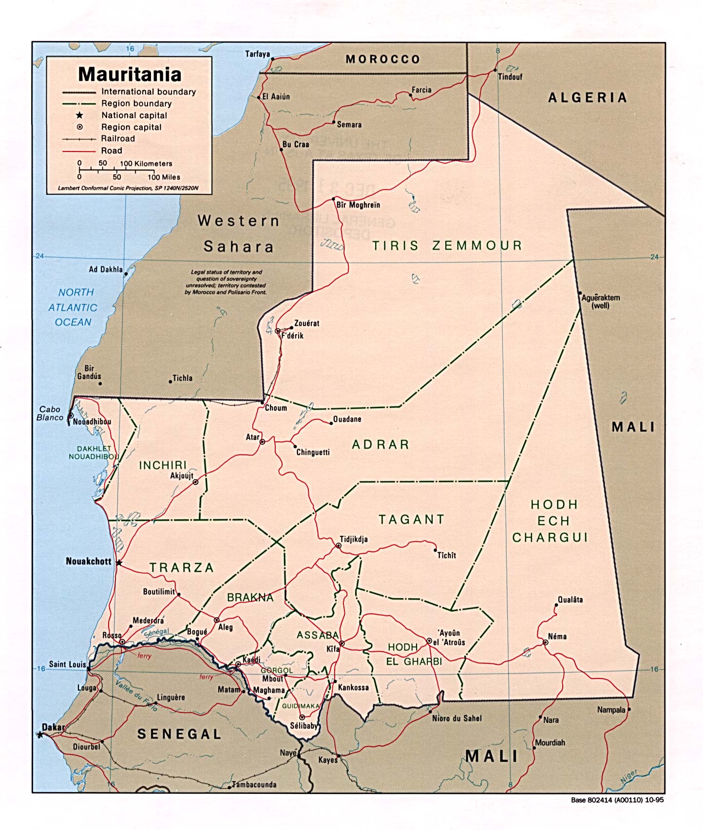
mauritania http://www.lib.utexas.edu/maps/africa/mauritania_pol95.jpg
uganda http://en.wikipedia.org/wiki/File:Uganda_Districts.png
vietnam http://en.wikipedia.org/wiki/File:VietnameseProvincesMap.png
& one that even i consider too enthusiastic & original but which also could be added if anyone is so exuberant
http://webcache.googleusercontent.com/search?q=cache:ffCpWgpWKAMJ:en.wikipedia.org/wiki/Bir_Tawil+halaib+quadripoint&cd=1&hl=en&ct=clnk&gl=us —Preceding unsigned comment added by Egull (talk • contribs) 17:24, 1 November 2010 (UTC)
- I'm waiting to see how the deletion process turns out before doing anything here. But let me say that even if the page survives it should describe notable quadripoints--ones that are famous and frequently mentioned in reliable sources (WP:RS), or at least are described with the word quadripoint in reliable sources (boundary treaties especially, I'd say). Famous "close calls", if described in reliable sources, would also be good, as I see it--with the point that some points are frequently said to be quadripoints but are in fact not. The obvious example would be the Namibia-Botswana-Zambia-Zimbabwe one. There's an almost point in England (counties) that appears relatively famous. My main point is the need to avoid a list serving no purpose other than being a list. I'm not up on the specific guidelines, but WP:TRIVIA should describe how and why Wikipedia should avoid trivia lists. Points mentioned should be backed up by reliable sources that describe them (and ideally why they are important), and should also be notable in some way other than simply being a quadripoint (see WP:N). By these criteria most of the points you list above seem like trivia to me (unless there are other, better references out there). The Yahoo group "boundarypointpoint" is not a reliable source, nor does it establish notability. A map may be a reliable source but does not establish notability. Just saying--if the page survives deletion, I suggest editors should not allow it to devolve further into trivia and original research. Pfly (talk) 18:00, 1 November 2010 (UTC)
yes yes great thanx & hilarious too that the punctilious boundary pointing crowd is as leery of wikipedia as wikipedia is leery of it
but i am totally with you on famous quadripoints & famous near misses
& you know i saluted your excellent 20th century history of bwnazmzw by continuing it with my sketch of the relevant & perhaps even more incredibly fascinating 21st century history of it
& which was justly disallowed & admonished & now decorates nay emblazons the very abolishment bill we are considering
so i understand you are sensibly idling & just waiting to see if we get any more wind for our sails
but if the article survives it will immediately beg to be enlarged & enhanced by the very exhibits 1 & 2 of the indictment
& i would submit this is actually not trivial
the inherent question of whether a particular border exists or not is not trivial inconsequential irrelevant nor unimportant
the tripoint articles yes & their lists yes are trivial yes certainly by comparison & even absolutely yes trivial literally
but quadripoints & the greater pluripoints are far more remarkable & rare than mere trivia & the world knows itEgull (talk) 01:39, 2 November 2010 (UTC)
current lede reversion requesting undo or discussion[edit]
hi olenglish & thanx for your consideration
i understand i can just hit an undo button
but if its only my mainiac newenglish you are rightly objecting to then maybe we can negotiate & or finesse this —Preceding unsigned comment added by Egull (talk • contribs) 17:53, 4 November 2010 (UTC)
- Hi Egull. Some useful guidance on writing style can be found at the following links, WP:AUDIENCE and WP:TERSE. Also please try to remember to sign your posts so the Autosign bot doesn't keep signing for you. -- Ϫ 09:44, 5 November 2010 (UTC)
ok good all points well taken likewise those by skookum & especially aymatth hence the following
suggestions for the requested visuals[edit]
http://groups.yahoo.com/group/boundarypointpoint/message/1725 Egull (talk) 17:03, 5 November 2010 (UTC)
- I suppose this article could benefit from a few more images... Did you take those photos yourself? If so, be sure to mark it with the proper license tag and upload them to commons. See Wikipedia:Uploading images for help on how to do this. -- Ϫ 18:06, 5 November 2010 (UTC)
- The Manitoba-Sask-NWT-(maybe Nunavut) monument photo comes from this page. It does not appear to be licensed in a way we can use. One could contact the photographer and ask. A while ago I searched a bit for a photo we could use--perhaps an old one from a Canadian government archive site, but didn't find anything (not that I looked very hard). Pfly (talk) 18:56, 5 November 2010 (UTC)
- I added a map of Monesnet from The Commons. There's also File:Drilandenpunt.jpg, a photo of the monument that stands at what was the quadripoint there. Today it is only a tripoint, thus the three flags. Not sure if it was worth using. It's just a little survey obelisk with three flags, not obviously meaningful. The map seemed better. Pfly (talk) 19:16, 5 November 2010 (UTC)
officialtourism.ca is NOT a Canadian government website[edit]
I removed the re-insertion of the bogus claim that the NT-NU-MB-SK location is called Four corners by a Canadian government website....Egull, if only you'd READ sources instead of thinking they say what you want them to say. See HERE and note this paragraph:
- The Canadian Tourism Development Corporation (CTDC) is an independent organization involved in the growth and development of the tourism industry in Canada. The CTDC works with industry partners to supply tourism expertise to member organizations, provides marketing opportunities to its members, and provides advice and marketing assistance to best manage tourist facilities and programs. The CTDC is not in any way affiliated with the Canadian Tourism Commission (CTC), the Tourism Industry Association of Canada (TIAC), the Hotel Association of Canada, or any provincial/territorial marketing organizations.
Oh, and this one too:
- The Canadian Tourism Development Corporation is neither funded nor endorsed by the Federal Government of Canada, or any Provincial Governments of Canada. CTDC's future depends on the continued support of national businesses in the tourism industry. Supporting the industry to promote research and development is critical to the growth of the tourism industry Canada.
Not affiliated with ANYBODY. And decidedly NOT a Canadian government usage - no more than the Parliament of Canada "intended to create a quadripoint" or will at some point hold a Boundary Commission just to keep you happy. Stop fabricating stuff, and stop adding meaningless obscurities like internal boundaries in the Dominican Republic.Skookum1 (talk) 06:22, 9 November 2010 (UTC)
- Whoa whoa whoa - Skookum1, that was me putting in the "official" and "federal" guff. On review, I was incredibly careless there - I unimaginably misinterpreted the site page when I read it. You are completely right, in fact I'd agree if you removed all mention of it. But the mistake this time round was certainly mine. Franamax (talk) 06:32, 9 November 2010 (UTC)
- Well, sorry to take it out on Egull, then.....but it's this kind of fuzziness that has aggraveted me with this page from the start, likewise on certain other pages (like this one) where wiki-clones adn wiki-mutations are used as if RS...there are any number of tourism sites out there; this one seems to be something to do with the Big Players in Candian tourism, whoemver that maybe (Fairmont Hotels maybe, for starters) but it's just a money pit for grants and clearly isn't even a tourism=oriented, or even informative, site.....and no doubt was subjected to lobbying by the bushwhacker promoting this obscure location, possibly for his own tour ops (though that's just a speculation, or rather a speculation on his part....the hordes are not going to beat a path to a mosquito-and-muskeg hellhole like 60-102.Skookum1 (talk) 06:43, 9 November 2010 (UTC)
- I think I originally added that link, with text to the effect of the place being "sometimes called Canada's Four Corners". Some searching on the term seemed to have turned up quite a few places making use of the term. Aside from WP mirrors and the like yes, tourist-type places, along with an assortment of oddball pages. I chose the CTDC one to link because it seemed more serious than most (not because I thought it was a government site--it clearly wasn't). However, I didn't search very hard, and might have read more into the results than warranted--and I could certainly be wrong. All in all, it doesn't matter to me. Just thought I should mention it was me who added that link. Previously the claim was worded a bit differently and cited to http://www.hasbalalake.com/location.html -- I just thought the CTDC page made a better reference. Again though--doesn't matter much to me. Just spent far too long copyediting the Dominion Land Survey page. Can't be bothered with mere quadripoints much today. Pfly (talk) 08:27, 9 November 2010 (UTC)
- moved DLS chat to Talk:Dominion Land Survey. Pfly (talk) 18:40, 9 November 2010 (UTC)
[undent]Oh, I had a look at that CDTC site - to me it's clearly a tax writeoff, has no real useful information - check out the dorky maps, which cost them money for crown copyright maps but are really sad - and while they have "featured members" and seem to have a login for members, my bet is that any of their members who advertise on it write off their ad copy, just the same way the CDTC itself, and donations to it, are a write-off for the companies sponsoring it....it's a money dump. Only exists as a way to waste money and not do anything useful....other than provide a way to fluff up the tax losses....Skookum1 (talk) 18:16, 9 November 2010 (UTC)
Inclusion criteria[edit]
well i am glad all this happened tho including the detour into the more important places because it points to the importance even here of really understanding & properly representing official texts
& also of dropping any sense of aggravation & culpability etc since presumably thats not useful or wanted by anyone
& i do think we are beginning to create a far better negligible article on a slight subject than ever before
but let me ask here while we are talking candidly tho the question arose elsewhere
how is it possible to consider the grand quadripoint or four corners of some countries as somehow more significant or more remarkable or credible than that of others
i can see giving the usa special treatment because its quad is arguably best known & perhaps even an archetype or progenitor of sorts
& canada & mexico must rank high by association as well as by general comparison
it appears we all have no problem with that much
or would all have no problem if we all really studied the texts
yet what has become of our cyclopedic purview & impartiality if we cant allow bulgaria or any other member of the turtle bay country club an equality of distinction for its national 4corners or quadripoint
i submit if 1 or 2 or 3 or 8 then all 192 official countries are officially in play here or should be tho i think youll find only a couple dozen would even bother showing up it is so negligible so nothing to worry about if you worry about such stuff
& as far as documentation & substantiation goes i apologize if my links werent working for you all as well as they were for me & will try to correct & or improve that both specifically & in general
but it seems to me a strong prima facie map appearance plus even a thin but earnest layer of backup ought to serve us well unless & until a given claim is disproved by better proof rather than arbitrarily busting everything outright & often on only technical grounds at that
as if it were a miss or worse too insignificant
just because it doesnt seem to some people to be quite as worldclass or quite as watertight yet as say azconmut or mbntnusk is
so yes lets keep having fun but lets keep playing fair tooEgull (talk) 19:27, 9 November 2010 (UTC)
- No, a "strong prima facie map appearance" will not do it, and no you don't get to insert material "until a given claim is disproved", the onus is on the editor who wishes to add material to prove its relevance. This is not a trivia list. Franamax (talk) 21:26, 9 November 2010 (UTC)
ok thanxx franamax both for the inclusion criteria tag & the opinion
you seem to me to be mixing standards of proof with standards of importance here tho
& i think these are really 2 different sets of criteria so lets take them one at a time
first lets be clear & see if we can agree about importance & relevance etc
or else just agree to disagree about them
several people including yourself have characterized the topic as trivial & instances of its occurrence as trivia or trivialities
to say so little of tripoints is perhaps fair & even philologically apt insofar as tripoints are in fact both 3way in character & commonplace as a streetcorner in their occurrence & are thus quite literally trivial actualizations thru & thru
but to call quadripoints trivial is to discount their triviality by 25percent & also to fail to see that they have 33percent more conviviality than tripoints
so it seems to me all you trivialists or trivializers have actually been both shortchanging & overcharging us a hefty slice all this time just because you think you can get away with it by mere association & sleight of hand or of expression
& i myself have even been complicit in this abuse both by my long acquiescence to it & even by a few comments i too have recently made to this general effect just in order to try to harmonize better with you all
but having tried your opinion on for size & comfort i am finding i dont really believe it for a moment
for i must confess that is my true feeling
& i cant conceal it any longer just for the sake of being able to relate to you all
so from here on out i would like to respectfully ask you & your party of fellow believers if you wouldnt be kind enough to just agree to disagree with me about whether quadripoint & quadripoints really are trivial or whether conversely they might somehow be valuable & important enough to take seriously on some level
i am not necessarily trying to convince you that they are
but you all truly have not persuaded me that they arent
so lets quit pretending if thats the case
& i think the mere fact that they are a topic & have survived a termination try & constant severe trimming qualifies them for at least enough respect that their very supposed triviality should have to be as evinced & proven as the existence of particular examples of them in the world must be evinced & proven
i think this is only fair
if you are going to say they are shit as grounds for anything then you should have to demonstrate that they really are as shitty as you make them out to be
& otherwise a more nearly neutral & impartial opinion is just as fully warranted as it would be with any other topic besides shit
as for whether a given example of a quadripoint might be trivial relative to other quadripoints there could well be some discussion & guidance about exactly where we might draw the line of individual importance vs individual unimportance
but to say the entire topic is shit or out of bounds is pushing it a bit as i hope you will agree or else will quit hovering over it with such care & interest & concern
now turning to standards of proof let me just say that if mbntnusk tho already clearly qed for anyone who will just read the full plain & effective english of the nunavut act for what it is remains unaccepted then i think no standards are high enough to be realistic
rather the burden of proof on the mbntnusk deniers is now to set a standard of proof that actually reflects reality rather than only contorts & screws it up
if a proved quadripoint is still denied then we wont get anywhere at all trying to prove or disprove others
i think it only fair to set & abide by a fair & common standard
i am not suggesting we accept what is untrue or unworthy but only that we stop saying something is untrue or unworthy when it hasnt actually been demonstrated but only repeatedly alleged to be
& give yourselves a break
slighting & demeaning & belittling the topic or anything else wouldnt appear to be doing anyone any goodEgull (talk) 03:46, 10 November 2010 (UTC)
- Egull, you have not done your research. The Nunavut Act is federal legislation which assumes that the SK-MB border and the 102nd meridian are co-terminous. In fact, the two provinces agreed in 1965 legislation to set their mutual border where the survey markers are. Under the British North America Act, provincial boundaries are subject to provincial jurisdiction, not federal. The feds can't move the MB-SK border back to the 102nd meridian, regardless of what wording they use to establish a territory boundary (which is under federal jurisdiction). Franamax (talk) 18:53, 10 November 2010 (UTC)
- Hmm, actually I'm having trouble finding a Wikipedia policy/guideline/essay/etc that really applies here. I had thought of notability, WP:N, first, but that is about whether a topic should have an article or not--it isn't about content within articles. Verifiability, WP:V, seems closest. As that page points out, "This policy requires that all...material challenged...be attributed to a reliable, published source...and that the source directly support the material in question." Also, "The burden of evidence lies with the editor who adds or restores material. Any material lacking a reliable source directly supporting it may be removed." Clearly, some of the quadripoints you've been adding, Egull, are being challenged. The next question is, does a map by itself "directly support the material in question"?
- The Verifiability page does not directly address the use of maps as a source. It seems obvious to me that a map would be a perfectly acceptable source for supporting claims like "Toronto's latitude is more southernly than Venice's", or "Andorra has seven parishes". Less obvious to me is whether a map can support claims like "The borders of Yemen, Oman, and the Yemeni governorates of Al Mahrah and Hadhramaut meet at a quadripoint", despite the fact that every map I have seen that show these things indicate their borders meeting at a point. I actually researched this one a little, because I had heard that boundary markers were being placed in the desert along the southern Saudi Arabian border. I was able to determine that a boundary marker seems to have been recently placed at the Oman–Yemen–Saudi Arabia tripoint. But I could not find a reliable source about it. There was a Confluence Project trip report, with photos of the marker. But that's not a reliable source--plus the report mentioned additional survey markers in the vicinity. Plus, one would need to find a source supporting the claim that the governorate borders in Yemen also run to that point. I was unable to find any source about that whatsoever. It seems likely that this point is a quadripoint, but I would want more than a map to verify the claim.
- But, then again, most of the additions you've made, Egull, which have been challenged/removed, do not claim a quadripoint exists at various locations, but merely that one "appears to exist". Now this is something a map can certainly support, but brings up a different question: is "appearing to exist" enough to warrant inclusion? There are many Wikipedia policies, guidelines, etc, that somewhat address the question, but not quite (eg, WP:NOT#OR, WP:ALLEGED, WP:LISTCRUFT, etc). I can't find anything specific enough to justify not including "appears to exist" statements (granted, I am far from fully versed in Wikipedia's guidelines & policies). If these kind of speculative examples are alright, I'd recommend listing them in a special section near the end of the page, perhaps in actual list format. If a list of this kind become overly long it would certainly edge into "trivia" (perhaps better called "listcruft"), but the odds of such a list getting super long seem slim.
- Sorry for the barrage of policy/guideline acronym links—I dislike citing policy in discussions on content, but I thought it might be helpful here, not only to guide Egull to learn things about Wikipedia he/she might not have known, but also for Franamax and Skookum, to point out the apparently acceptability of this kind of statements. Perhaps you guys have a different way of seeing it I hadn't considered. Anyway, spent too long writing this already, must stop. Good night. (Doh, one final point; an essay that does perhaps seem relevant is WP:BITE. Egull's account is over 2 years old now, but with a total of only 153 edits (compare to Skookum's 65,400 edits, Franamax's 14,600, and my mere 13,590--we should refrain from biting, imho). Pfly (talk) 09:12, 10 November 2010 (UTC)
- I think the guideline you want is WP:UNDUE. It's fine to say something "appears to exist" but you have to explain why that is relevant. My neighbour across the street appears to have curtains in their window, but so what? WP:NOTSTATS and WP:NOTDIR give guidance here. The US Four Corners is relevant as a tourist attraction. The Caprivi Strip quadripoint is relevant as there was an international dispute revolving around it. Mexico has a named stone. The Canadian thing is of minor interest because of the error in the federal legislation that created Nunavut (Saskatchewan and Manitoba mutually agreed to change their borders in 1965 to be where the boundary marker is, not at the 102nd meridian). The large number of apparent four-corner points created by multiple-baseline surveying is of interest. The mere fact that four of something meet somewhere is not of interest - or if it is, of interest to whom and discussed in what reliable sources?
- And unfortunately, there is a difference between BITE and upholding the standards of the encyclopedia. New editors should be shown courtesy and helped to understand policy and guideline, but just because someone is new doesn't mean they can add anything they want. That's just reality. Egull might benefit from working on some unrelated areas of the 'cyclo to better understand how our standards are applied. Franamax (talk) 18:47, 10 November 2010 (UTC)
- "the large number of apparent four-corner points created by multiple-baseline surveying"....means also any street intersection, anywhere. It means the back corner of your back yard where your fence meets the propertly line of three other houses, or anywhere a surveyed section touches another section. yes, there's zillions of them - but are they "of interest"?Skookum1 (talk) 18:57, 10 November 2010 (UTC)
- The "of interest" I'm thinking of is the contrast between North America and most of the rest of the world. NA was surveyed using a grid system, long before European settlers actually got to the surveyed areas. As a result, there are lots of arbitrary lines imposed on the geography, as opposed to Europe, say, where boundaries reflect historical patterns of settlement and conflict. For me that is the kind of thing an encyclopedia can illuminate, for someone asking "why are there so many four-corner points in the US Midwest". Street intersections don't need an encyclopedia to explain that they happen because two roads cross. The grid system is of minor interest at best, but that is my interpretation. Franamax (talk) 19:23, 10 November 2010 (UTC)
- Minor interest I suppose....but an intersection of two property lines vs an intersection of two roadways....well, no doubt there's already an article on Crossroads.....Skookum1 (talk) 20:40, 10 November 2010 (UTC)
- Actually I have to step back from that last bit. Road patterns are actually a fascinating and 'cyclo-worthy topic. Contrast the streets of Venice and Washington, DC - each has their precise reasons for being that way. And the roundabout of insanity on the Champs-Elysee... Social factors, geographic, historic, economic, fire-catastrophe, imperial ambition, defense and "populace-control" considerations - fascinating topic. Franamax (talk) 23:02, 10 November 2010 (UTC)
- Franamax is gone from this world RIP so cannot reply; DC was of French design and deliberately geometric in nature.....the street patterns of the grand boulevards and places (as in Place D'Armes and Place de l'Etoile (of which the Champs d'Elysee is one of the 'spokes') were not built until after the Paris Commune of the 1860s, I think was the era they were designed and built in, are geometric but for a different purpose; to quickly move troops around the Paris and reduce the power of the Paris mob, which was difficult to suppress without them. Different purpose from those of DC, which was entirely Masonic in origin; so are Paris' streets but they were not just for show or metaphor, but for military/political reasons. Skookum1 (talk) 03:21, 4 February 2013 (UTC)
- Actually I have to step back from that last bit. Road patterns are actually a fascinating and 'cyclo-worthy topic. Contrast the streets of Venice and Washington, DC - each has their precise reasons for being that way. And the roundabout of insanity on the Champs-Elysee... Social factors, geographic, historic, economic, fire-catastrophe, imperial ambition, defense and "populace-control" considerations - fascinating topic. Franamax (talk) 23:02, 10 November 2010 (UTC)
- Minor interest I suppose....but an intersection of two property lines vs an intersection of two roadways....well, no doubt there's already an article on Crossroads.....Skookum1 (talk) 20:40, 10 November 2010 (UTC)
- The "of interest" I'm thinking of is the contrast between North America and most of the rest of the world. NA was surveyed using a grid system, long before European settlers actually got to the surveyed areas. As a result, there are lots of arbitrary lines imposed on the geography, as opposed to Europe, say, where boundaries reflect historical patterns of settlement and conflict. For me that is the kind of thing an encyclopedia can illuminate, for someone asking "why are there so many four-corner points in the US Midwest". Street intersections don't need an encyclopedia to explain that they happen because two roads cross. The grid system is of minor interest at best, but that is my interpretation. Franamax (talk) 19:23, 10 November 2010 (UTC)
- "the large number of apparent four-corner points created by multiple-baseline surveying"....means also any street intersection, anywhere. It means the back corner of your back yard where your fence meets the propertly line of three other houses, or anywhere a surveyed section touches another section. yes, there's zillions of them - but are they "of interest"?Skookum1 (talk) 18:57, 10 November 2010 (UTC)
Initial refs do not say what they're used to cite[edit]
I had a look at the two refs used to backup the statement/definition that "a quadripoint is....etc" but they're not definitions; in the second case it's not clear what the context of that phrase is, and whether or not the word "quadripoint" even APPEARS in Geographic Magazine. As for the main one from the googlebook on the Caprivi strip, there are http://books.google.com/books?id=0-TSdvAg2IgC&pg=PA201#v=onepage&q=quadripoint&f=false THREE instances in that book] (and three only) of the word Quadripoint - two of them as titles, and one using it as a construct - "the quadripoint theory" - as in a theory about whether boundaries at a certain location do intersect, or not. NEITHER CITATION is relevant to the opening sentence.Skookum1 (talk) 04:19, 10 November 2010 (UTC)
if it were only akweenda alone then yes perhaps your cavils would be justified
but akweenda is standing on the shoulders of that real giant & true culprit brownlie
nor would i so lightly turn you on your ear or ask you to cross your eyes & my apologies for it but this poorly collated copy attached to the bottoms of the following 3 pages in succession is evidently the only full copy of brownlies 5 theses of bwnazmzw available online [[3]] [[4]] [[5]]
yes theses not feces
plus besides grandfather azconmut & the fl3laorospo 4corners we do have the oregon 4corners in casual use [[6]]
mbntnusk or possibly another 4corners besides in normal nonpromotional usage [[7]]
generic 4corners in common usage & could be anywhere [[8]]
but the thing is once you have a 4corners national monument thingy it is hard not to use the expression loosely & generically
& on top of that azconmut is almost never called a quadripoint
so i wish you would just stand up & take responsibility & push that undo button for me this time
i dont see that you would lose anything & in my estimation you could only gain in stature for agreeing to this simple & natural & normal equivalencyEgull (talk) 05:25, 10 November 2010 (UTC)
- "It could be anywhere"...but it's not anywhere, it's the original Four Corners that's talked about, the link is about the mis-survey and the supposed relocation or maybe-relocation. The Oregonian item is about Four Corners Point, which is not "Four Corners", and it's only a county point (of which there must be dozens if not hundreds in Midwest/Great Plains states). your other ones are newsgroup citations, not acceptable. And they also do not establish common usage - or relevance - for the lede; and of coruse they can't be uesd to cite the lede, or anything; you're pretending this is a common word, and should be a common word, but it's just not. Rarefied newsgroups on diplomacy in the MidEast or whatever that was, and that one usage was just a forum post in response to the item on the UT-AZ-CO-NM marker, and she was really speaking about the same place, just by however many yards off; she wasn't using it in a general sense; she was directly referring to the original point, the UT-NM-AZ-CO boundary convergence. People behave like it's mystical or somethign; it's just some lines drawn on meridians and parallels and they were designed to land there....maybe it was the Masons huh? Skookum1 (talk) 18:07, 10 November 2010 (UTC)
Four Corners in USGS/CGNDB[edit]
I can't post teh search results because of the way the USGS/GNIS search engine works, but there are 137 places of various kinds named "Four Corners" or including that as part of the name in USGS. In CAnada, there are by comparison, searching CGNDB, only three - one each in Saskatchewan and New Brunswick that are unincorporated areas, and in Ontario a "Four Corners Water", which is a bay. Four Corners certainly needs to be disambiguation, or at least Four Corners (disambiguation) needs to exist since the "most common usage" could be argued to be NM-UT-CO-AZ. But my wager is most of these places have to do with intersections of streets - but hey, those are "quadripoints" too if that term is applied to everwhere two intersecting lines meet, which is the principle that's been being applied here....there's items also like Four Corners Dam in Idaho.....Skookum1 (talk) 18:07, 10 November 2010 (UTC)
Indian Territory[edit]
I don't think there was ever a quadripoint between Arkansas, Missouri, Indian Territory, and Unorganized Territory. As far as I can tell, Indian Territory was not more than an informal name for an unorganized territory until the creation of Kansas Territory. Take a look at the map at Territorial evolution of the United States and the various sources there. It is possible there was a point between some of the Indian Reservations established in that area, but the reservation borders were changed quite a lot over a short period of time before Kansas Territory was created. In short, I just don't see evidence for this. Pfly (talk) 00:23, 12 November 2010 (UTC)
oh ok i see what you mean
interesting
yet when i checked the footnote for those maps numbered 34 it led to this diagram http://www.tngenweb.org/tnletters/territories/ar-terr.html which does show as of 1828 a quadripoint of missouri arkansas & choctaw with unorganized territory
this is also described & shown in the usgovt pub bus&ss1976 diagram27 so i dont much doubt it
& the question then appears to become how long did choctaw remain a separate entity & maintain that quadri configuration along n36d30m
i believe the portion of it north of the arkansas river became cherokee in the 1830s without changing the quadripoint
but am not sure when cherokee & all of indian territory was officially extended from the quadripoint at 36n30 up to n37 aka kansas
i later found this 1844 map that shows no quad http://www.lib.utulsa.edu/speccoll/collections/maps/gregg/Gregg%20%20complete.jpg
but possibly the change was as early as 1836 or earlier if this map is rightly dated http://en.wikivisual.com/images/c/c7/Map_of_Indian_territory_1836.png
& yikes this version says 1830 http://www.pbs.org/weta/thewest/places/trails_ter/indian.htm
so evidently the quadripoint was 1828 to perhaps 1830s or 1840s
& i should & will certainly change what i wrote about the 1889 end date whooops as soon as i can nail & source the true end dateEgull (talk) 03:58, 12 November 2010 (UTC)
- Hmm, of those four links: The first seems to show only the changing definition of Arkansas Territory, which was originally much larger, then reduced, then reduced again. When reduced, the land taken away became part of the unorganized territory no different from that to the north, thus there's no quadripoint as far as I can see. That map only shows changes to Arkansas Territory, not any reservation or territory boundaries, no? The second and fourth links do not seem to show a quadripoint at all. The third link returns a "403 Forbidden: You don't have permission to access /images/c/c7/Map_of_Indian_territory_1836.png on this server." Pfly (talk) 04:59, 12 November 2010 (UTC)
- Another point: Even if there was a quadripoint between Arkansas Territory, Missouri, and two Indian reservations in unorganized territory, for a few years in the early 19th century, does it really warrant special mention? Seems quite insignificant to me, if it even existed. Pfly (talk) 05:10, 12 November 2010 (UTC)
shire quadripoints etc[edit]
thanxx skookum for the comments & changes
& i dont think i imputed our topical term itself to the sources but only the thing we and the term are trying to describe
but how do you figure i did that
& if you really do then at what chronological date are you thinking we may say a quadripoint is or becomes a quadripoint
also whats not right about speaking in terms of the oldest or earliest known instance of a thing at the start of a history section
please elaborate on these points
but also are you not indulging in anachronism yourself when you describe mercian subdivisions as ancient counties tho they werent yet even shires
& there seems to be an inadvertent grammatical lapse or something still in need of a fix there too if you would prefer to take care of it yourself
thanxEgull (talk) 00:19, 14 November 2010 (UTC)
- Most of the Gbooks search for the term show it as being used in international law relating to surveys between countries. To describe history it is better to use the contemporary terms where possible - so e.g. discuss the four-shire stone as a meeting point of four territories without claiming it is a "quadripoint" as such. I haven't yet seen a formal definition of the term from an outside source, though I may have missed it somewhere. Franamax (talk) 00:45, 14 November 2010 (UTC)
thanx franamax & you do appear to be right about there being no formal definition available anywhere in any field or any sense
so i guess we are it
at least until we find something better
but i have looked at all 72 gbooks hits you mention
& while many are mathematical or even more remote & irrelevant trademark usages etc & a good bit of what is left is legal just as you say nevertheless my impression of the available field is of an equal or greater weight of nontechnical vernacular usages such as 2008 http://books.google.com/books?id=SABf5bkvbJIC&pg=PA16&dq=quadripoint&hl=en&ei=z0ffTIGiL8P98AakvfkV&sa=X&oi=book_result&ct=result&resnum=2&ved=0CCgQ6AEwATgK#v=onepage&q=quadripoint&f=false & 2007 http://books.google.com/books?id=1LpwLDoIkHwC&pg=PA252&dq=quadripoint&hl=en&ei=z0ffTIGiL8P98AakvfkV&sa=X&oi=book_result&ct=result&resnum=6&ved=0CD4Q6AEwBTgK#v=onepage&q=quadripoint&f=false & 1981 http://books.google.com/books?id=4w8VAAAAYAAJ&q=quadripoint&dq=quadripoint&hl=en&ei=xUrfTNfxA8qs8Aad77nRDw&sa=X&oi=book_result&ct=result&resnum=7&ved=0CD4Q6AEwBjgU going back it seems to the 1970 ferry shootup fyi & fwiw but not earlier so far as i can see or have found either there or anywhere else in any field
but the procedence & age & areas of application of the term dont seem to me nearly so important as something we ourselves first have to decide in any case
is our article going to be about a thing called a quadripoint & thus about things that are quadripoints or is it only going to be about the word quadripoint & which we ourselves may not even use to describe the thing
is this a normal situation or some weird contortion developingEgull (talk) 03:29, 14 November 2010 (UTC)
also skookum please answer my above questions first too before criticizing my english
& to call self evident facts pov & synth is pushing your luck & pulling your rank tooEgull (talk) 04:51, 14 November 2010 (UTC)
- "so i guess we are it / at least until we find something better" - no actually, and I think that is maybe what youe missing. We are not in the business of deciding new definitions. We can only record existing knowledge we've seen published elsewhere. We can't really do anything new. When you read terms like "POV" and "synth", that is what is being talked about. We just can't make our own decisions on what to call things, we have to sort it out from what other people have said in the past. Franamax (talk) 05:52, 14 November 2010 (UTC)
right but not all self evident truths are so easy to document because most people dont belabor the obvious much
nor do they constitute new definitions but just simple observations
& it seems whenever i do bring examples to bear here just as citations of usage or simple fact rather than scholarly dissertation they are ignored or disallowed as being not scholarly enough when that wasnt my intention at all anyway
we are actually looking at some rather simple facts here
& i think you may be missing the fact that we must & do make decisions all the time regarding what to call simple things
when we decide to call only certain quadripoints quadripoints & all the others something else & indeed anything else but quadripoints then we are not only making decisions on what to call things but very poor decisions indeed imoEgull (talk) 06:13, 14 November 2010 (UTC)
- The cite against the UK qaudrapoint is a self-pub, and maps I have examined to date certainly show a quadrapoint. I think we should probably state that there is one, and maybe mention that it has been challenged. Rich Farmbrough, 20:13, 5 February 2011 (UTC).
moresnet map[edit]
since our present moresnet map is slightly confusing because it actually shows a quintipoint can i suggest we switch to this less pretty but clearer possibility http://upload.wikimedia.org/wikipedia/commons/thumb/a/ac/TMK_vierlandenpunt.jpg/170px-TMK_vierlandenpunt.jpg —Preceding unsigned comment added by Egull (talk • contribs) 22:32, 14 November 2010 (UTC)
Really awkward phrasing[edit]
"it may not have been used before 1964, by the Geographer of the United States." Taken from the lead. It pretty much makes little to no sense to me. Is it supposed to say the Geographer didn't start using the term until after 1964? – Kerαunoςcopia◁galaxies 08:49, 9 February 2011 (UTC)
County Quadripoint?[edit]
MapQuest shows a quadripoint between four California counties: Stanislaus, San Joaquin, Alameda, and Santa Clara. — Preceding unsigned comment added by 69.225.88.174 (talk) 15:07, 3 July 2011 (UTC)
- There's another one shared by Columbia, Washington, Tillamook and Clatsop Counties in Oregon. We ought to have an article List of quadripoints, but many people argue that it's not encyclopedic. -- Denelson83 05:40, 28 May 2013 (UTC)
Zimbabwe/Southwest-Africa//Zambia/Botswana[edit]
It not clear how a detailed land-survey could answer the question. Surely we would need to go back to the original documents relating to the transfer of the Caprivi Strip to Germany in 1890? And judging by Ian Brownlie's remarks, they did not make the facts clear - probably because at that time nobody thought it mattered ... i.e., noone could foresee that a dispute would actually arise 80 to 90 years later. I do know that in the 1970s, the Rhodesian authorities were quite adamant that it was a quadripoint.--DLMcN (talk) 16:26, 9 July 2011 (UTC)
- It's been a while since I looked into the topic and edited this page a bit on it. But if I recall right the borders were not defined with enough precision to settle the matter. And that the way international borders are made more precise (at least peacefully) is for the involved nations to set up some kind of international boundary survey commission. Usually there are just two nations in such cases and each surveys the boundary, checking their work against each other and diplomatically working out problems as they arise. If all goes well both sides eventually agree on a single line. Of course they don't always go well. The only example on Wikipedia I could find about a boundary commission dealing with a contentious border is Irish Boundary Commission. A quick skim shows how complicated it was and, apparently, failed in the end. Anyway, something along these lines is, I think, what Brownlie was saying would be required to definitively settle the matter. In this case, however, not two but four nations would have to agree to create and participate in an international boundary commission. It seems unlikely to happen anytime soon, if ever. Anyway, it's been a while, like I said, but I think that was the idea behind how "a detailed land-survey could answer the question". Page 203 of the book cited, puts it, "a joint boundary commission could be established to survey and demarcate this boundary". Pfly (talk) 11:02, 11 July 2011 (UTC)
- Thanks ... I did read somewhere that Zimbabwe is even prepared, now, to cede extra land to Botswana, to enable them to build the trans-Zambesi bridge in the best possible location - i.e., the quadruple boundary is no longer the contentious issue which it was in the 1970s (when the diametrically opposite nations were allies - and when each of the four states concerned, was distrustful of its neighbours - and at times even quite hostile towards them!) .--DLMcN (talk) 20:36, 12 July 2011 (UTC)
- [Regarding my rewording of a few minutes ago:] There seems to be no record of any kind of official document (dated 1890, or whenever ... at least, not before year 2000) which specifically stated that there were two separate tripoints 150 metres apart (or any other distance) ... In any event, Ian Brownlie was unable to locate one, despite his best efforts. In 1890, it is possible that nobody thought it was necessary to be specific about it, because the two territories lying to the east, were both under British control. --DLMcN (talk) 16:44, 5 May 2012 (UTC)
Another binational quadripoint discovered[edit]
The Washington State counties of Whatcom and Okanogan and the British Columbia regional districts of Fraser Valley and Okanagan-Similkameen meet at a common point. -- Denelson83 07:37, 31 May 2012 (UTC)
- Irrelevant; regional districts are not counties, they're not the same at all, in purpose or origin; why not include Forest Districts, Land Districts, Environment Regions, Tourism Regions etc. It's attempts to create/document new intersections of bvoundaries, in this case extant because of landforms defining those boundaries, that make this article totally specious original research and why it doesn't belong in Wikipedia. Even your ungrammatical usage of the regional district names (without "the" which is who they're used) is not encyclopedic.Skookum1 (talk) 02:58, 4 February 2013 (UTC)
- They may not be the same, but they perform exactly the same function: They serve as a form of local government in areas not covered by municipalities. -- Denelson83 06:54, 27 May 2013 (UTC)
- They are similar but definitely do not "perform exactly the same function". One of the primary functions/purposes of US counties are courthouses and the judicial system, and this is completely absent from BC regional districts. There are many other things US counties do that RDs do not. Overall BC RDs are significantly weaker than US counties in many ways. They are more like "planning districts" while US counties are more like regions given local sovereignty not otherwise under state or federal control, but including the power of rule of law (police, courts, jails, etc) power to tax, eminent domain, and so on. Pfly (talk) 22:07, 27 May 2013 (UTC)
- They may not be the same, but they perform exactly the same function: They serve as a form of local government in areas not covered by municipalities. -- Denelson83 06:54, 27 May 2013 (UTC)
- That said, RDs are sometimes considered the closest equivalent to US counties. But is this particular point (Whatcom Co-Okanogan Co-FVRD-RD Okanagan-Similkameen) is somehow noteworthy in itself? This page is already bloated with what seems to be an indiscriminate collection of non-notable factoids. Shouldn't this page be about the concept of quadripoints, rather than an attempt to create an exhaustive list? If a list really is desired I'd argue for splitting off to List of Quadripoints, or something, and some heavy pruning here. Pfly (talk) 22:25, 27 May 2013 (UTC)
Kazungula[edit]
Clarifying my edit of a few minutes ago, it is perhaps worth repeating what I wrote on 9th July 2011 (above), i.e. - "... we would need to go back to the original documents relating to the transfer of the Caprivi Strip to Germany in 1890? And judging by Ian Brownlie's remarks, they did not make the facts clear - probably because at that time nobody thought it mattered" - > > because the three territories to the northeast and southeast were all British, so the various parties did not apparently bother to specify what touched what, and to what precise degree. --DLMcN (talk) 20:13, 1 October 2012 (UTC)
- And on 5th May 2012 I wrote: There seems to be no record of any kind of official document (dated 1890, or whenever ... at least, not before year 2000) which specifically stated that there were two separate tripoints 150 metres apart (or any other distance) ... In any event, Ian Brownlie was unable to locate one, despite his best efforts. --DLMcN (talk) 20:17, 1 October 2012 (UTC)
- No argument. Brownlie's overarching take on it was that it was unclear and could not be confirmed either way at the time (and he was, at least with the known geography and facts of 1979, the premier African boundaries expert.) I was going with hardcopy page 1105 (African Boundaries, 1979) where, under "9. Some conclusions" he reiterates that it is "impossible to reach firm conclusions" but adds in paragraph three of his three paragraph "conclusions": "There is one final point to be made. The S. Rhodesia Order in Council 1898......It is inherently unlikely that the intention would have been to employ a road (the Botswana-Zimbabwe Hunter's Road boundary)....-as the basis for an alignment which would lead to a quadripont (or any other union of frontiers) which created a barrier to north-south communcations." He then says that they were all internal British colonial boundaries at the time, so the alignment might have had a "certain artificiality." Anyway, that's where I got the "unlikely" from, but since it addresses just one of several arguments in his "conclusions", I can see your point for leaving it out. DLinth (talk) 20:34, 1 October 2012 (UTC)
Time for an AFD again; this article is wholly OR[edit]
....and continues to grow with more and more specious statistics; even the title is OR. An AFD has been tried here before; jejune arguments were used to keep it, it's establishing currency for a term that has no place in geography nor any relevance in the real world. Wikipedia should not be used to create reality/analysis, it should only mirror legitimate subjects. This is not one; and it's being used as a citation for the sources it cites......Time to go, kiddies, this is a playpen of irrelevance....Skookum1 (talk) 02:55, 4 February 2013 (UTC)
External links modified[edit]
Hello fellow Wikipedians,
I have just added archive links to 2 external links on Quadripoint. Please take a moment to review my edit. If necessary, add {{cbignore}} after the link to keep me from modifying it. Alternatively, you can add {{nobots|deny=InternetArchiveBot}} to keep me off the page altogether. I made the following changes:
- Added archive https://web.archive.org/20100708015952/http://en.poehali.org:80/maps/100k--l34-074.html to http://en.poehali.org/maps/100k--l34-074.html
- Added archive https://web.archive.org/20100822131200/http://www.skogsstyrelsen.se/episerver4/templates/skogensparlor.aspx to http://www.skogsstyrelsen.se/episerver4/templates/skogensparlor.aspx
When you have finished reviewing my changes, please set the checked parameter below to true to let others know.
![]() An editor has reviewed this edit and fixed any errors that were found.
An editor has reviewed this edit and fixed any errors that were found.
- If you have discovered URLs which were erroneously considered dead by the bot, you can report them with this tool.
- If you found an error with any archives or the URLs themselves, you can fix them with this tool.
Cheers.—cyberbot IITalk to my owner:Online 11:35, 16 January 2016 (UTC)
Does Arizona border Colorado? (or Utah border New Mexico?)[edit]
Arizona, Colorado, New Mexico and Utah all meet at a common point: does this mean that Arizona and Colorado border each other? or Utah border New Mexico? --Holapaco77 (talk) 06:55, 28 June 2017 (UTC)
- If one uses the mathematical concept of a point and a line, they do not touch, as those are infinitely small objects. However, most sources I've read (since I was a child and before the internet existed) claim they do touch as a matter of practicality. It is easily possible to walk from New Mexico to Utah without setting foot in Colorado or Arizona (but granted, impossible to do so without violating their "airspace").Dave (talk) 17:31, 14 July 2019 (UTC)
External links modified (January 2018)[edit]
Hello fellow Wikipedians,
I have just modified 5 external links on Quadripoint. Please take a moment to review my edit. If you have any questions, or need the bot to ignore the links, or the page altogether, please visit this simple FaQ for additional information. I made the following changes:
- Added archive https://web.archive.org/web/20110514110613/http://www.law.fsu.edu/library/collection/LimitsinSeas/IBS030.pdf to http://www.law.fsu.edu/library/collection/LimitsinSeas/IBS030.pdf
- Added archive https://web.archive.org/web/20110511092539/http://permanent.access.gpo.gov/lps35389/1990/world12.txt to http://permanent.access.gpo.gov/lps35389/1990/world12.txt
- Added archive https://web.archive.org/web/20120812001647/http://www.moresnet.nl/english/geschiedenis_en.htm to http://www.moresnet.nl/english/geschiedenis_en.htm
- Added archive https://web.archive.org/web/20090624020217/http://kart.statkart.no/adaptive2/default.aspx?gui=1&lang=2 to http://kart.statkart.no/adaptive2/default.aspx?gui=1&lang=2
- Added archive https://web.archive.org/web/20120204044748/http://www.law.fsu.edu/library/collection/limitsinseas/IBS018.pdf to http://www.law.fsu.edu/library/collection/LimitsinSeas/IBS018.pdf
When you have finished reviewing my changes, you may follow the instructions on the template below to fix any issues with the URLs.
This message was posted before February 2018. After February 2018, "External links modified" talk page sections are no longer generated or monitored by InternetArchiveBot. No special action is required regarding these talk page notices, other than regular verification using the archive tool instructions below. Editors have permission to delete these "External links modified" talk page sections if they want to de-clutter talk pages, but see the RfC before doing mass systematic removals. This message is updated dynamically through the template {{source check}} (last update: 18 January 2022).
- If you have discovered URLs which were erroneously considered dead by the bot, you can report them with this tool.
- If you found an error with any archives or the URLs themselves, you can fix them with this tool.
Cheers.—InternetArchiveBot (Report bug) 11:22, 25 January 2018 (UTC)
Ilemi Triangle[edit]
Just curious, why was Ilemi Triangle deleted? Jeff in CA (talk) 21:10, 25 February 2018 (UTC)
A Commons file used on this page has been nominated for deletion[edit]
The following Wikimedia Commons file used on this page has been nominated for deletion:
Participate in the deletion discussion at the nomination page. —Community Tech bot (talk) 14:35, 30 October 2018 (UTC)
Article clean up[edit]
It's pretty clear reading this talk page that this article was quite a battle ground in the 2007-2012 time frame. While not dismissing anybody's opinion, the following is quite obvious to me
- Regardless of weather this is a term recently invented or not, the article is here to stay
- All of this edit warring has left the article in bad shape.
- The worst is the lead, which is a collection of notes (including a hat-note that points to the wrong article) about the complexities of the subject, without providing any useful information about what this subject actually is.
As such I would like to take 15 minutes to clean up the lead. I assure the warring factions my edits are not picking sides, just acknowledging the lead is in bad shape and cleaning it up to what I see as the least painful way to do it. Dave (talk) 17:28, 14 July 2019 (UTC)
Concision[edit]
glad to see somebody is keeping an eye on this page as it seems much improved lately great thanks
in the interest of conciseness i have been trying to pare down the growing & potentially overwhelming list of examples of major quadripoints
til recently the criteria introducing the list i think had wisely specified entirely primary subdivisions of countries & that spec has caused many otherwise lovely offerings to be weeded out by me over the year swhenever i chanced to visit
lately tho i see the spec has become modified perhaps inadvertently i dont know in such a way as to invite all manner of international quadripoints however minor they may be geopolitically & of course this only enlarges a list that as several people have observed was already overblown years ago
so i would just like to suggest in case anyone is checking in here if we did restore that single golden criterion it cwould shrink the list significantly & keep it shrunk
would love to hear other opinions
Mexico quadripoint existence[edit]
Looking at the GIS mapping tool by the Mexican Geological Survey here, the existence (and thus inclusion in the list) of the Mexico quadripoint seems somewhat dubious. The map suggests that these coordinates are actually the northern of two tripoints that are separated by some distance, apparently over 10 kilometers. While there is a marker at the given coordinates (based on photos, including the Wikimapia content provided as a reference for this entry), I can't find anything that confirms that the marker is there to indicate a quadripoint. Is "mojonera de los cuatro estados" actually the name of this marker, or is this something that's been propagated based on the content of this article and/or the Wikimapia entry (which of course is also user-generated content)? Anything I find appears to be mirroring one or the other. The use of the word "effectively" to describe the presumptive quadripoint seems weasely as well: either this is a quadripoint or it isn't, and there needs to be something to suggest that it is to merit inclusion. Otherwise, the entire mention of it is violating verifiability. --Kinu t/c 06:36, 9 July 2022 (UTC)
Plagiarism[edit]
Either this article has been copied from https://civilstuff.com/what-is-a-quadripoint/?utm_content=cmp-true or vice versa, but someone is behaving dishonestly here! 92.40.197.84 (talk) 16:33, 5 July 2023 (UTC)
- This copying of Wikipedia content is not "dishonest"; it is in conformity with Wikipedia's licensing. - Julietdeltalima (talk) 20:06, 5 July 2023 (UTC)
Antarctica[edit]
- The South Pole combines two parcels of unclaimed land with two parcels of Antarctic Treaty regulated territory (which have been variously claimed, disputed, recognized, ignored, disowned, and reclaimed as national sovereign territory by Argentina, Australia, Chile, France, the United Kingdom, New Zealand, and Norway).
I love the phrasing of the "variously claimed, disputed, recognized, ignored, disowned, and reclaimed" text (and there were more - the US and German, but I think the first section here is a little misleading - the entire area is "Antarctic Treaty regulated territory", regardless of the existence of the claims.
- The void areas meet the polar quadripoint between the 90th and 150th meridian west longitude (Marie Byrd Land) and, again, between the 20th meridian west and 45th meridian east (this latter sector, of indefinite extent, owing to the Norwegian exclusion of the South Pole from Queen Maud Land), while sovereign or treaty-regulated areas converge at the polar quadripoint in the two intervals between the void areas.
The situation has got a bit simpler since this was written (I think in about 2011?) - in 2015 the Norwegian territorial claim (Queen Maud Land) was defined to stretch as far as the Pole, rather than having an undefined southern boundary as was previously the case, leaving only one "void area" on the continent. I think this means (going clockwise from the meridian) there is now Norway, Australia, France, Australia, New Zealand, unclaimed, Chile only, Chile/UK, Chile/UK/Argentina, UK/Argentina, UK only. So 7-9 distinct claims (depending if you count "unclaimed" & if you count Australia twice), 11 if you count all the overlaps as distinct.
I'll try to think of a way to reword this but I'm conscious I'm not quite familiar with the terminology here. Andrew Gray (talk) 19:01, 1 February 2024 (UTC)
Cameroon–Chad–Nigeria–United Kingdom was not a quadripoint[edit]
The borders between Cameroon, Chad, Nigeria and British Cameroon (not 'UK') did not form a quadripoint because the intersection of the Nigeria-Cameroon-British Cameroon borders is about 20 miles/32 km south of the intersection of the Nigeria-Chad-Cameroon borders. In other words, the borders of the four territories in question formed two tripoints separated by about 32 km. This is clearly shown in the official map produced by the British-administered government survey department in Lagos in 1949. The map is in Wikimedia commons, here:
https://upload.wikimedia.org/wikipedia/commons/b/bb/Map_of_British_Cameroons_in_1949.jpg.
And by the way, British Cameroon was never part of the United Kingdom, so using 'United Kingdom' in the name of 'quadripoint', and in the heading, is wrong, it should have been 'British Cameroon' as per the name of the Wikipedia article on the territory.
I suggest the section be corrected in the same way as the Kazungula 'quadripoint' was. Strayan (talk) 06:54, 12 February 2024 (UTC)