
Teckop
Teckop | |
|---|---|
Hamlet | |
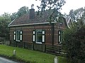
 Bridige in Teckop | |
 Teckop Location in the Netherlands  Teckop Teckop (Netherlands) | |
| Coordinates: 52°08′00″N 4°55′17″E / 52.13333°N 4.92139°E | |
| Country | Netherlands |
| Province | Utrecht (province) |
| Municipality | Woerden |
| Time zone | UTC+1 (CET) |
| • Summer (DST) | UTC+2 (CEST) |
| Postal code | 3471[1] |
| Dialing code | 0348[1] |
Teckop is a hamlet in the Dutch province of Utrecht. It is a part of the municipality of Woerden, and lies about 6 km northeast of Woerden.
Teckop was a separate municipality from 1817 to 1857, when it was merged with Kamerik.[2]
Teckop is not a statistical entity,[3] and the postal authorities have placed it under Kamerik.[1]
The hamlet was first mentioned between 1280 and 1287 as teykincoep, and means "concession of Teyke (person)".[4] Teckop used to have place name sign, however they have been removed. In 1840, it was home to 161 people. Nowadays, it consists of about 40 houses.[5]
Gallery[edit]
-
 Pumping station in Teckop
 -
 Farm "De Lente"
 -
 View on the windmill of Kockenge from Teckop


References[edit]
- ^ a b c "Postcode Teckop in Kamerik". Postcode bij adres (in Dutch). Retrieved 26 March 2022.
- ^ Ad van der Meer and Onno Boonstra, Repertorium van Nederlandse gemeenten, KNAW, 2011.
- ^ "Kerncijfers wijken en buurten 2021". Central Bureau of Statistics. Retrieved 26 March 2022.
not found
- ^ "Teckop - (geografische naam)". Etymologiebank (in Dutch). Retrieved 26 March 2022.
- ^ "Teckop". Plaatsengids (in Dutch). Retrieved 26 March 2022.
Wikimedia Commons has media related to Teckop.
This Utrecht location article is a stub. You can help Wikipedia by expanding it. |