
The Doward
| The Doward | |
|---|---|
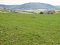
 View of Monmouth from Great Doward | |
 The Doward Location within Herefordshire | |
| Unitary authority | |
| Ceremonial county | |
| Region | |
| Country | England |
| Sovereign state | United Kingdom |
| Police | West Mercia |
| Fire | Hereford and Worcester |
| Ambulance | West Midlands |
| UK Parliament | |
The Doward (Welsh: Deuarth Fach, lit. "two small hills"),[1] is an area in the parish of Whitchurch in south Herefordshire, England, consisting of the hills of Little Doward and Great Doward and extensive woodland. It is within the Wye Valley Area of Outstanding Natural Beauty, on the border with Monmouthshire, Wales. The area, about 3 miles (4.8 km) north-east of Monmouth, is shrouded in legend and King Arthur's Cave is in the vicinity.
Geography[edit]

The Doward is located in the far south of Herefordshire, just across the border from Wales. In 1854, the district was reported to be of 254 acres.[2] Little Doward is located about 3 miles (4.8 km) from Monmouth, just to the southeast of Ganarew and just to the west of Symonds Yat. The River Wye flows through the area forming the eastern and southern boundary of the area, and the A40 road forming its western boundary. It is heavily forested with several cave formations.[3] The landscape is mountainous common, sprinkled with rock outcrops.[4]
The Great Doward area is marked by "extensive stratified limestone mountains" and the Great Doward Hill is said to contain "large deposits of rich iron-ore of a peculiar quality".[5][6] A lane in the area is called Black Stone Kiln's Lane, indicating historical economic activity here.[7] To the west, the area is woody with wild elevations, interspersed with tame swells and hollows.[4] Maliscot Wood lies to the southeast of The Doward.[7] The woodland is part of an Area of Outstanding Natural Beauty (AONB), and is protected by the Herefordshire Nature Trust.
Landmarks[edit]
King Arthur's Cave[edit]
King Arthur's Cave was occupied by man during the Upper Palaeolithic era.[8][9] In 1871 the caves were excavated by Reverend W. S. Symond.[10][11] The cave is shrouded in local superstition and is said to have had a part in the early legend of King Vortigern, a native British king who fought against the invading Anglo Saxons.[11]
Hillfort[edit]
Little Doward hosts a British hillfort which seems to have been refortified in the post-Roman era. Ford tentatively identified it with the Cair Guorthigirn[12] ("Fort Vortigern") listed by Nennius among the 28 cities of Britain in his History of the Britains.[13]
Wyastone Leys[edit]
Wyastone Leys, formerly Lays House, is located at the southwestern corner of The Doward.[4] The original house, The Leys, was built in 1795 by S. O. Attley of London. It was purchased around 1820 by Richard Blakemore who bought the Hadnock estate on the other side of the River Wye, demolished Hadnock House, and used the materials to rebuild and extend the Leys, between 1821 and 1838. The house was rebuilt in 1861 for John Bannerman of Manchester, by William Burn.[14] In the woodland of Little Doward Hill above the house, the Forestry Commission planted, in 1953, a pattern of trees with contrasting foliage in the shape of the letters ER, to mark the Coronation of Queen Elizabeth II.
Other[edit]
The Doward also contains several cottages.[15] The camp has traces of three circular terraces winding in a snail mount. The Vikings once escaped via the precipice near the camp.[16] Vaga Cottage is also of note and was home to the local reverend in the early 19th century.[4] Other cottages include Beech Cottage, Leaping Stocks House, Lilac Cottage, and Highland Cottage near Symonds Yat.[7] In the north of the Doward the small Biblins Bridge footbridge crosses the Wye to the Forestry Commission Biblins Youth Campsite.[15][17]
Gallery[edit]
-
 View of Monmouth from Little Doward in autumn
 -
 A house in the southern part of The Doward
 -
 The wooded hill at Doward viewed from a footpath near Llangrove
 -
 Wooded slopes of Little Doward
 -
 Doward Farm viewed from the south
 -
 Farm track with a view of Little Doward From the Llangrove road
 -
 Little Doward trig point
 -
 Welcome sign in Little Doward woods
 -
 Trees on the banks of the River Wye below Little Doward
 -
 The River Wye below Little Doward
 -
 A public footpath cuts through farmland towards Little Doward


.jpg)


References[edit]
- Notes
- ^ "Welsh – English dictionary". kimkat.org. Retrieved 13 April 2012.
- ^ Great Britain. Parliament. House of Commons (1854). House of Commons papers. HMSO. p. 51.
- ^ Murray, John (1872). A Handbook for Travellers in Gloucestershire, Worcestershire, and Herefordshire ... J. Murray.
- ^ a b c d Fosbroke, Thomas Dudley; Gilpin, William (1822). The Wye tour, or Gilpin on the Wye. Printed for and sold by W. Farror. p. 31.
- ^ Taylor, Robert (1854). Taylor's illustrated guide to the banks of the Wye. p. 70.
- ^ Lewis, Samuel (1848). "A Topographical Dictionary of England". Institute of Historical Research. pp. 543–551.
{{cite web}}: Missing or empty|url=(help) - ^ a b c Maps (Map). Google Maps.
- ^ "KING ARTHUR'S CAVE – THE DOWARD". Wyenot.com. Retrieved 26 March 2012.
- ^ Painter, K. S. (1964). The Severn Basin. Cory, Adams & Mackay. pp. 14–19.
- ^ The Antiquarian. E.W. Allen. 1871. p. 164.
- ^ a b Oldham, Tony; Jones, Keith (2003). "King Arthur's Cave, Caves of the South Eastern Outcrop". Showcaves.com.
- ^ Nennius (attrib.). Theodor Mommsen (ed.). Historia Brittonum, VI. Composed after AD 830. (in Latin) Hosted at Latin Wikisource.
- ^ Ford, David Nash. "The 28 Cities of Britain" at Britannia. 2000.
- ^ Keith Kissack, Monmouth and its Buildings, Logaston Press, 2003, ISBN 1 904396 01 1, p.24
- ^ a b "Doward Park Campsite". Dowardpark.co.uk. Retrieved 13 April 2012.
- ^ The Art Journal London. Virtue. 1859. p. 85.
- ^ Biblins Youth Campsite
- Sources
 This article incorporates text from this source, which is in the public domain: E.W. Allen's The Antiquarian, 1871
- This article incorporates text from this source, which is in the public domain: Thomas Dudley and William Gilpin's The Wye Tour, or Gilpin on the Wye, 1822