Tres Fronteras

Tres Fronteras (Portuguese: Três Fronteiras, English: Three Frontiers) is the Spanish name for an area of the Amazon Rainforest in the Upper Amazon region of South America. It includes, and is named for, the tripoint where the borders of Brazil, Peru, and Colombia meet. The upper Amazon River flows through the area.
Geography[edit]
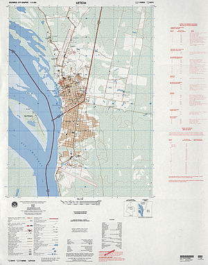
The area is noted for its natural beauty. Cities in the Tres Fronteras area include Tabatinga (in Brazil), Leticia (in Colombia), and Santa Rosa de Yavari (in Peru) on an island in the Amazon River.
Much of this land is within the borders of the Alto Rio Negro and Yanomami reserves, a combined 18 million hectares.[1]
Population[edit]
According to Fabricio Amorim from Fundação Nacional do Índio, the region contains "the greatest concentration of isolated groups in the Amazon and the world".[2][3]
Crime[edit]
A UN report called the hotspot where a reporter was killed."probably [had] among the densest concentration of organized crime groups on earth”.[4] In June 2022 Guardian reporter Dom Phillips and his companion Bruno Pereira were killed in Tabatinga in the Vale do Javari.[5]
See also[edit]
References[edit]
- ^ Challenges and Opportunities in Protecting Amazon Tri-Border Regions, 8 August 2023, JUAN DIEGO CÁRDENAS, MARÍA FERNANDA RAMÍREZ AND SETH ROBBIN], Insight Crime
- ^ Phillips, Tom (22 June 2011). "Uncontacted tribe found deep in Amazon rainforest". The Guardian. Retrieved 22 June 2011.
- ^ Monica Yanakiew (5 Jun 2023). "One year after killings in Brazil's Amazon, tensions run high: Defence of Indigenous lands in Brazil still poses many dangers, a year after killing of Bruno Pereira and Dom Phillips". Al Jazeera.
- ^ Tom Phillips; Ana Ionova (28 June 2023). "Amazon facing 'urgent' crime crisis after gutting of protections, says drugs tsar: Brazilian government warning comes as UN report says that flourishing organized crime groups are driving a boom in environmental devastation". The Guardian.
- ^ Tom Phillips; Jonathan Watts (1 June 2023). "Brazilian Amazon at risk of being taken over by mafia, ex-police chief warns: Alexandre Saraiva gives alert on organised crime in region ahead of anniversary of killings of Dom Phillips and Bruno Pereira". The Guardian.
- ^ Watson, Katy; Cruz, Jessica (2022-06-13). "Dom Phillips and Bruno Pereira: 'A tragedy foretold'". BBC News. Retrieved 2022-08-17.
- ^ Anjos, Anna Beatriz (2022-06-09). "Vale do Javari teve multa recorde por pesca ilegal de pirarucu". Agência Pública (in Brazilian Portuguese). Retrieved 2022-08-17.
- ^ Spring, Jake; Boadle, Anthony; Spring, Jake (2022-06-19). "Brazil indigenous defender, sidelined under Bolsonaro, gave life for 'abandoned' tribes". Reuters. Retrieved 2022-08-17.
The work of the vigilance team quickly drew attention from local fishermen who sell tons of threatened river fish across the nearby border with Peru. Illegal fishing, mining and poaching in the area is often financed by criminal groups laundering money from a growing cross-border drug trade, according to state and federal police.
- ^ Resende, Leandro. "Estudos mostram relação entre tráfico de drogas e pesca ilegal no Javari". CNN Brasil (in Brazilian Portuguese). Retrieved 2022-08-17.
- ^ Dias Balieiro, Luiz Felipe de Vasconcelos; Nascimento, Izaura Rodrigues (2015-07-06). "Tríplice fronteira Brasil, Peru e Colômbia e as implicações com o narcotráfico". Textos e Debates (26). doi:10.18227/2317-1448ted.v2i26.2789. ISSN 2317-1448.
- ^ Tom Philips (4 January 2011). "Rio drug trade turns Amazon city into crime capital". The Guardian. Retrieved 5 January 2011.
Much of the cocaine sold in Rio is said to arrive through Tabatinga, a smuggling mecca lost on Brazil's tri-border with Peru and Colombia, around 700 miles upriver from Manaus.
External links[edit]
- Human mobility in the triple border of Peru, Colombia and Brazil, Márcia Maria de Oliveira, São Paulo May/August 2006 (abstract in English, text in Portuguese).
4°13′37″S 69°56′50″W / 4.22694°S 69.94722°W
- Tres Fronteras
- Border tripoints
- Brazil–Colombia border
- Brazil–Peru border
- Colombia–Peru border
- Geography of Amazonas (Brazilian state)
- Geography of Loreto Region
- Regions of Brazil
- Regions of Colombia
- Regions of Peru
- Upper Amazon
- Regions of South America
- Amazonas (Brazilian state) geography stubs
- Colombia geography stubs
- Peru geography stubs
