
Tum Airport
Tum Airport Maji Airport | |||||||||||
|---|---|---|---|---|---|---|---|---|---|---|---|
| Summary | |||||||||||
| Airport type | Public | ||||||||||
| Operator | Ethiopian Civil Aviation Authority | ||||||||||
| Serves | Maji, Ethiopia | ||||||||||
| Location | Tum | ||||||||||
| Elevation AMSL | 4,650 ft / 1,417 m | ||||||||||
| Coordinates | 6°15′35″N 35°31′10″E / 6.25972°N 35.51944°E | ||||||||||
| Map | |||||||||||
 TUJ Location of the airport in Ethiopia | |||||||||||
| Runways | |||||||||||
| |||||||||||
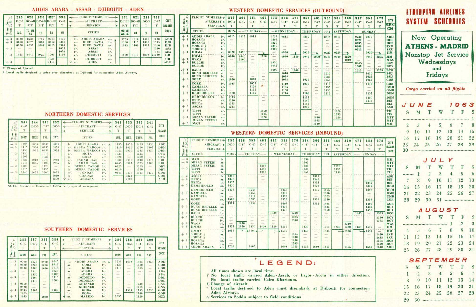
Tum Airport (IATA: TUJ, ICAO: HAMJ) is a public airport in southwestern Ethiopia. Located at an elevation of 4,650 feet above sea level, the airport serves the villages of Tum and Maji, the administrative center of the Maji District. The airport was formerly served by Ethiopian Airlines.[3]
Maji sits atop a ridge on the Boma Plateau, more than 3,000 feet (910 m) above the airport at Tum. The plateau runs west through southeast of the airport. The runway slopes uphill to the southeast.[4]
See also[edit]
References[edit]
- ^ Google Maps - Tum
- ^ "Maji Airport". SkyVector. Retrieved 6 December 2018.
- ^ "Ethiopian Airlines 1963 schedule". WebCite. Archived from the original on 22 December 2015. Retrieved 6 December 2018.
- ^ "Tum Airport". OpenStreetMap. Retrieved 6 December 2018.
External links[edit]
- OpenStreetMap - Tum Airport
- Airport information for Tum Airport at Great Circle Mapper.
- Accident history for TUJ at Aviation Safety Network
- Google Earth
This Ethiopia location article is a stub. You can help Wikipedia by expanding it. |
This article about an airport in Ethiopia is a stub. You can help Wikipedia by expanding it. |