Črmlja
Črmlja | |
|---|---|
| Coordinates: 46°31′22.28″N 15°52′3.22″E / 46.5228556°N 15.8675611°E | |
| Country | |
| Traditional region | Styria |
| Statistical region | Drava |
| Municipality | Trnovska Vas |
| Area | |
| • Total | 1.48 km2 (0.57 sq mi) |
| Elevation | 262 m (860 ft) |
| Population (2002) | |
| • Total | 88 |
| [1] | |
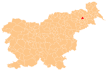
Črmlja (pronounced [ˈtʃəːɾmlja]) is a settlement in the Municipality of Trnovska Vas in northeastern Slovenia. It lies in a valley of a minor right tributary of the Pesnica River west of Trnovska Vas. The area is part of the traditional region of Styria. It is now included in the Drava Statistical Region.[2]
A number of Roman period burial mounds have been identified in the hills southwest of the settlement in the Črmlja Woods (Slovene: Črmljenski les).[3]
References[edit]
- ^ Statistical Office of the Republic of Slovenia
- ^ Trnovska Vas municipal site
- ^ Slovenian Ministry of Culture register of national heritage reference numbers ešd 6443, 6444, 6445, 6446, 6447, 64438


