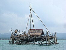
Pangandaran


Pangandaran is a town and district of Pangandaran Regency within the province of West Java, Indonesia. It is located on the southern coast of the island of Java. A well-known surfing beach has made Pangandaran a popular tourist destination.[citation needed]
History
[edit]On 17 July 2006, an undersea earthquake measuring 7.7 on the moment magnitude scale triggered a tsunami that engulfed the resort area and caused destruction as far inland as half a kilometre. Over three hundred people from the town were killed.[1]
Tourism
[edit]
Pangandaran is a large fishing village situated on a narrow isthmus with Pangandaran National Park occupying the entire headland.
On either side to the east and to the west of Pangandaran village and the National Park isthmus are two beaches of volcanic black sand.[2]
The Penanjung Pangandaran nature reserve is nearby on a peninsula connected to the mainland by a narrow neck of land. The isthmus is around 200 m wide. About eighty percent of the nature reserve is secondary rainforest.[3] The flora of the nature reserve includes the Rafflesia.[citation needed]
The Pangandaran International Kite Festival has been held since 1985.[4]
Transportation
[edit]Cijulang Nusawiru Airport is located nearby and provides facilities for domestic service to Jakarta.[citation needed]
Climate
[edit]Pangandaran has a tropical rainforest climate (Af) with heavy to very heavy rainfall year-round.
| Climate data for Pangandaran | |||||||||||||
|---|---|---|---|---|---|---|---|---|---|---|---|---|---|
| Month | Jan | Feb | Mar | Apr | May | Jun | Jul | Aug | Sep | Oct | Nov | Dec | Year |
| Mean daily maximum °C (°F) | 31.0 (87.8) |
31.4 (88.5) |
31.4 (88.5) |
31.3 (88.3) |
31.1 (88.0) |
30.4 (86.7) |
29.2 (84.6) |
29.3 (84.7) |
29.8 (85.6) |
30.5 (86.9) |
30.6 (87.1) |
31.0 (87.8) |
30.6 (87.0) |
| Daily mean °C (°F) | 27.2 (81.0) |
27.3 (81.1) |
27.5 (81.5) |
27.4 (81.3) |
27.2 (81.0) |
26.5 (79.7) |
25.7 (78.3) |
25.6 (78.1) |
26.1 (79.0) |
26.7 (80.1) |
27.0 (80.6) |
27.3 (81.1) |
26.8 (80.2) |
| Mean daily minimum °C (°F) | 23.5 (74.3) |
23.3 (73.9) |
23.6 (74.5) |
23.6 (74.5) |
23.4 (74.1) |
22.6 (72.7) |
22.2 (72.0) |
21.9 (71.4) |
22.4 (72.3) |
23.0 (73.4) |
23.5 (74.3) |
23.6 (74.5) |
23.1 (73.5) |
| Average rainfall mm (inches) | 236 (9.3) |
219 (8.6) |
248 (9.8) |
282 (11.1) |
318 (12.5) |
297 (11.7) |
246 (9.7) |
182 (7.2) |
177 (7.0) |
416 (16.4) |
409 (16.1) |
292 (11.5) |
3,322 (130.9) |
| Source: Climate-Data.org[5] | |||||||||||||
References
[edit]- ^ Indonesian Tsunami kills over 357
- ^ (Indonesian) Pangandaran Beach Archived 9 April 2017 at the Wayback Machine
- ^ Adnan, Bahana Aditya; Hadisusanto, Suwarno; Purnomo, Purnomo (27 October 2021). "<i>Rafflesia patma</i> Blume in Pananjung Pangandaran Nature Reserve, West Java: Population Structure, Distribution Patterns, and Environmental Influences". Journal of Tropical Biodiversity and Biotechnology. 6 (3): 64800. doi:10.22146/jtbb.64800. ISSN 2540-9581.
- ^ Pangandaran International Kites Festival Archived 3 March 2016 at the Wayback Machine (Indonesian)
- ^ "Climate: Pangandaran". Climate-Data.org. Retrieved 12 November 2020.
External links
[edit] Pangandaran travel guide from Wikivoyage
- Photographs of the effect of the tsunami of 17 July 2006 on Pangandaran
